


Skip to product information


America North and South 1876 Ottoman Script Map Empire USA Canada Mexico Brazil
$200.00
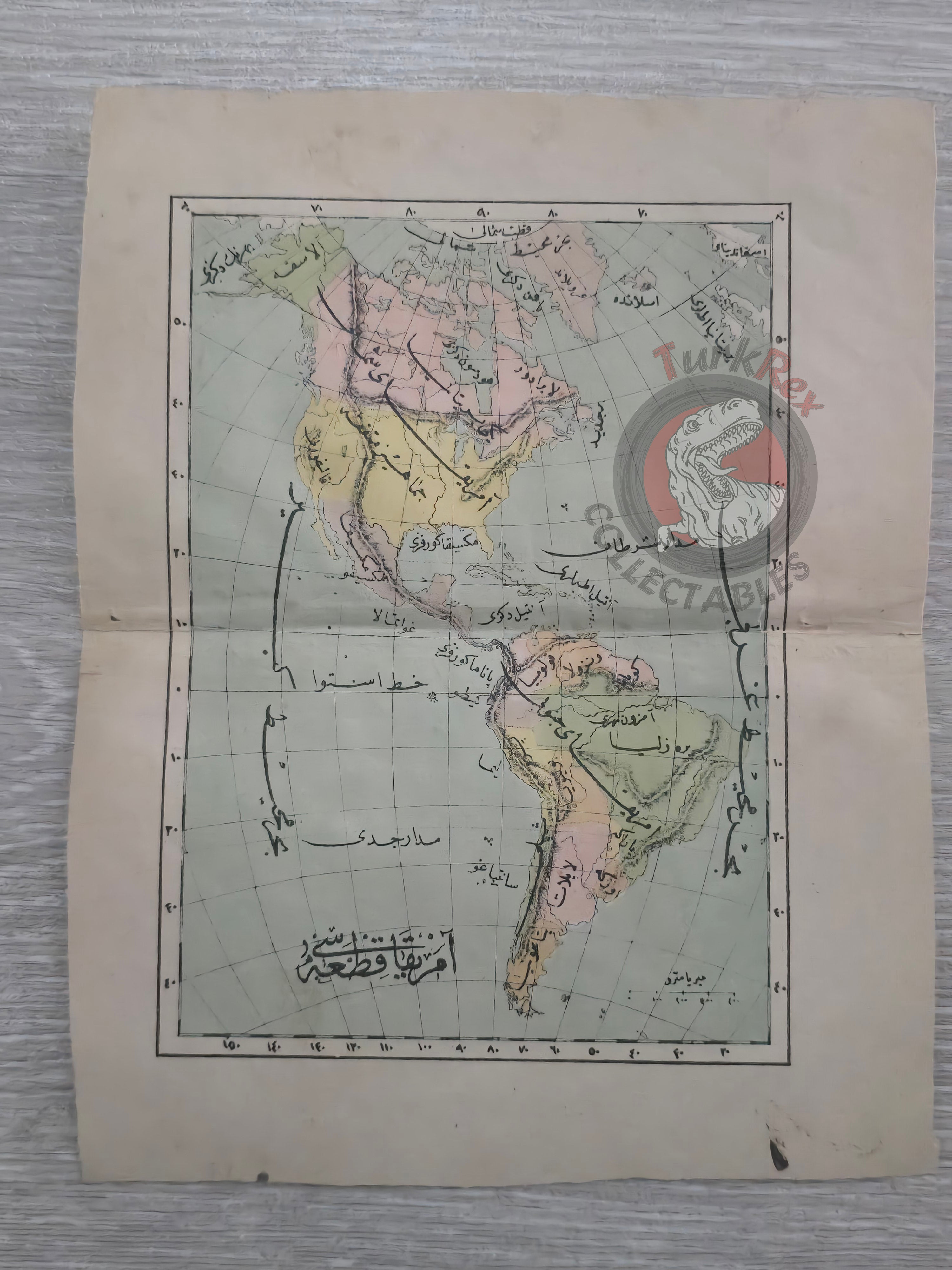
Ottoman Map of North and South America - From Muhtasar Coğrafya Risalesi by Selim Sabit (1293 AH / 1876 CE)
Description:
An Ottoman Turkish map of North and South America, published in 1293 AH (1876 CE) in Selim Sabit’s Muhtasar Coğrafya Risalesi. This work was printed in Istanbul as a geography textbook specifically prepared for Ottoman primary schools (Sıbyan mektepleri), reflecting the empire’s efforts to modernize education and introduce global geography to young students.
As part of a concise educational treatise, the map was designed in a simplified manner to make the geography of the Americas accessible to schoolchildren in the late 19th century Ottoman world.
Key Features:
- Region: North and South America
- Date: 1293 AH / 1876 CE
- Source: Muhtasar Coğrafya Risalesi by Selim Sabit
- Publisher: Istanbul, Ottoman Empire
- Dimensions: 22.6 × 18.2 cm
- Purpose: Educational textbook map for Ottoman primary schools (Sıbyan mektepleri)
- Significance: Rare 19th-century Ottoman school atlas map, reflecting the early introduction of global geography into the Ottoman education system