


Australia Oceania 1867 Ottoman Atlas Map Ottoman Empire Indonesia New Zealand
Ottoman Map of Australia & Oceania, 1284 AH, 1867
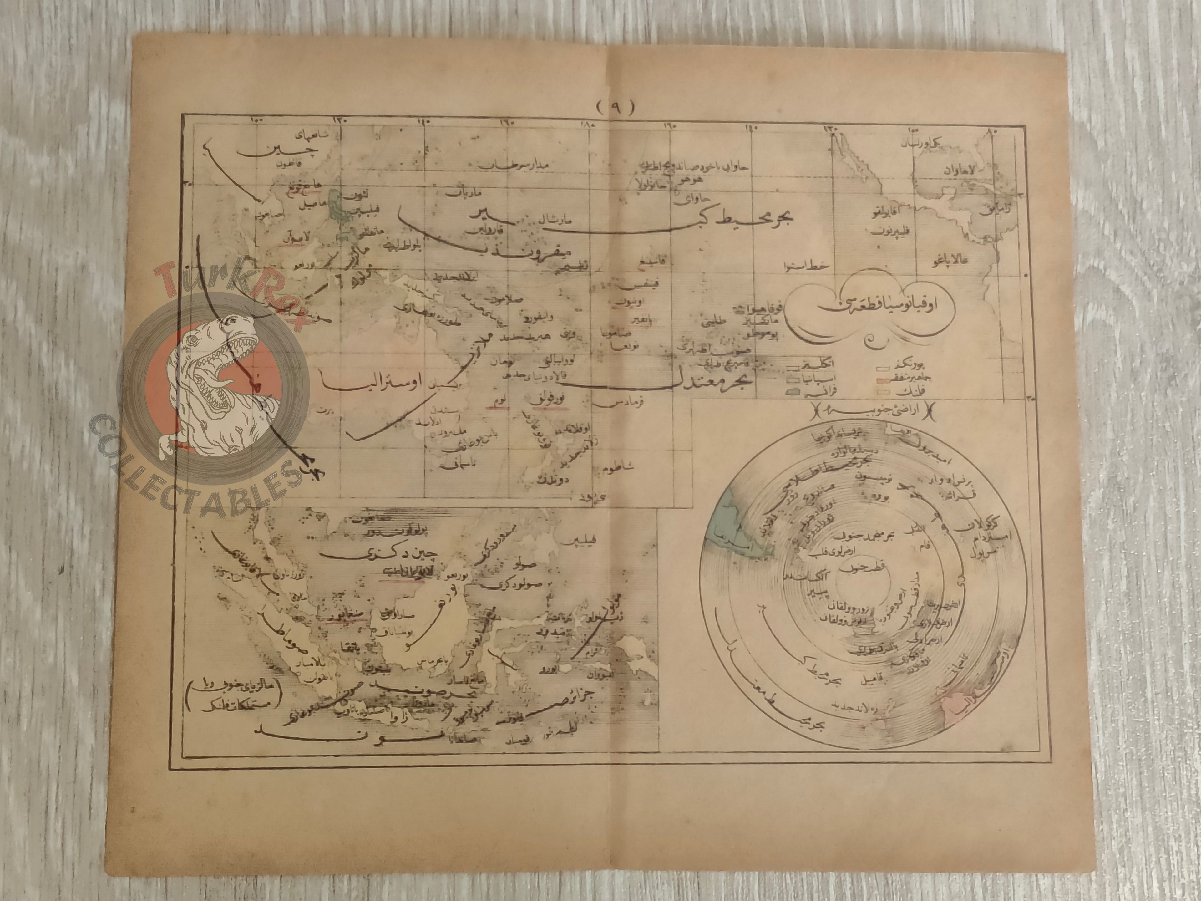
Description:
This rare Ottoman-era map, dated 1284 AH, 1867, depicts the region of Australia and Oceania and originates from the work Sağir Coğrafya Atlası by Mustafa Hami Pasha. The map is entirely in Ottoman Turkish script, offering a fascinating glimpse into 19th-century geographical knowledge and the Ottoman Empire’s cartographic tradition. It reflects the detailed craftsmanship and printing style of the period, making it an exceptional collectible for those interested in Ottoman maps, maritime history, and historical geography.
Key Features:
-
Date: 1284 AH (1867)
-
Origin: From Sağir Coğrafya Atlası by Mustafa Hami Pasha
-
Language: Ottoman Turkish
-
Depicts: Australia and Oceania region
-
Dimensions: 22.3 x 19.5 cm
-
Excellent example of 19th-century Ottoman cartography