


Australia Oceania 1867 Ottoman Atlas Map Ottoman Empire Indonesia New Zealand
Ottoman Map of Australia & Oceania, 1284 AH, 1867
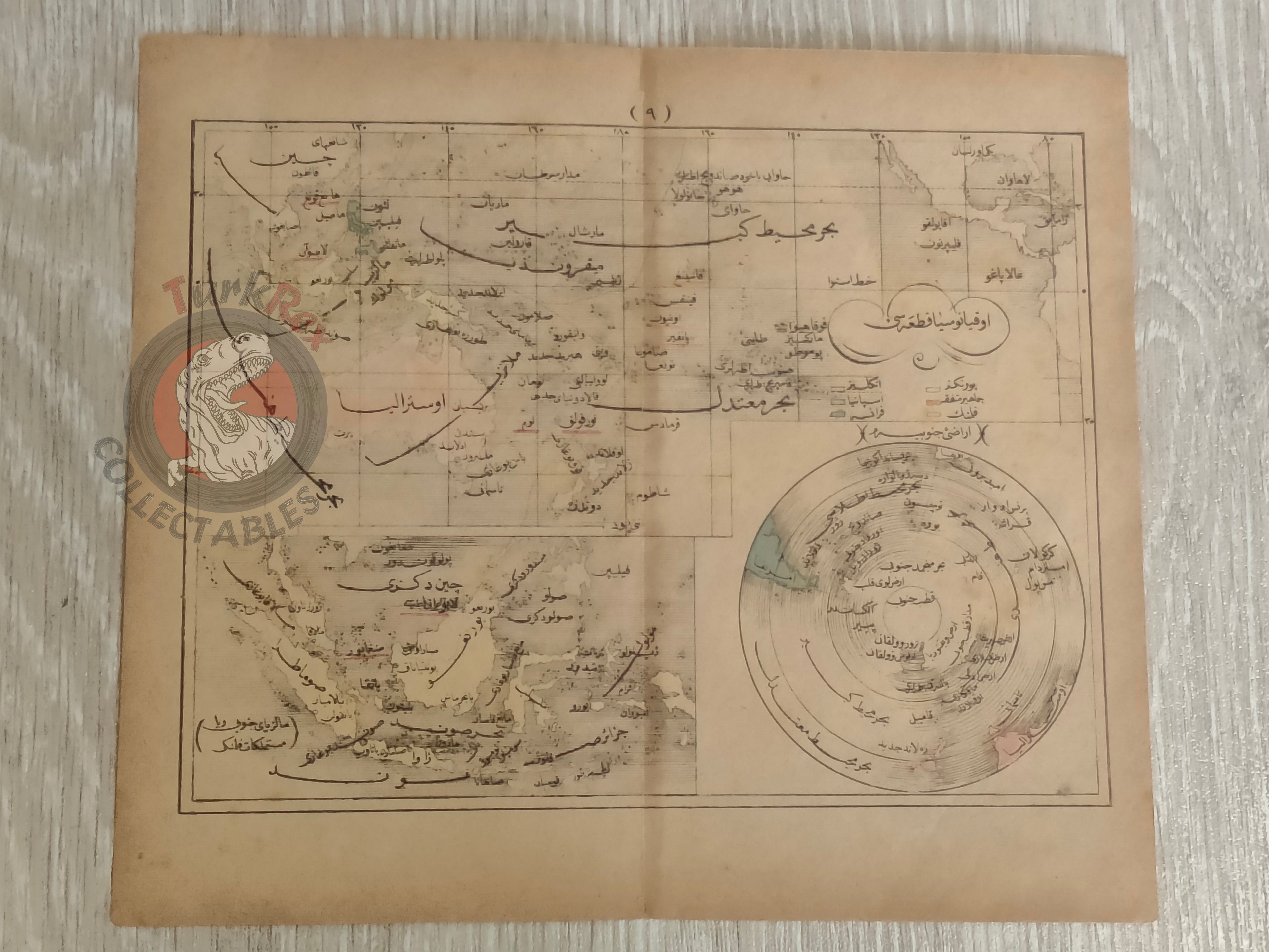
Description:
This rare Ottoman-era map, dated 1284 AH, 1867, depicts the region of Australia and Oceania and originates from the work Sağir Coğrafya Atlası by Mustafa Hami Pasha.
The atlas itself is considered among the earliest examples of Ottoman educational cartography, created with the purpose of introducing modern geographic knowledge to students. At a time when the Ottoman Empire was actively reforming its educational system, works like this played a crucial role in bridging traditional learning with contemporary European scientific approaches.
Mustafa Hami Pasha, originally a military physician (Mirliva) and a graduate of the Mekteb-i Tıbbiye-i Şahane, was a prolific and versatile Ottoman intellectual. He authored more than thirty works across disciplines such as medicine, military science, and education. In preparing this atlas, he drew extensively from French geographical sources, adapting Western cartographic techniques into an Ottoman educational framework. This synthesis of knowledge is clearly visible in the structure, clarity, and geographic scope of the map.
Beyond its educational function, this piece stands as a rare and insightful document illustrating how a 19th-century Ottoman scholar perceived the broader world, particularly the vast territories dominated by Australia . It offers collectors not only a visually appealing cartographic artifact but also a meaningful representation of intellectual exchange, modernization, and the Ottoman engagement with global
Key Features:
• Type: Ottoman printed map
• Title: Australia
• Source: Sağir Coğrafya Atlası
• Author: Mustafa Hami Pasha
• Date: 1284 AH (1867 AD)
• Place of Publication: Istanbul
• Language: Ottoman Turkish (Arabic script)
• Region Depicted: Australia and Oceania region
• Dimensions: 22.3 × 19.5 cm
• Cartographic Context: Early Ottoman educational atlas influenced by French geographic sources
• Historical Significance: Demonstrates the adoption of Western cartographic methods in Ottoman education during the 19th century
• Collectible Significance: Rare example of early Ottoman school atlas mapping Australia and reflecting Ottoman geopolitical perspective