


Balkans Ottoman Map 1916 Greece Aegean Islands Bulgaria Serbia Romania Bosnia
Ottoman Turkish Map of Greece and the Aegean Region – From “Yeni Cep Atlası” by Faik Sabri (c. 1916)
Description:
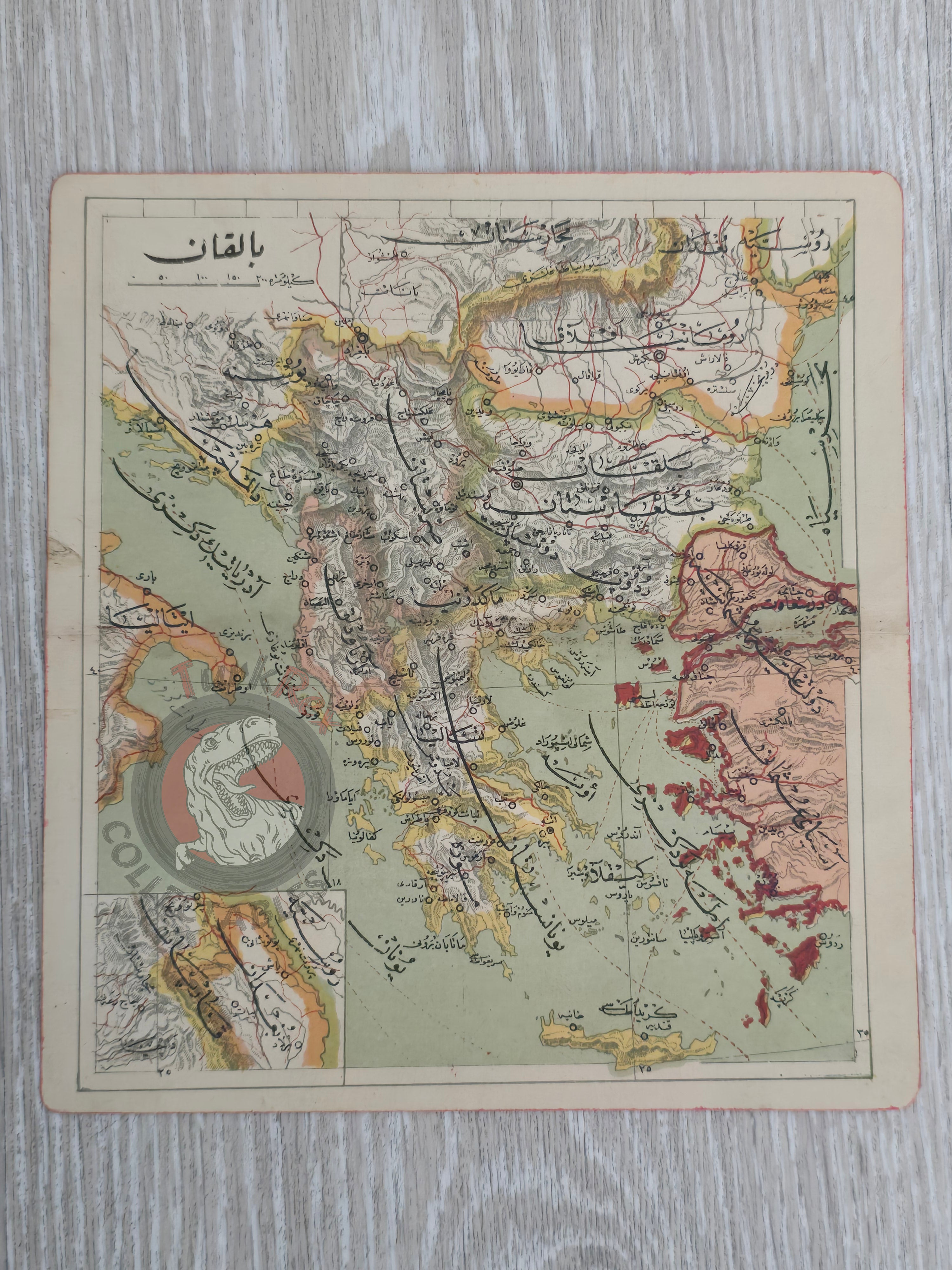
This Ottoman Turkish colored map, measuring 18.5 × 17.1 cm, presents Greece and its surrounding regions in a compact yet detailed format. The map covers not only mainland Greece but also extends to neighboring territories, including Bulgaria, Romania, Macedonia, Crete, the Aegean Islands, parts of Albania, and the Aegean coastline of the Ottoman Empire. This wide geographic scope reflects the geopolitical awareness of the late Ottoman period, particularly during the years surrounding the First World War.
The map originates from the “Yeni Cep Atlası,” published in 1333 (circa 1916) in Istanbul by Kanaat Matbaası, and authored by Faik Sabri, one of the most prominent Ottoman geographers and educators of the early 20th century. Faik Sabri played a key role in modernizing geographical education, producing accessible atlases and textbooks that introduced contemporary cartographic knowledge to a broad readership.
Designed as a portable reference, the Yeni Cep Atlası was intended for practical use by students and educated readers. Due to frequent handling and use, surviving individual maps from this atlas have become relatively scarce, increasing their desirability among collectors today.
The map itself is printed in color, enhancing both its visual appeal and readability. Borders, coastlines, and regional divisions are clearly delineated, offering insight into how the Ottoman world visualized the Balkans and Aegean region during a time of significant political transformation.
For collectors, this piece holds strong appeal as a combination of educational history, cartographic craftsmanship, and regional significance. It is particularly valuable for those interested in Ottoman geography, Balkan history, and early 20th-century printed atlases.
Key Features:
• Type: Ottoman printed map
• Title: “Yunan”
• Region Depicted: Greece, Balkans, Aegean Islands, Crete, parts of Albania and Ottoman Aegean region
• Author: Faik Sabri
• Source: “Yeni Cep Atlası”
• Publication Date: 1333 (c. 1916)
• Printer: Kanaat Matbaası, Istanbul
• Language: Ottoman Turkish
• Dimensions: 18.5 × 17.1 cm
• Color: Original color map
• Historical Context: Late Ottoman period, World War I era geopolitical landscape
• Collectible Significance: Work of a leading Ottoman geographer; scarce example from a widely used pocket atlas