


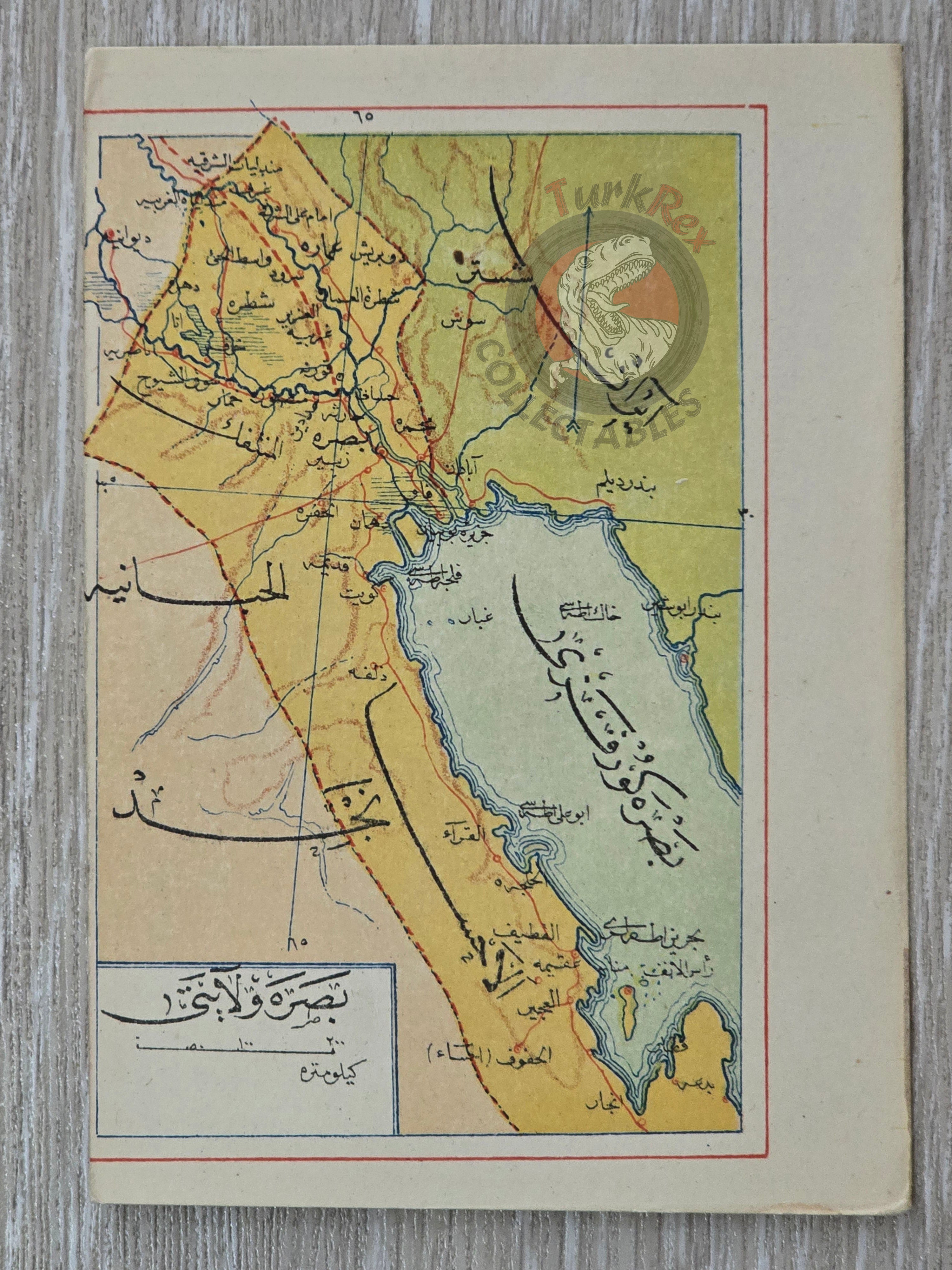

Basra Vilayet 1907 Ottoman Map Qatar Kuwait Saudi Arabia Iraq Mehmed Eşref
Basra Vilayet Map 1907, from Umum-i Vilayet-i Şahane’yi Havi Küçük Atlas by Mehmed Eşref
Description:
This is an Ottoman Turkish map of the Basra Vilayet, published in 1907. It was published in the Umum-i Vilayet-i Şahane’yi Havi Küçük Atlas, authored by Mehmed Eşref. This rare atlas included a 32-page brochure in Ottoman script and 128 maps (some composed of two parts), printed on thick paper and loosely inserted after the text. Many of the maps of certain areas worldwide are the first and possibly only Ottoman maps of those regions.
The map was created for educational and reference purposes, providing readers with a detailed view of the Basra region, its cities, and administrative divisions. Compact and precise, this map reflects the Ottoman Empire’s approach to provincial geography and its emphasis on accurate cartography for educational and administrative use. It serves as a valuable historical document of the late Ottoman understanding of southern Mesopotamia.
Key Features:
-
Title: Basra Vilayet Map
-
Source: Umum-i Vilayet-i Şahane’yi Havi Küçük Atlas
-
Author: Mehmed Eşref
-
Publication Year: 1907
-
Language: Ottoman Turkish
-
Dimensions: 14.6 × 10.3 cm
-
Historical Context: Ottoman depiction of Basra province during the early 20th century
-
Educational Significance: Part of an atlas designed for geography instruction and administrative reference