


Belgium 1867 Ottoman Atlas Map Ottoman Empire Europe
Belgium Map – Ottoman Script 1867 (1284)
Description:
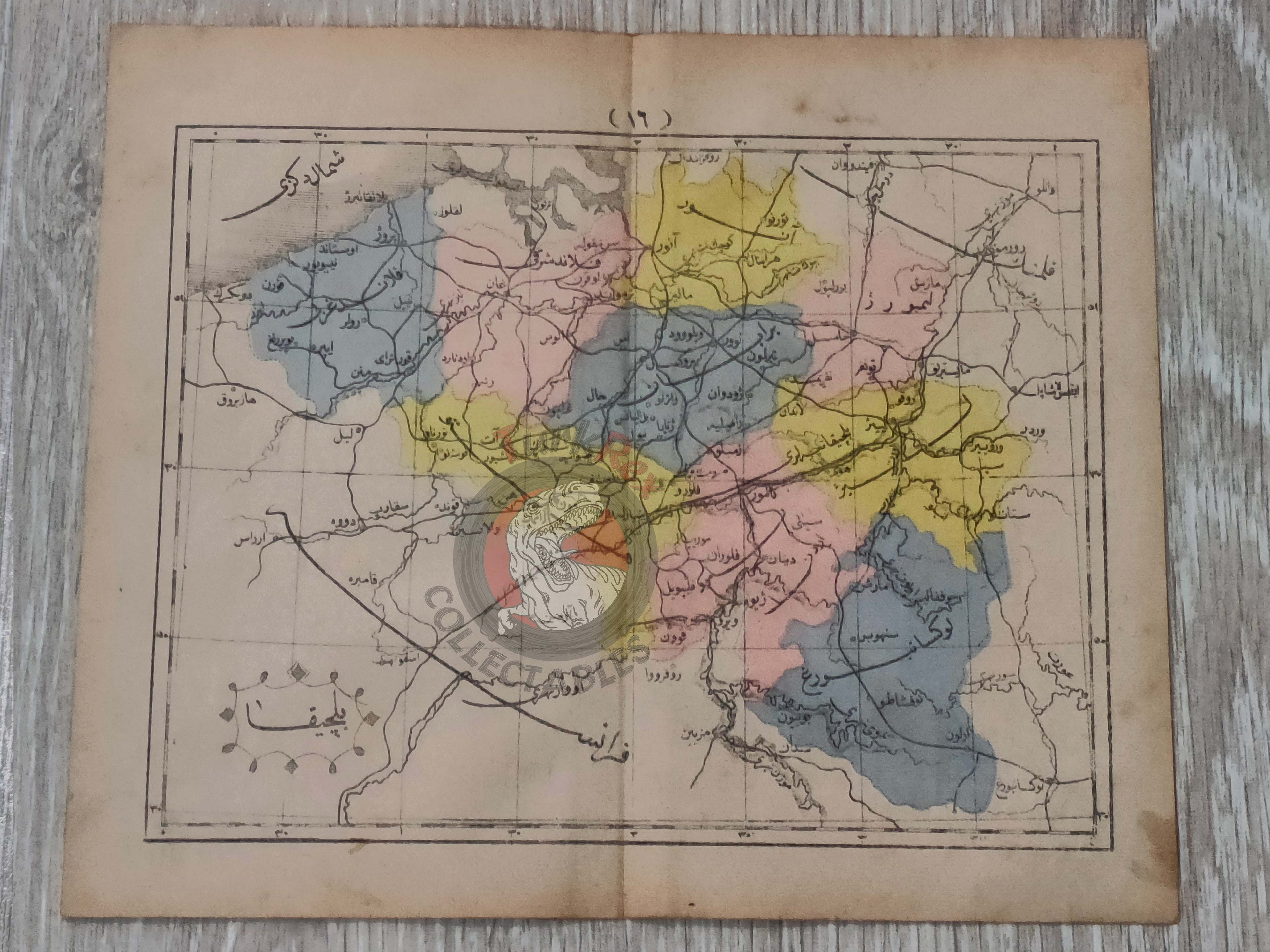
This is an original Ottoman-era map of Belgium, published in 1867 (1284 AH) as part of Mustafa Hami Pasha’s “Sağir Coğrafya Atlası”. Measuring 24 x 19.4 cm, the map is printed in Ottoman Turkish and represents one of the earliest Ottoman efforts to create comprehensive geographic atlases for educational use.
Mustafa Hami Pasha’s Sağir Coğrafya Atlası was a pioneering atlas prepared during the Tanzimat period, a time when the Ottoman Empire sought to modernize education and incorporate Western-style scientific methods. Maps such as this provided Ottoman students and scholars with accessible information about European geography.
This piece is not only valuable for its cartographic detail, but also as a reflection of the intellectual and educational reforms of the late Ottoman Empire.
Key Features:
-
Title: Belçika (Belgium)
-
Source: Sağir Coğrafya Atlası by Mustafa Hami Pasha
-
Date: 1284 AH / 1867 AD
-
Size: 24 x 19.4 cm
-
Language: Ottoman Turkish
-
Historical Context: Early Ottoman educational atlas, bridging European geography with Ottoman scholarship.
-
Collectibility: Rare example of 19th-century Ottoman cartography, significant for collectors of maps, atlases, and Ottoman educational history.