


Bosnia Herzegovina and Serbia Map 1894 Ottoman Military School Crotia
Bosnia-Herzegovina and Serbia Map – Ottoman Military Geography, 1894 (1310)
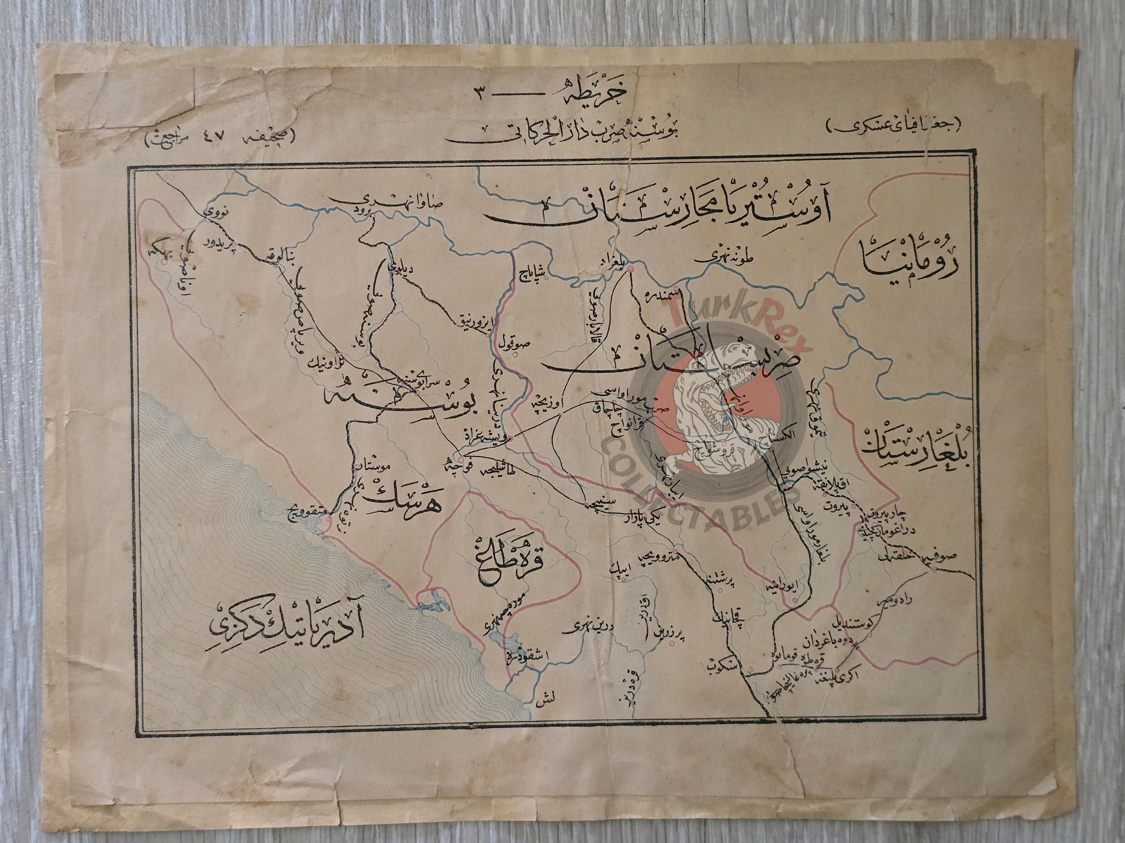
Description:
This is an original Ottoman military map titled “Bosna-Sırp Darül Harekatı” (The Bosnia-Serbia Theater of Operations), published in 1310 AH (1894 AD). It comes from Ahmed Cemal’s Coğrafya-i Askeri: Memalik-i Osmaniye'ye Mahsus, a geography book specifically prepared for use in Ottoman military schools. The map is marked as “Harita 3” (Map No. 3) within the volume.
Measuring 25.7 x 19.7 cm, the map is printed in Ottoman Turkish and reflects the military and strategic focus of the late Ottoman Empire on the Balkans. Such maps were essential educational tools in officer training, providing geographical knowledge for military planning in one of the empire’s most contested regions.
Key Features:
-
Title: Bosna-Sırp Darül Harekatı
-
Source: Coğrafya-i Askeri: Memalik-i Osmaniye’ye Mahsus by Ahmed Cemal
-
Date: 1310 AH / 1894 AD
-
Size: 25.7 x 19.7 cm
-
Language: Ottoman Turkish
-
Map No.: 3
-
Context: Created for Ottoman military schools; focuses on the Balkans (Bosnia & Serbia)
-
Condition: A paper reinforcement has been applied, with minor tears present, but no missing sections
-
Historical Importance: A strategic geography map illustrating the Ottoman Empire’s military interest in the Balkans during the late 19th century.