


Cyprus 1907 Ottoman Atlas Map Empire Mehmed Eşref
Ottoman Map of Cyprus 1907
Description:
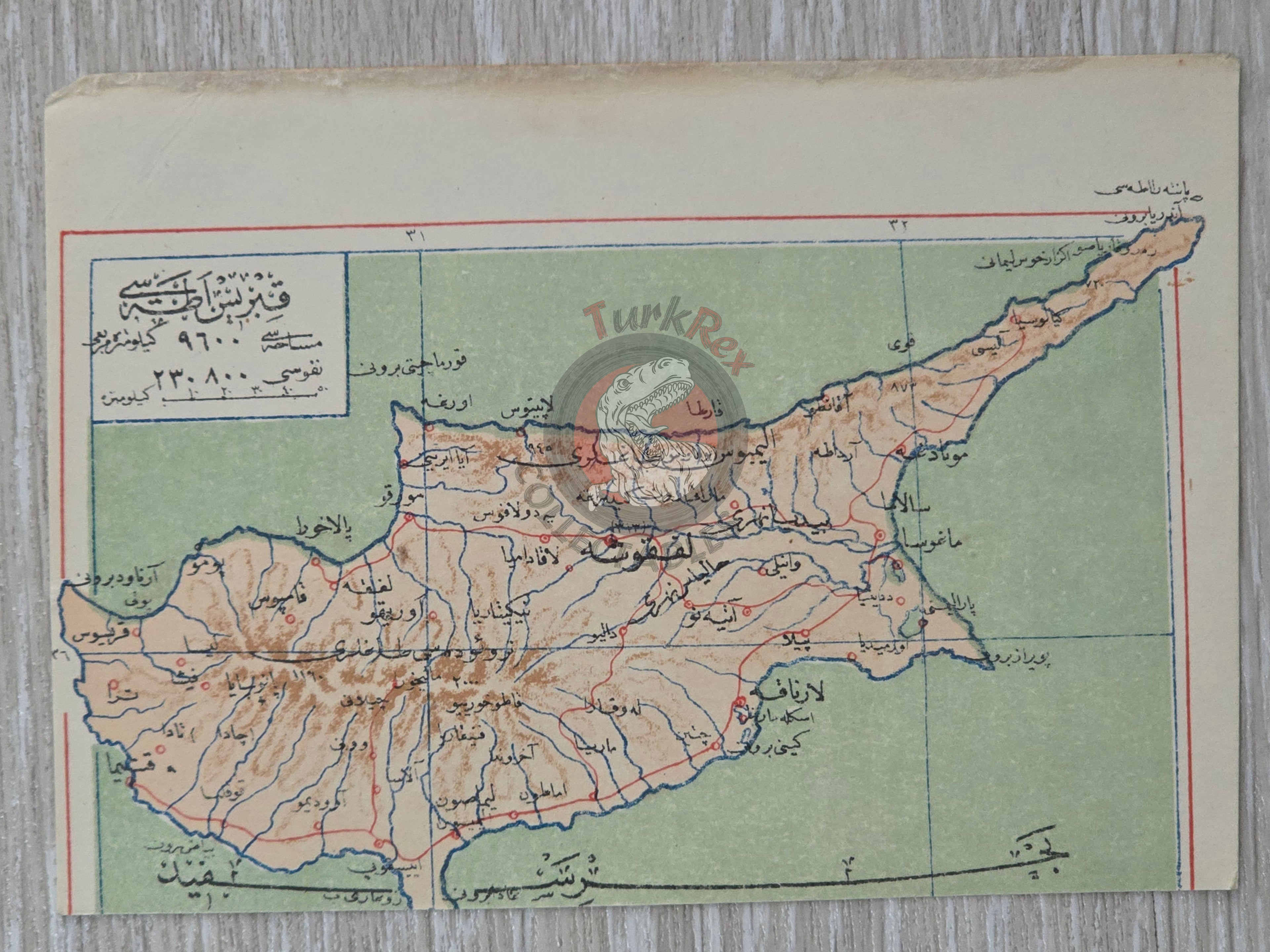
This original Ottoman map, dated 1325 AH (1907 CE), depicts the Cyprus.
It was published in the Umum-i Vilayet-i Şahane’yi Havi Küçük Atlas, authored by Mehmed Eşref. This rare atlas included a 32-page brochure in Ottoman script and 128 maps (some composed of two parts), printed on thick paper and loosely inserted after the text. Many of the maps of certain areas worldwide are the first and possibly only Ottoman maps of those regions.
The map, measuring 14.4 × 10.3 cm, is printed in Ottoman script (Arabic letters) and highlights the geography of Cyprus (Kıbrıs) during the late Ottoman period. Although under British administration since 1878, Cyprus remained officially Ottoman territory until its formal annexation in 1914. This map is therefore historically significant as one of the last Ottoman depictions of the island as part of the empire.
Key Features:
-
Title: Kıbrıs (Cyprus)
-
Source: Umum-i Vilayet-i Şahane’yi Havi Küçük Atlas
-
Author: Mehmed Eşref
-
Date: 1325 AH / 1907 CE
-
Language: Ottoman Turkish (Arabic script)
-
Size: 14.4 × 10.3 cm
-
Condition: Very good; light age-related toning consistent with atlas maps