


Cyprus Ottoman Postcard Map Ibrahim Hilmi Military Press 1910s
Ottoman Map Postcard of Cyprus – ca. 1910
Published in Istanbul by Tüccarzade İbrahim Hilmi’s Military Press (Kitaphane-yi Askeri)
Description:
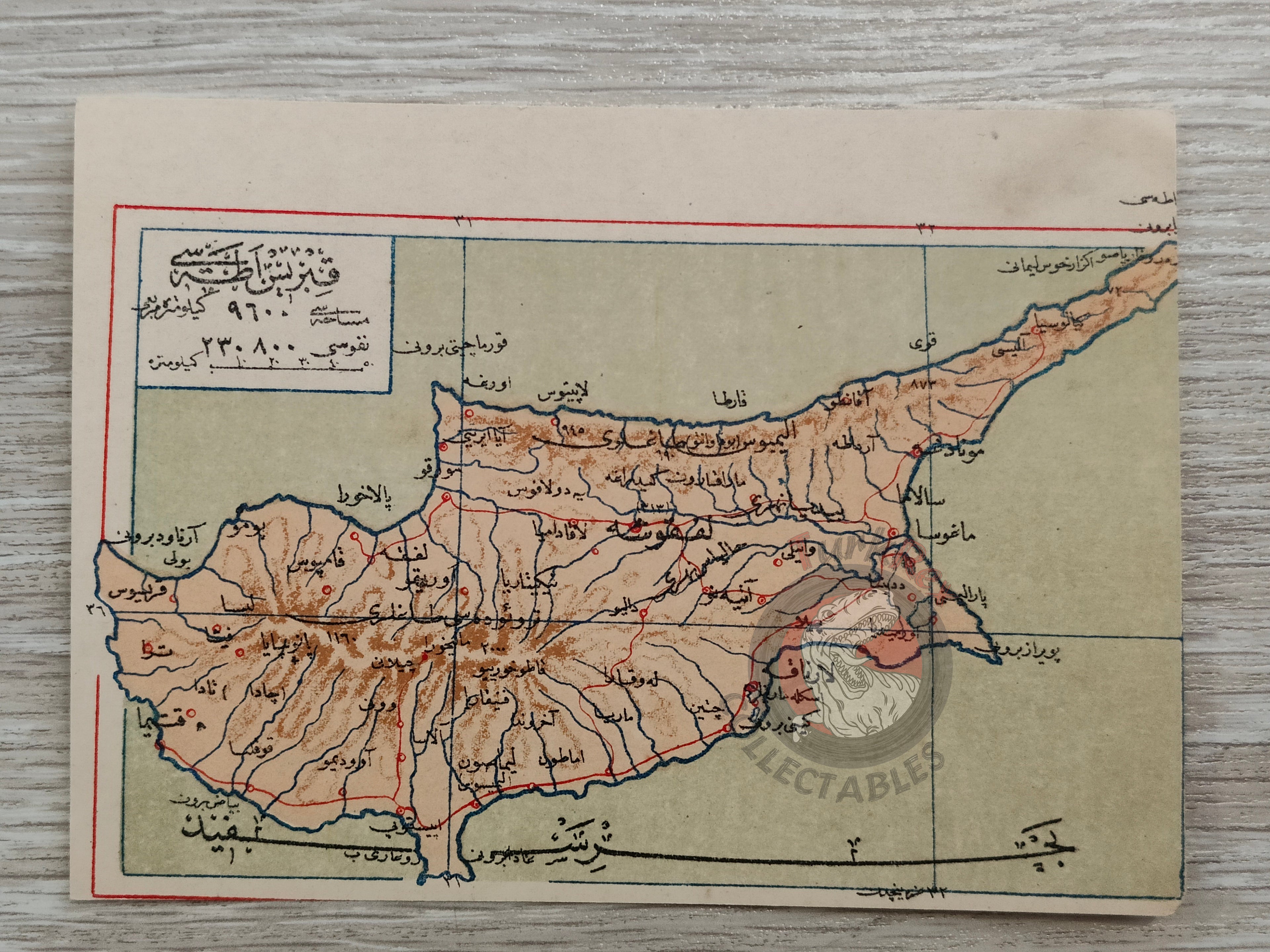
A rare Ottoman map postcard of Cyprus (Kıbrıs), circa 1910, issued in Istanbul by Tüccarzade İbrahim Hilmi’s Military Press (Kitaphane-yi Askeri) as part of a series of educational and historical postcards.
The postcard, measuring 13.8 × 10.2 cm, is printed in Ottoman Turkish (Arabic script) and depicts the island of Cyprus, which, although under British administration since 1878, was still regarded as part of the Ottoman domains until its official annexation in 1914.
Key Features:
-
Title: Kıbrıs (Cyprus)
-
Publisher: Tüccarzade İbrahim Hilmi, Kitaphane-yi Askeri (Istanbul)
-
Format: Postcard
-
Date: circa 1910
-
Language: Ottoman Turkish (Arabic script)
-
Size: 13.8 × 10.2 cm
-
Condition: Well-preserved with only light toning typical of early 20th-century postcards
Historical Significance:
This postcard is not only a cartographic artifact but also part of the early Ottoman postcard culture, combining educational value with visual appeal. It represents one of the final Ottoman depictions of Cyprus before its annexation by Britain in 1914, making it a highly collectible and historically meaningful piece.