


Eastern Rumelia 1907 Ottoman Atlas Map Ottoman Empire Bulgaria Mehmed Eşref
Ottoman Map Eastern Rumelia (Rumeli-i Şarki Vilayeti), 1907
Description:
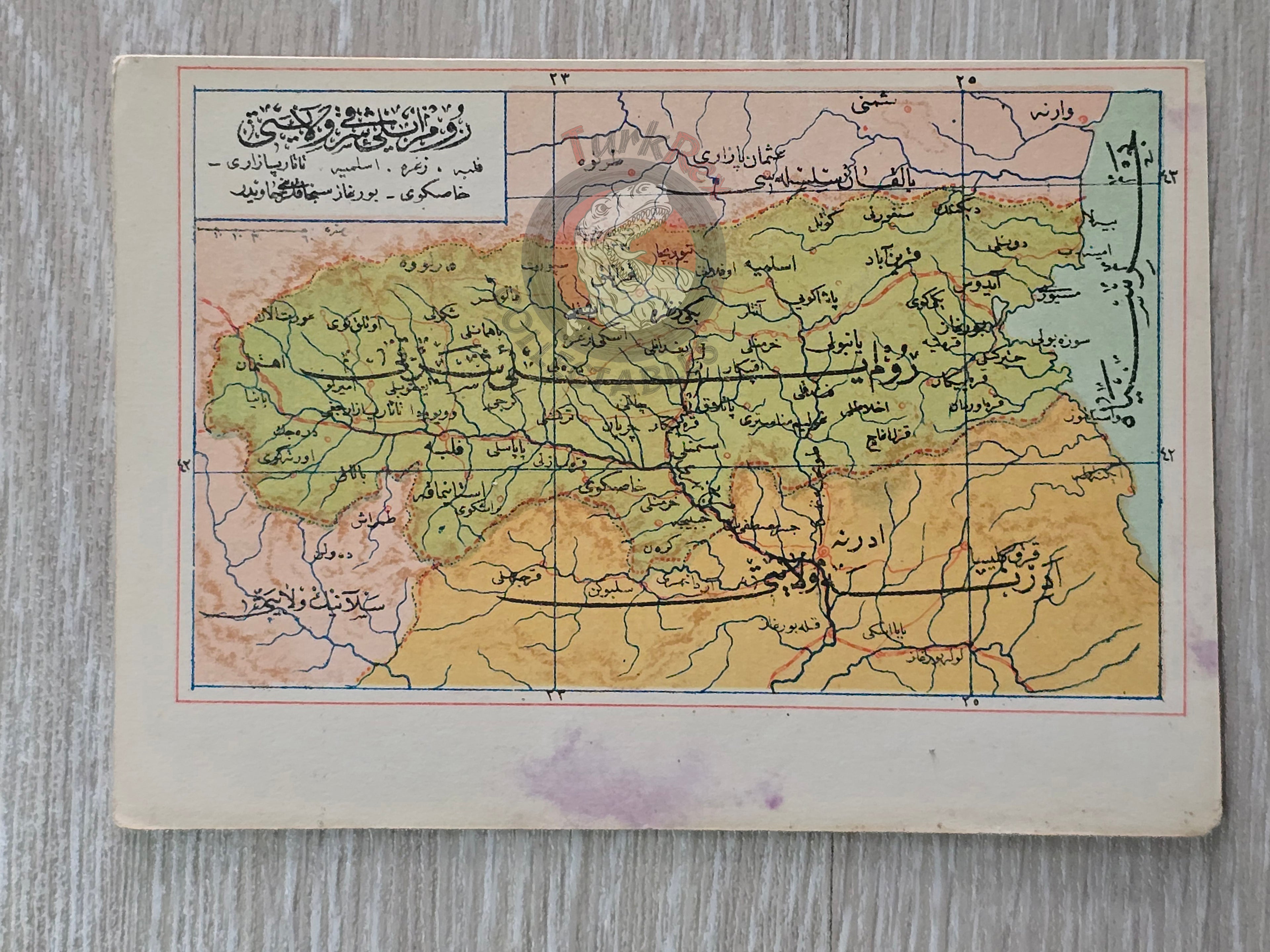
This original Ottoman map, dated 1907, depicts the province of Eastern Rumelia (Rumeli-i Şarki Vilayeti), a historically significant region that today lies within modern Bulgaria.
It was published in the Umum-i Vilayet-i Şahane’yi Havi Küçük Atlas, authored by Mehmed Eşref. This rare atlas included a 32-page brochure in Ottoman script and 128 maps (some composed of two parts), printed on thick paper and loosely inserted after the text. Many of the maps of certain areas worldwide are the first and possibly only Ottoman maps of those regions.
The map’s compact dimensions (14.5 × 10.3 cm) reflect its use in pocket atlases designed for accessibility and portability, typical of Ottoman educational cartography of the early 20th century.
Key Features:
-
Date: 1907
-
Source: Umum-i Vilayet-i Şahane’yi Havi Küçük Atlas
-
Author: Mehmed Eşref
-
Region Depicted: Eastern Rumelia (Rumeli-i Şarki Vilayeti), today within Bulgaria’s borders
-
Dimensions: 14.5 × 10.3 cm
-
Language: Ottoman Turkish
-
Format: Printed map, atlas plate
-
Condition: Age-consistent wear; clear and legible details
-
Historical Context: A rare Ottoman cartographic record of the Balkans, produced during a period of shifting borders and rising national identities.