


Egypt 1907 Ottoman Atlas Map Arabian Peninsula Saudi Arabia Mehmed Eşref Palestine Israel
Ottoman Map – Egypt, Red Sea & Surrounding Regions, 1907
Description:
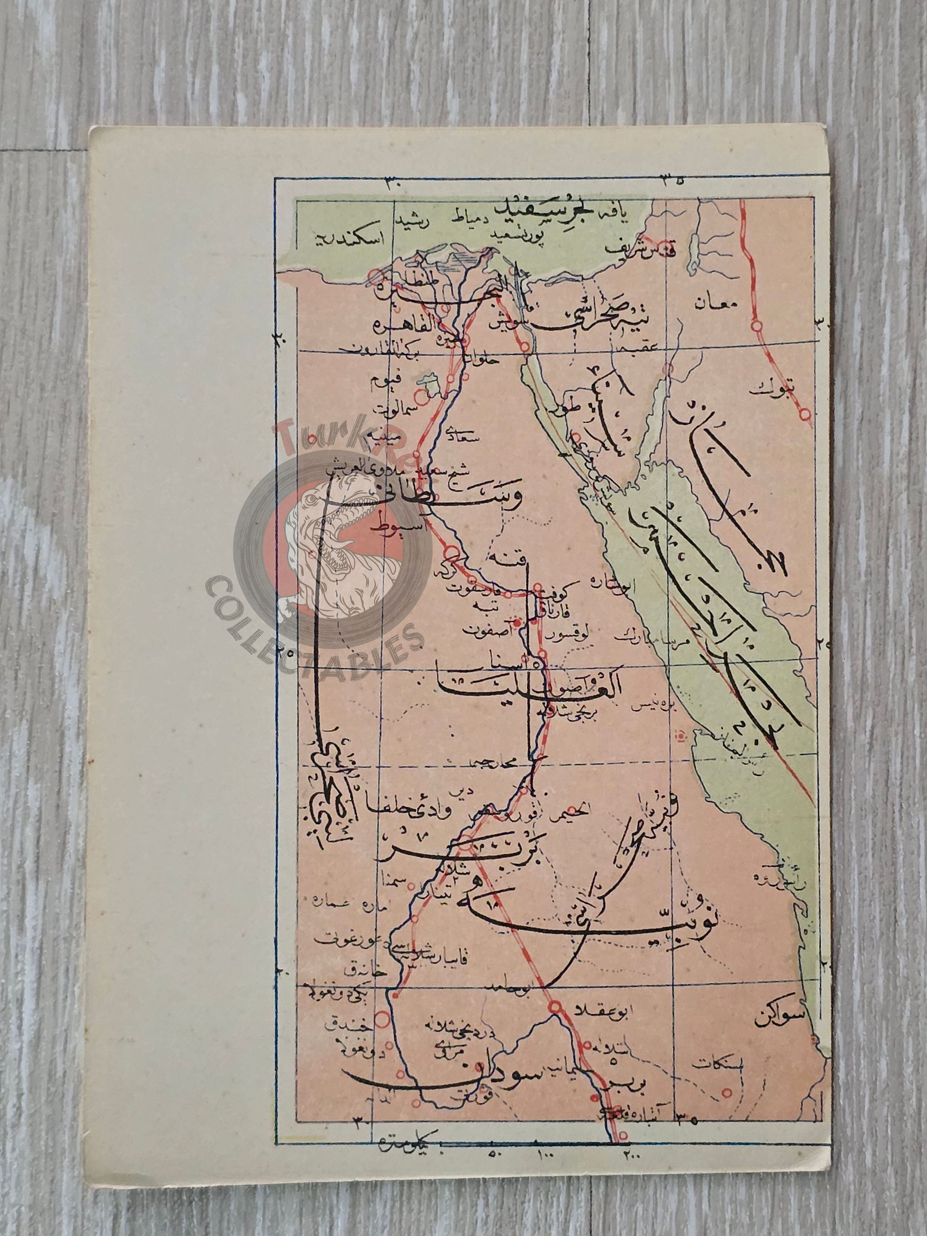
This original Ottoman map, dated 1907, depicts Egypt, parts of the Arabian Peninsula, and the region of Palestine/Israel, with the Red Sea also clearly shown.
It was published in the Umum-i Vilayet-i Şahane’yi Havi Küçük Atlas, authored by Mehmed Eşref. This rare atlas included a 32-page brochure in Ottoman script and 128 maps (some composed of two parts), printed on thick paper and loosely inserted after the text. Many of the maps of certain areas worldwide are the first and possibly only Ottoman maps of those regions.
With its compact dimensions (14.5 × 10.3 cm), this map reflects the portable design of the atlas, intended for educational and administrative use in the late Ottoman Empire.
Key Features:
-
Date: 1907
-
Source: Umum-i Vilayet-i Şahane’yi Havi Küçük Atlas
-
Author: Mehmed Eşref
-
Region Depicted: Egypt, Red Sea, parts of the Arabian Peninsula, and Palestine/Israel
-
Dimensions: 14.5 × 10.3 cm
-
Language: Ottoman Turkish
-
Format: Printed map, atlas plate
-
Condition: Age-consistent wear; clear and legible details
-
Historical Context: An important Ottoman cartographic record of North Africa and the Middle East, offering a rare late-empire perspective on regions of enduring geopolitical importance.