


Egypt 1924 Ottoman Script Map Rıza Nur Africa
Ottoman Script Map of Egypt - Yeni Mısır Haritası (New Egypt Map) (1924)
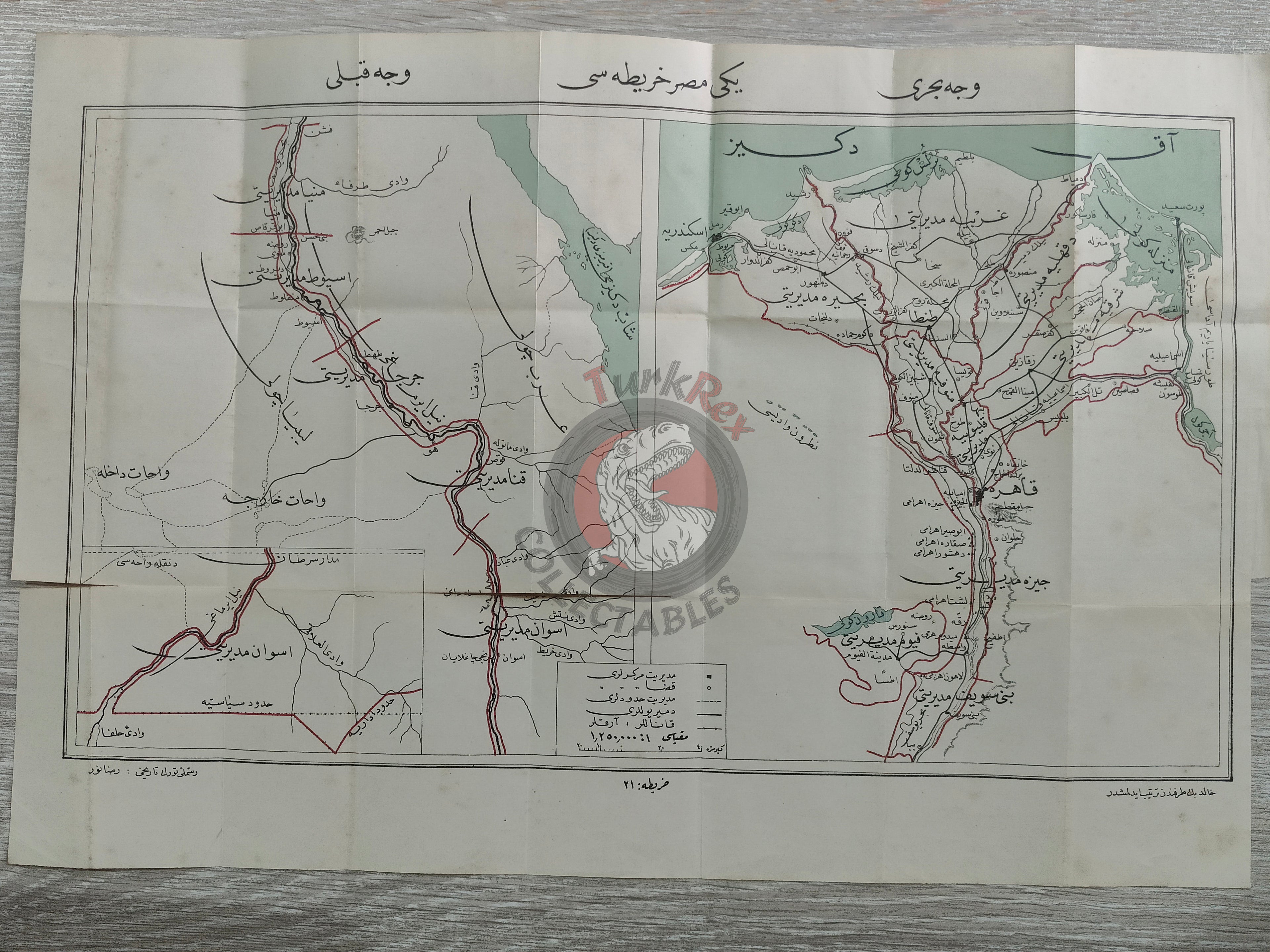
Description:
This historical Ottoman-era map, titled “Yeni Mısır Haritası”, presents both the Southern and Northern fronts of Egypt. Measuring 48.6 × 33 cm, the map was published in 1342 AH (1924 CE) in a Turkish history book authored by Rıza Nur.
The map traces Egypt’s political evolution: part of the Ottoman Empire from 1517 until the establishment of the autonomous Khedivate under Muhammad Ali Pasha in 1867, followed by British occupation, and ultimately the country’s declaration of independence as a monarchy in 1922. It illustrates the borders of the newly formed Egyptian state, offering valuable insight into early 20th-century geopolitical understandings of the region.
Key Features:
- Date of Publication: 1342 AH (1924 CE)
- Region Depicted: Egypt – Northern and Southern fronts
- Dimensions: 48.6 × 33 cm
- Source: Turkish History (Türk Tarihi) book by Rıza Nur
- Historical Context: Shows Egypt’s transition from Ottoman province to autonomous Khedivate and eventual independent monarchy
- Cultural Significance: A rare cartographic record highlighting Egypt’s borders and Ottoman-era perspectives on North African territories