


Europe 1876 Ottoman Script Map Empire Italy Germany Spain France England
Rare Ottoman Map of Europe – From Muhtasar Coğrafya Risalesi by Selim Sabit (1876)
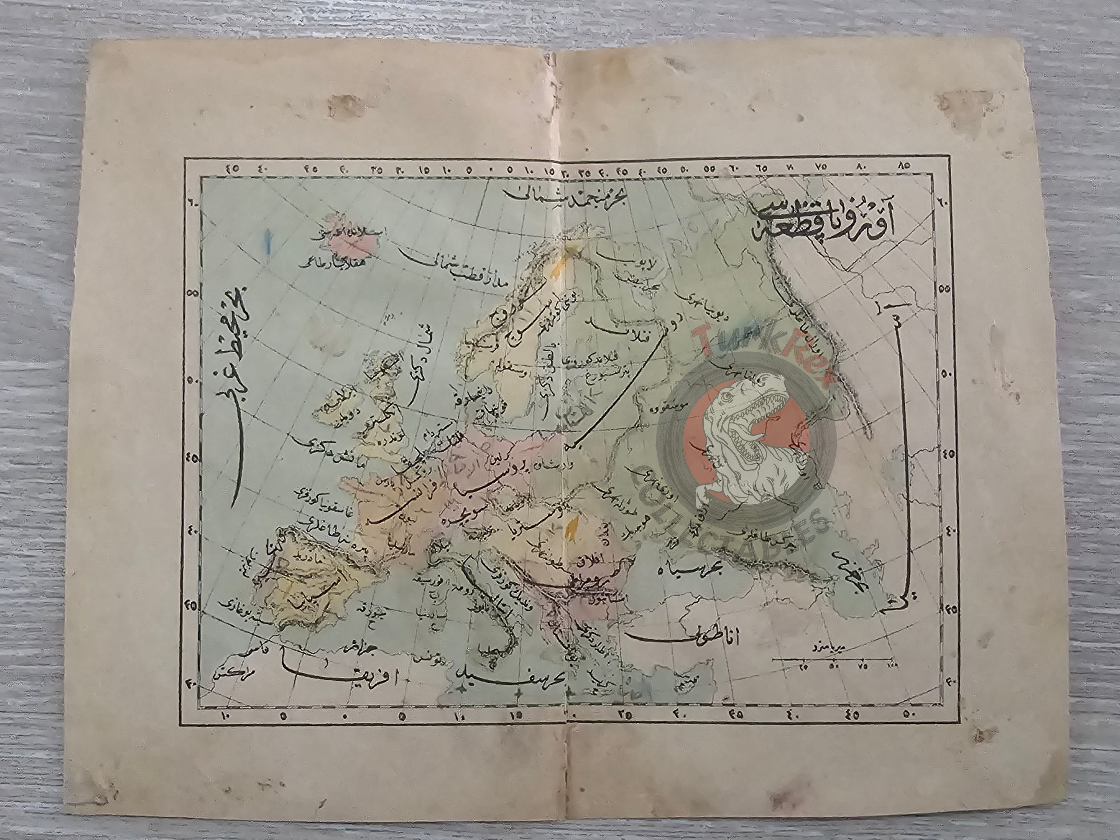
Description:
A rare 19th-century Ottoman map of Europe, published in 1293 AH (1876 CE) within Muhtasar Coğrafya Risalesi by Selim Sabit. Measuring 21 × 16.8 cm, this map was part of an elementary school geography textbook (sıbyan mektepleri), created during the Ottoman Empire’s efforts to modernize education in the Tanzimat era.
Unlike decorative wall maps, this example was printed for classroom use, making surviving copies extremely scarce today. Muhtasar Coğrafya Risalesi was among the first systematic attempts to introduce geography as a structured discipline in Ottoman primary education. The map not only illustrates the European continent as understood by the Ottomans in the late 19th century but also reflects the empire’s intellectual engagement with Western sciences and its commitment to modern schooling.
For collectors, this map represents both a rare piece of Ottoman educational history and an important artifact of Ottoman cartography. Its survival offers a tangible link to the classrooms of the late empire, where the next generation was first introduced to global geography through maps like this one.
Key Features:
-
Date: 1293 AH (1876 CE)
-
Author: Selim Sabit
-
Source: Muhtasar Coğrafya Risalesi (prepared for Ottoman primary schools)
-
Region: Europe
-
Dimensions: 21 × 16.8 cm
-
Rarity: Educational maps of this period rarely survived, making this an uncommon example
-
Cultural Significance: Combines Ottoman educational reform, early printed textbooks, and 19th-century cartography in one artifact