


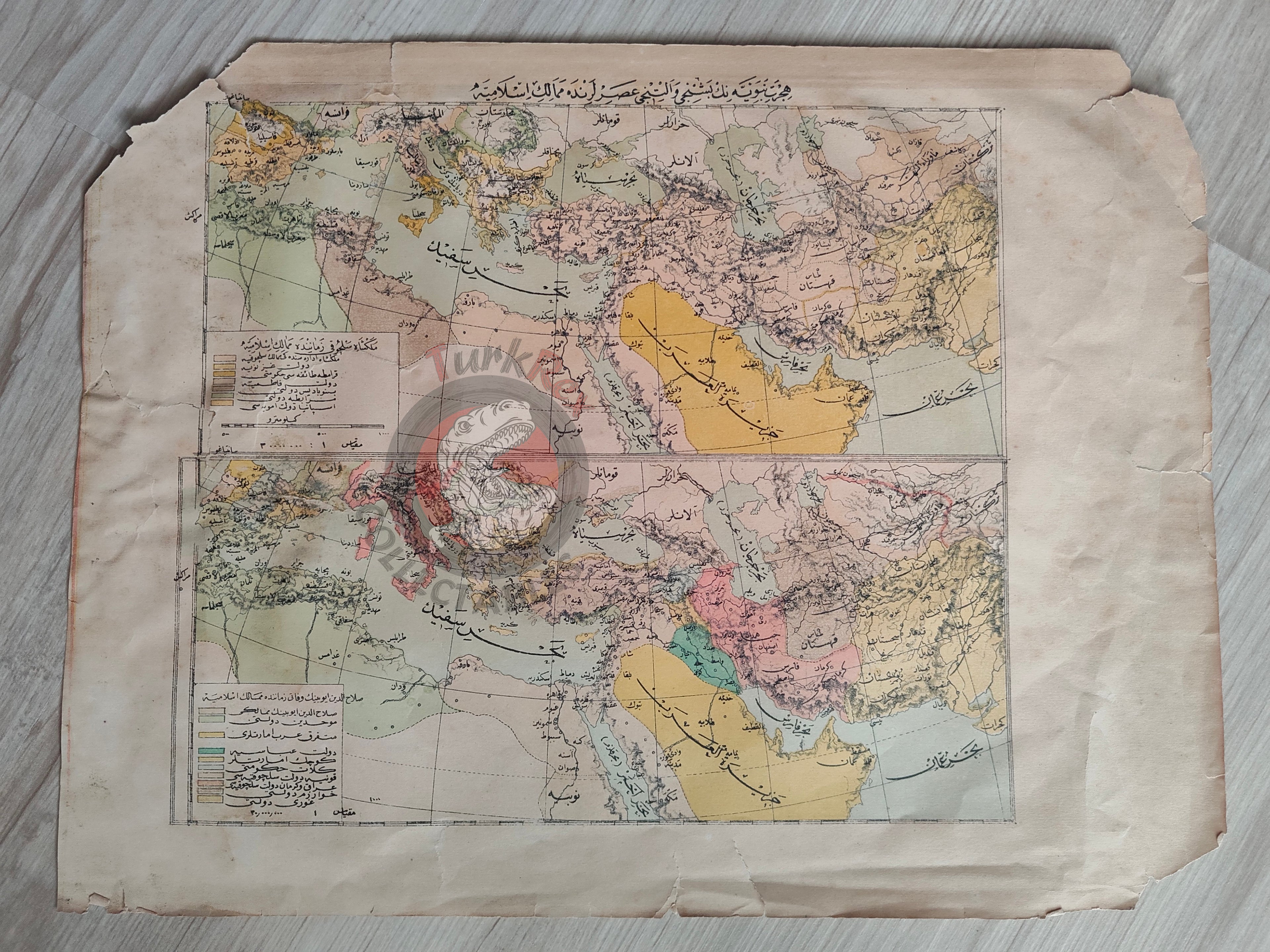


Expansion of Islam in the 5th and 6th Centuries Ottoman Map Arabian Peninsula Anatolia
Ottoman Turkish Historical Map – Expansion of Islam in the 5th and 6th Centuries (Memalik-i İslamiyye)
Description:
A large Ottoman Turkish historical map titled “Hicret-i Nebeviyyenin Beşinci ve Altıncı Asırlarında Memalik-i İslamiyye” (The Islamic Territories in the 5th and 6th Centuries of the Hijra). The map illustrates the expansion of Islam over time, showing the regions incorporated during these centuries.
Measuring 35.2 × 27.2 cm, the map depicts Anatolia, the Arabian Peninsula, North Africa, Iran, and parts of Europe. It was likely published in the early 20th century as part of an Ottoman historical or educational work, though the exact source volume is not identified.
This map represents a rare example of Ottoman historiographical cartography, where maps were used as visual aids to teach the spread of Islam across different territories.
Key Features:
-
Title/Subject: Expansion of Islam – 5th and 6th Centuries AH
-
Language: Ottoman Turkish
-
Date: Early 20th century (exact source unidentified)
-
Dimensions: 35.2 × 27.2 cm
-
Geographic Coverage: Anatolia, Arabian Peninsula, North Africa, Iran, and parts of Europe
-
Content: Illustrates territorial expansion of Islam in the 5th–6th centuries of the Hijra
-
Significance: Rare Ottoman historical map showing Islamic expansion as part of early 20th-century educational or scholarly publications
-
Condition: Minor tears and light creasing to the paper