


France 1867 Ottoman Atlas Map Ottoman Empire Europe
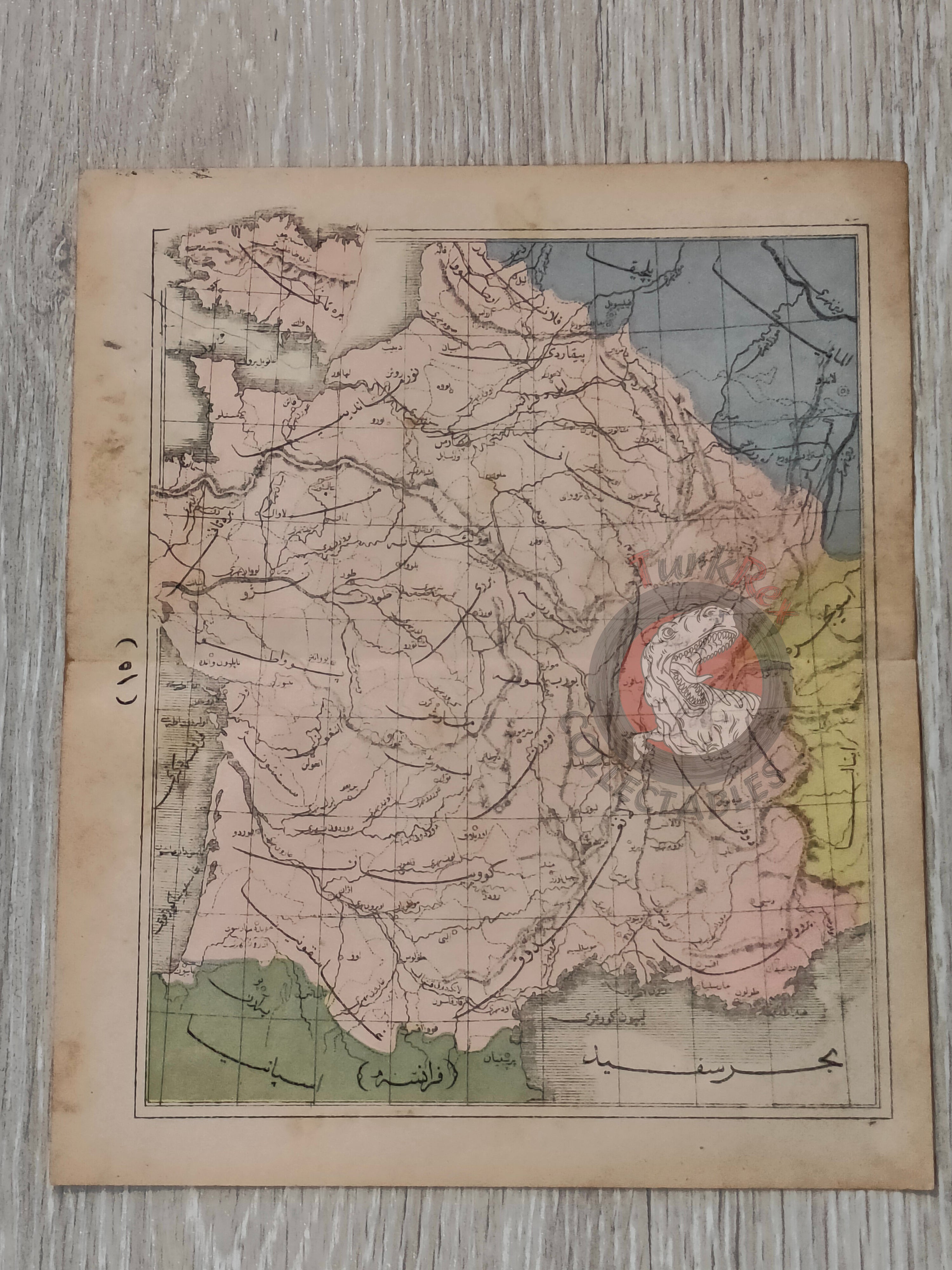
Ottoman Map of France – From Sağir Coğrafya Atlası by Mustafa Hami Pasha (1867)
Description:
This rare Ottoman map of France was published in 1284 AH (1867 CE) in Istanbul as part of Sağir Coğrafya Atlası by Mustafa Hami Pasha. Measuring 23.3 × 19.6 cm, the map originates from one of the earliest Ottoman printed atlases designed for educational use.
The Sağir Coğrafya Atlası (“Small Atlas of Geography”) represents a crucial stage in the modernization of Ottoman education during the mid-19th century. Printed in Istanbul, it introduced Ottoman students to European-style cartography and world geography, reflecting the empire’s increasing emphasis on scientific learning and schooling reforms of the Tanzimat period.
For collectors, this map is significant not only as a cartographic depiction of 19th-century France but also as a rare survival from early Ottoman school atlases. Such educational maps were heavily used by students, making intact examples uncommon today.
Key Features:
-
Date: 1284 AH (1867 CE)
-
Author: Mustafa Hami Pasha
-
Source: Sağir Coğrafya Atlası (Small Atlas of Geography)
-
Place of Publication: Istanbul
-
Region Depicted: France
-
Dimensions: 23.3 × 19.6 cm
-
Historical Context: Part of an Ottoman educational atlas introducing geography and cartography to schools during the Tanzimat reforms
-
Cultural Significance: Rare Ottoman educational map, bridging Western-style cartography and Ottoman pedagogy