


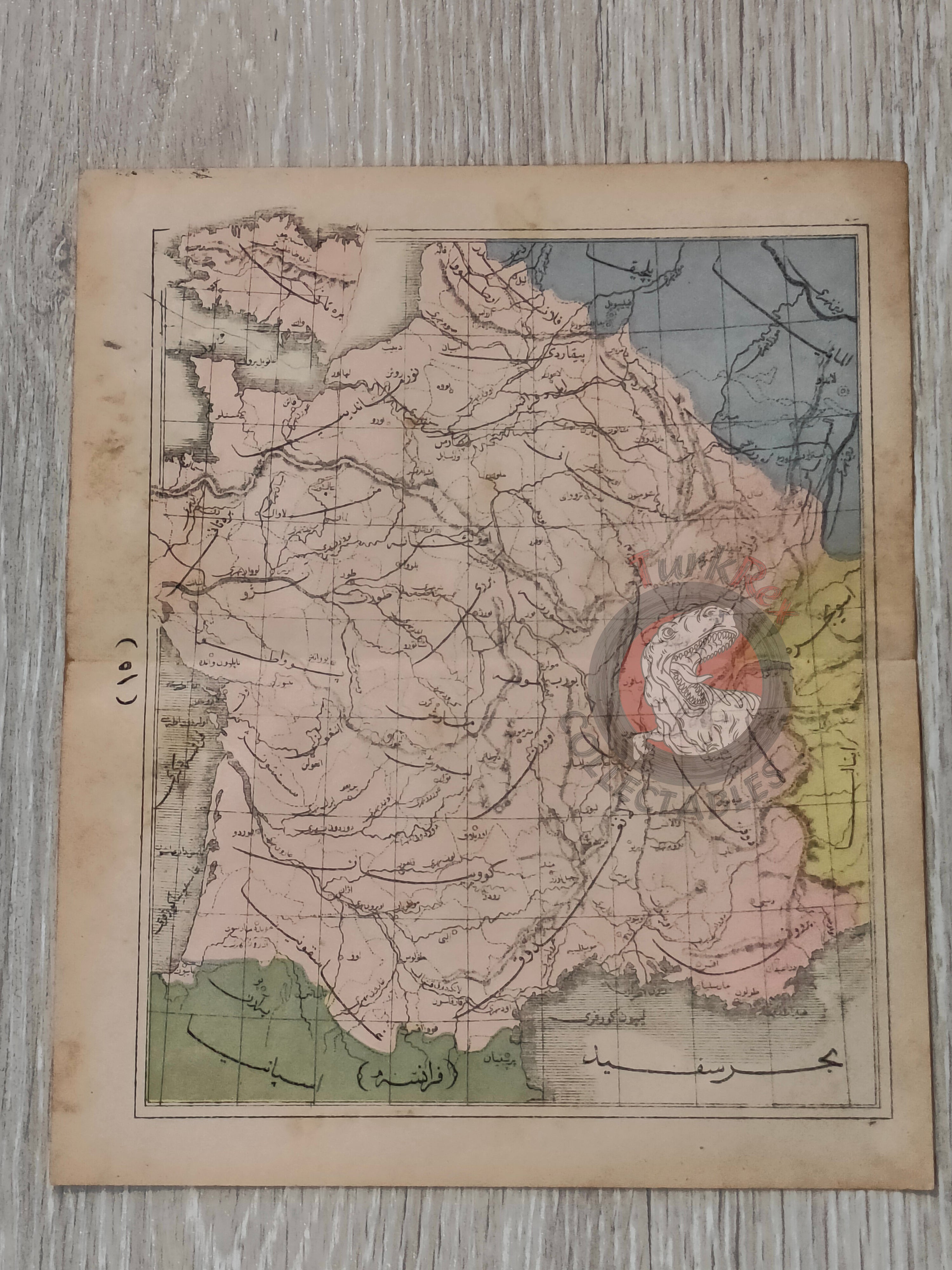


France 1867 Ottoman Atlas Map Ottoman Empire Europe
Ottoman Map of France from Sağir Coğrafya Atlası by Mustafa Hami Pasha – 1284 AH (1867)
Description:
This original Ottoman Turkish map depicts France and was published in 1284 AH (1867 AD) as part of the Sağir Coğrafya Atlası, authored by Mustafa Hami Pasha and printed in Istanbul. Measuring 23.3 × 19.6 cm, the map is presented in color and illustrates the full territory of France along with its surrounding geopolitical context. The borders with Spain, Italy, Germany, and Belgium are clearly shown, situating France within the broader framework of Western Europe.
The atlas itself is considered among the earliest examples of Ottoman educational cartography, created with the purpose of introducing modern geographic knowledge to students. At a time when the Ottoman Empire was actively reforming its educational system, works like this played a crucial role in bridging traditional learning with contemporary European scientific approaches.
Mustafa Hami Pasha, originally a military physician (Mirliva) and a graduate of the Mekteb-i Tıbbiye-i Şahane, was a prolific and versatile Ottoman intellectual. He authored more than thirty works across disciplines such as medicine, military science, and education. In preparing this atlas, he drew extensively from French geographical sources, adapting Western cartographic techniques into an Ottoman educational framework. This synthesis of knowledge is clearly visible in the structure, clarity, and geographic scope of the map.
Beyond its educational function, this map presents France as one of the central powers of 19th-century Europe, clearly framed by its major neighbors across the continent. The depiction of Spain, Italy, Germany, and Belgium emphasizes France’s strategic position within European geography and politics during a period of intense modernization and geopolitical change. For collectors, this piece offers both strong visual appeal and historical depth, reflecting how Ottoman scholars interpreted Western Europe through an educational and analytical lens.
Key Features:
• Type: Ottoman printed map
• Title: France
• Source: Sağir Coğrafya Atlası
• Author: Mustafa Hami Pasha
• Date: 1284 AH (1867 AD)
• Place of Publication: Istanbul
• Language: Ottoman Turkish (Arabic script)
• Region Depicted: France with neighboring countries Spain, Italy, Germany, and Belgium
• Color: Original colored map
• Dimensions: 23.3 × 19.6 cm
• Cartographic Context: Early Ottoman educational atlas influenced by French geographic sources
• Historical Significance: Reflects 19th-century European political geography and Ottoman educational modernization
• Collectible Significance: Rare Ottoman map showing France and its geopolitical surroundings