


France 1910s Ottoman Atlas Map Ottoman Empire Europe
Ottoman Map of France – Maybe From Mükemmel ve Mufassal Coğrafya-yı Umûmî Atlası (ca. 1910s–1920s)
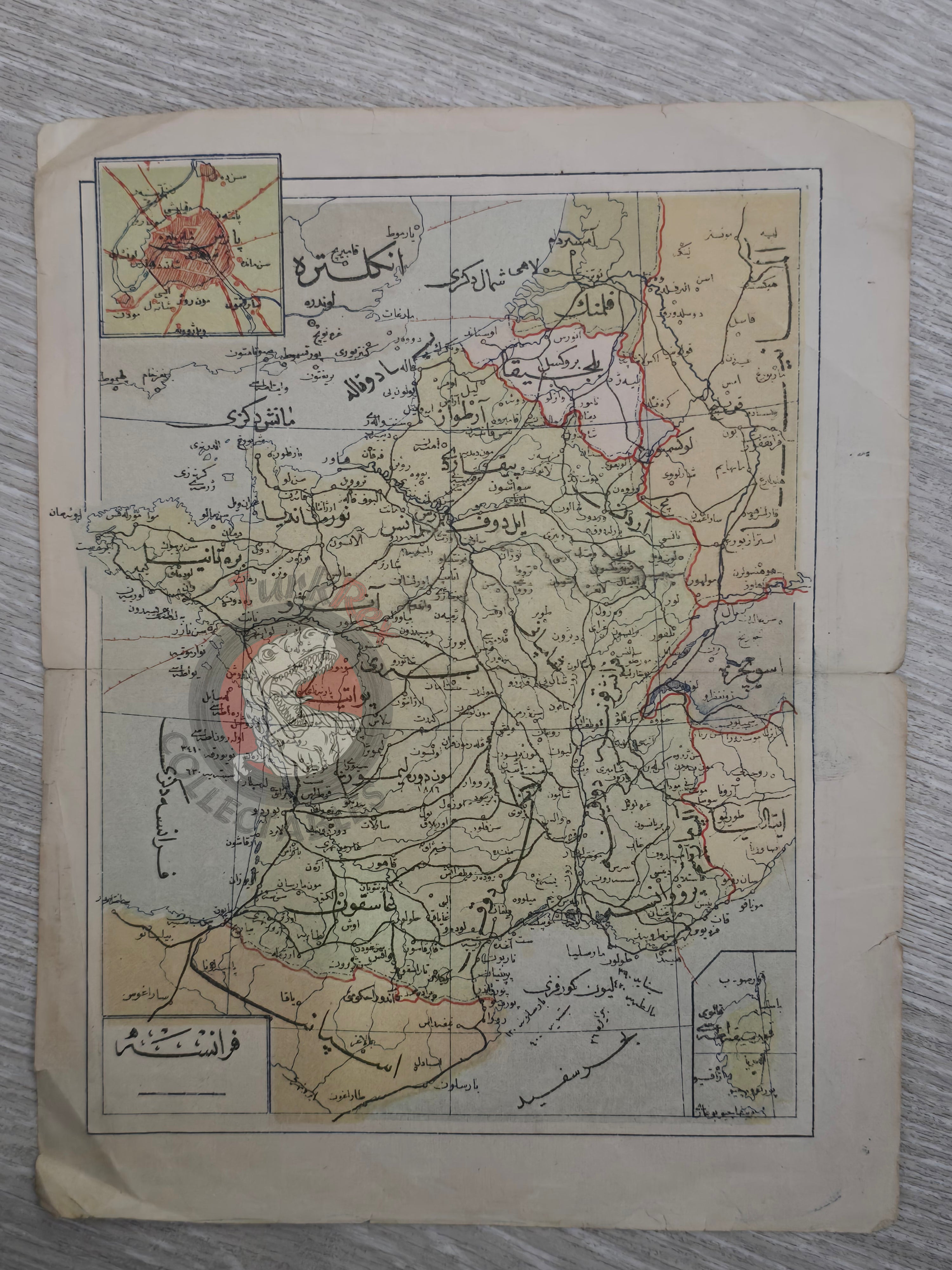
Description:
This Ottoman map of France, measuring 22.7 × 17.6 cm, closely matches the France map published in the 1324 AH (1908 CE) edition of Mükemmel ve Mufassal Coğrafya-yı Umûmî Atlası. However, the minor variation in the text at the lower right corner suggests that this example originates from a later printing of the atlas, likely dating from the 1910s or early 1920s.
The Mükemmel ve Mufassal Coğrafya-yı Umûmî Atlası (“The Complete and Detailed Atlas of General Geography”) was one of the most ambitious Ottoman attempts to produce a comprehensive world atlas for educational use. It reflected the empire’s growing commitment to modern sciences and geography teaching in the late Hamidian and early Constitutional periods.
Maps from this atlas are rare survivals, as they were originally intended for classroom and reference use rather than luxury printing. This particular map of France is a fine example of early 20th-century Ottoman cartography, bridging late Ottoman and early Republican print culture.
Key Features:
-
Date: ca. 1910s–1920s (later printing)
-
Source: Mükemmel ve Mufassal Coğrafya-yı Umûmî Atlası
-
Comparable to: The France map from the 1324 AH (1908) edition, with textual variations indicating later publication
-
Region Depicted: France
-
Dimensions: 22.7 × 17.6 cm
-
Historical Context: Produced during the late Ottoman period, reflecting modernization of geography education and printing
-
Cultural Significance: A rare Ottoman atlas map, valuable for both its educational role and as a transitional piece between late Ottoman and early Turkish cartography