


Greco Turkish War 1897 Armies Around Arta Greece Ottoman Empire Military Map
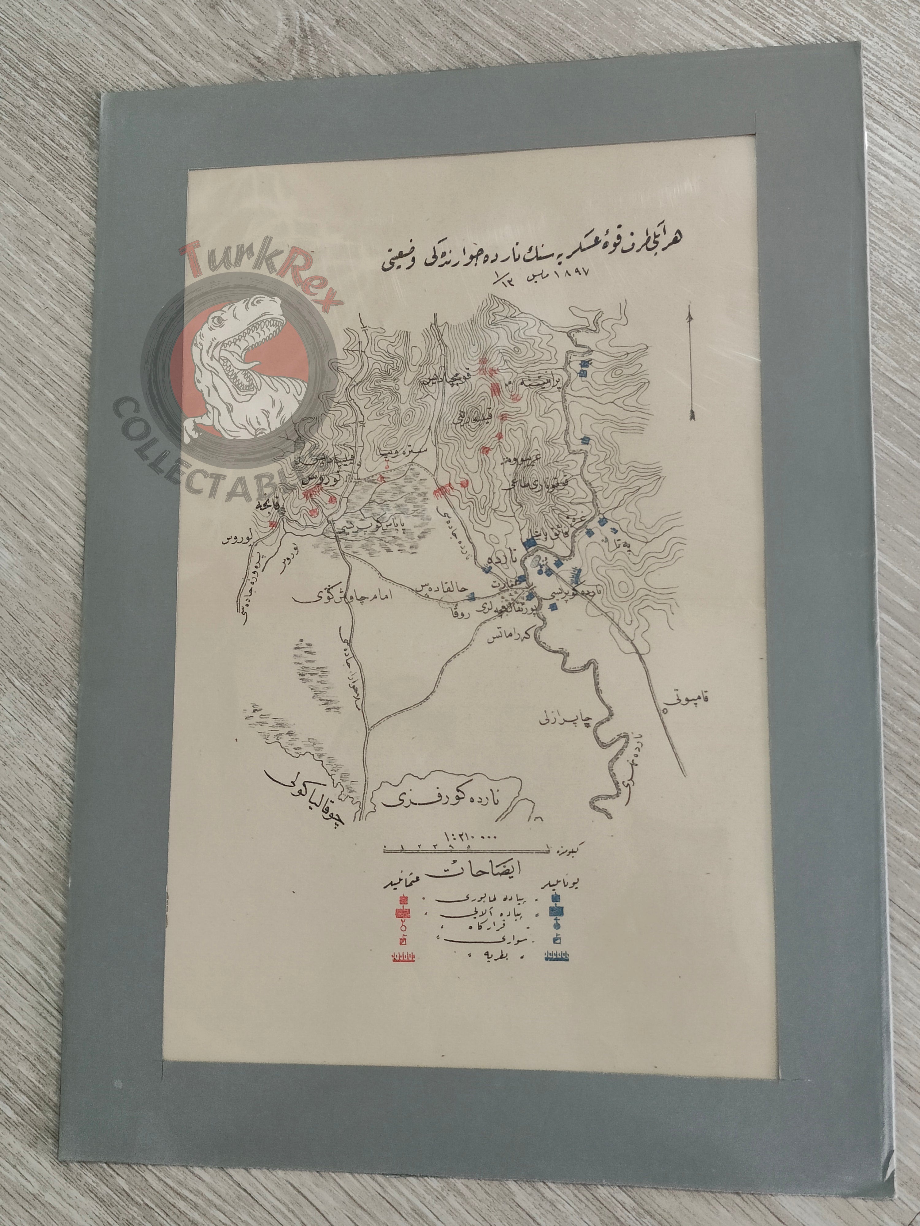
Ottoman Military Map – Greco-Turkish War, “Forces near Narda (Arta, Greece),” May 1897
Description:
This is an original Ottoman military map (kroki) showing the positions of both the Turkish and Greek armies around Narda (modern-day Arta, Greece) during the Greco–Turkish War of 1897. The title reads “Her iki taraf kuvve-i askeriyesinin Narda civarındaki vaziyeti, Mayıs 1897” (“The situation of the military forces of both sides near Narda, May 1897”).
The map distinguishes between infantry and cavalry units, providing a clear tactical representation of the battlefield. Such schematic maps were commonly prepared for and used in Ottoman military schools as instructional materials, helping officers study real examples of troop movements and strategy.
With its detailed depiction of unit types and positions, this document offers a rare glimpse into Ottoman military pedagogy and the empire’s approach to documenting contemporary conflicts.
Key Features:
-
Title: “Her iki taraf kuvve-i askeriyesinin Narda civarındaki vaziyeti, Mayıs 1897”
-
Conflict: Greco–Turkish War of 1897
-
Location: Narda (modern-day Arta, Greece)
-
Type: Military schematic map (kroki)
-
Content: Positions of Turkish and Greek forces; infantry and cavalry separately marked
-
Purpose: Educational use in Ottoman military schools
-
Size: 25 × 35 cm
-
Historical Significance: Rare example of Ottoman cartography used in military education, illustrating the 1897 war with Greece