


Iran and Afghanistan 1907 Ottoman Atlas Map Empire Mehmed Eşref Middle East Qatar UAE
Ottoman Map of Iran and Afghanistan - From Umum-i Vilayet-i Şahane’yi Havi Küçük Atlas (1325 AH / 1907)
Description:
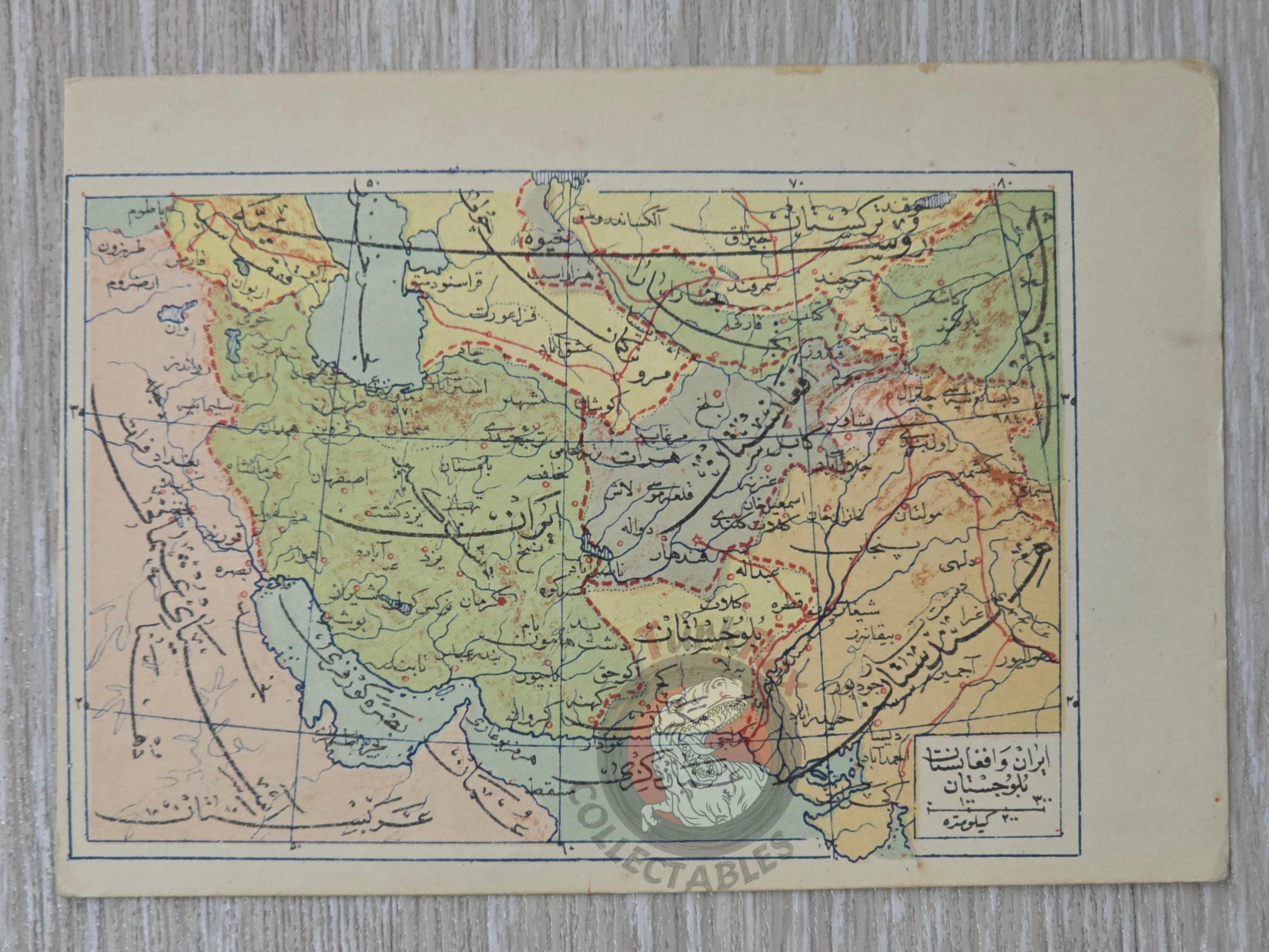
An original Ottoman Turkish map depicting Iran, Afghanistan, Pakistan, Qatar, and the United Arab Emirates, published in 1325 AH (1907 CE) as part of Umum-i Vilayet-i Şahane’yi Havi Küçük Atlas, authored by Mehmed Eşref. This rare atlas included a 32-page brochure in Ottoman script and 128 maps (some composed of two parts), printed on thick paper and loosely inserted after the text. Many of the maps represent the first and in some cases only Ottoman maps of these regions, making them significant for historical and cartographic research.
The map measures 14.6 × 10.3 cm and provides a detailed geographic representation of Iran, Afghanistan, and neighboring territories as understood in the early 20th century Ottoman context.
Key Features:
-
Region: Iran, Afghanistan, Pakistan, Qatar, United Arab Emirates
-
Dimensions: 14.6 × 10.3 cm
-
Date: 1325 AH (1907 CE)
-
Source: Umum-i Vilayet-i Şahane’yi Havi Küçük Atlas
-
Author: Mehmed Eşref
-
Format: Included in a rare small atlas with 32-page Ottoman script brochure and 128 maps
-
Historical Significance: Contains some of the first Ottoman maps of Iran, Afghanistan, and neighboring regions
-
Cultural Significance: Reflects Ottoman cartographic knowledge and atlas production in the early 20th century