


Iran and Persian Gulf 1898 Ottoman Atlas Map Empire Kuwait Saudi Arabia
Ottoman Turkish Map of the Persian Gulf and Iran – from Yeni Coğrafya Atlasi (1898)
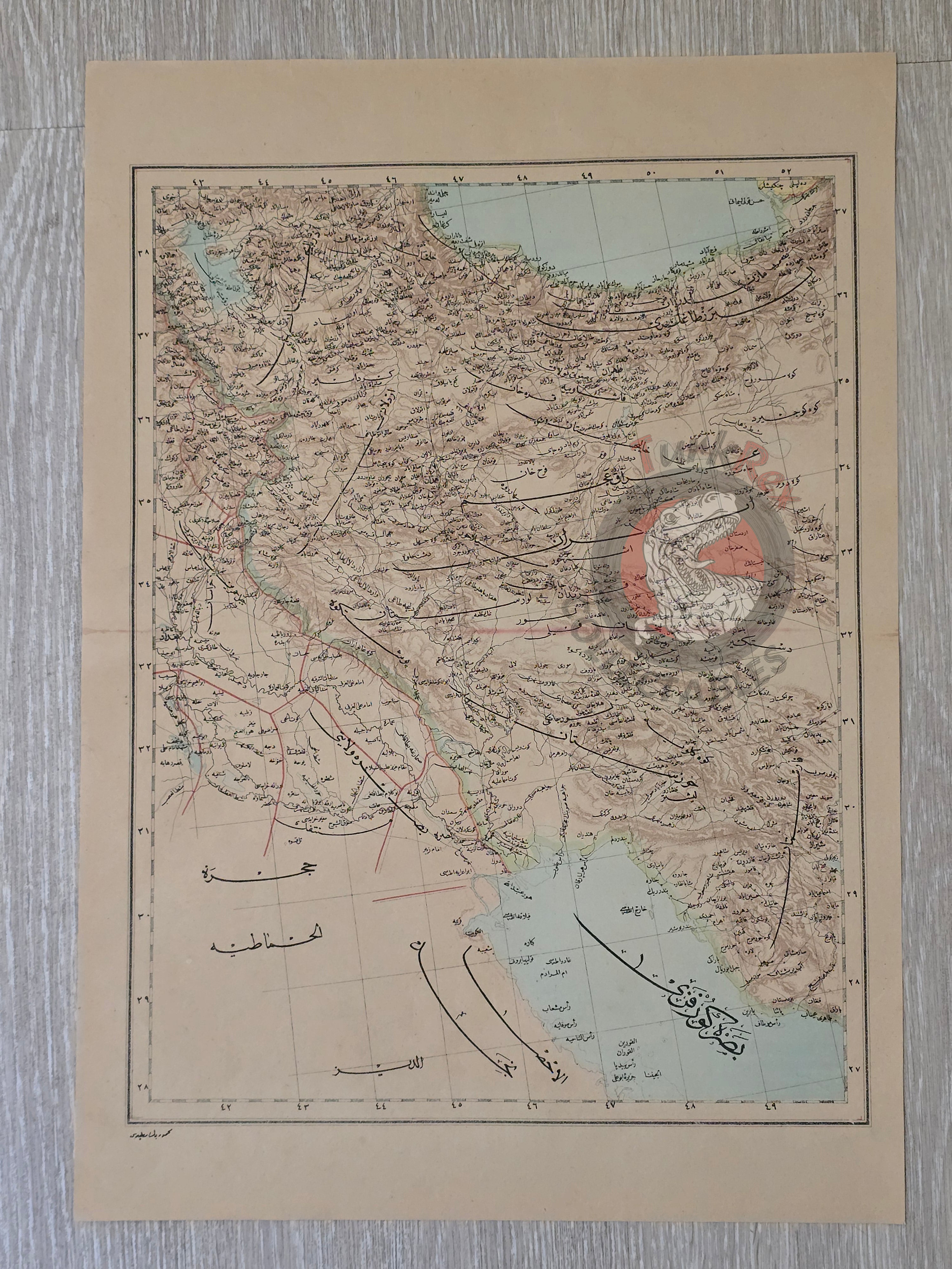
Description:
A large Ottoman Turkish map of the Persian Gulf and Iran, measuring 51 × 36 cm, published in 1316 AH (1898 CE). This map is part of the “Yeni Coğrafya Atlasi” (New Geographical Atlas), edited by Ali Şeref Paşa and Hafız Ali Eşref, issued by the Matbaa-i Âmire and printed by Hasan Ferid.
The Yeni Coğrafya Atlasi was a landmark Ottoman publication, containing 42 double-page lithographed color maps produced between 1309–1314 AH (1893–1898 CE). Covering diverse regions of the world, it reflects the Ottoman Empire’s wide-ranging geographic and strategic interests in the late 19th century.
This particular sheet covers the Persian Gulf region, including areas corresponding today to Saudi Arabia, Kuwait, Iran, and Iraq. It provides a valuable view of how the Ottomans understood and represented this geopolitically crucial area at the time.
Ali Şeref Paşa, one of the editors, had been trained as a cartographer in Paris before becoming chief cartographer at Matbaa-i Âmire, the successor to İbrahim Müteferrika’s pioneering press founded in 1727. His background highlights the strong influence of European cartographic methods on late Ottoman mapmaking.
Key Features:
-
Title/Subject: Persian Gulf and Iran
-
Publication Date: 1316 AH (1898 CE)
-
Atlas: Yeni Coğrafya Atlasi (New Geographical Atlas)
-
Editors: Ali Şeref Paşa & Hafız Ali Eşref
-
Printer: Hasan Ferid
-
Publisher: Matbaa-i Âmire, Istanbul
-
Dimensions: 51 × 36 cm
-
Content: Depicts the Persian Gulf and adjacent lands; modern-day Saudi Arabia, Kuwait, Iran, Iraq
-
Technique: Lithographed color map
-
Significance: Rare late Ottoman atlas map, combining imperial strategic concerns with European-trained scientific cartography