


Iran India Turkistan 1906 Ottoman Atlas Map Empire China Arabian Peninsula Pakistan
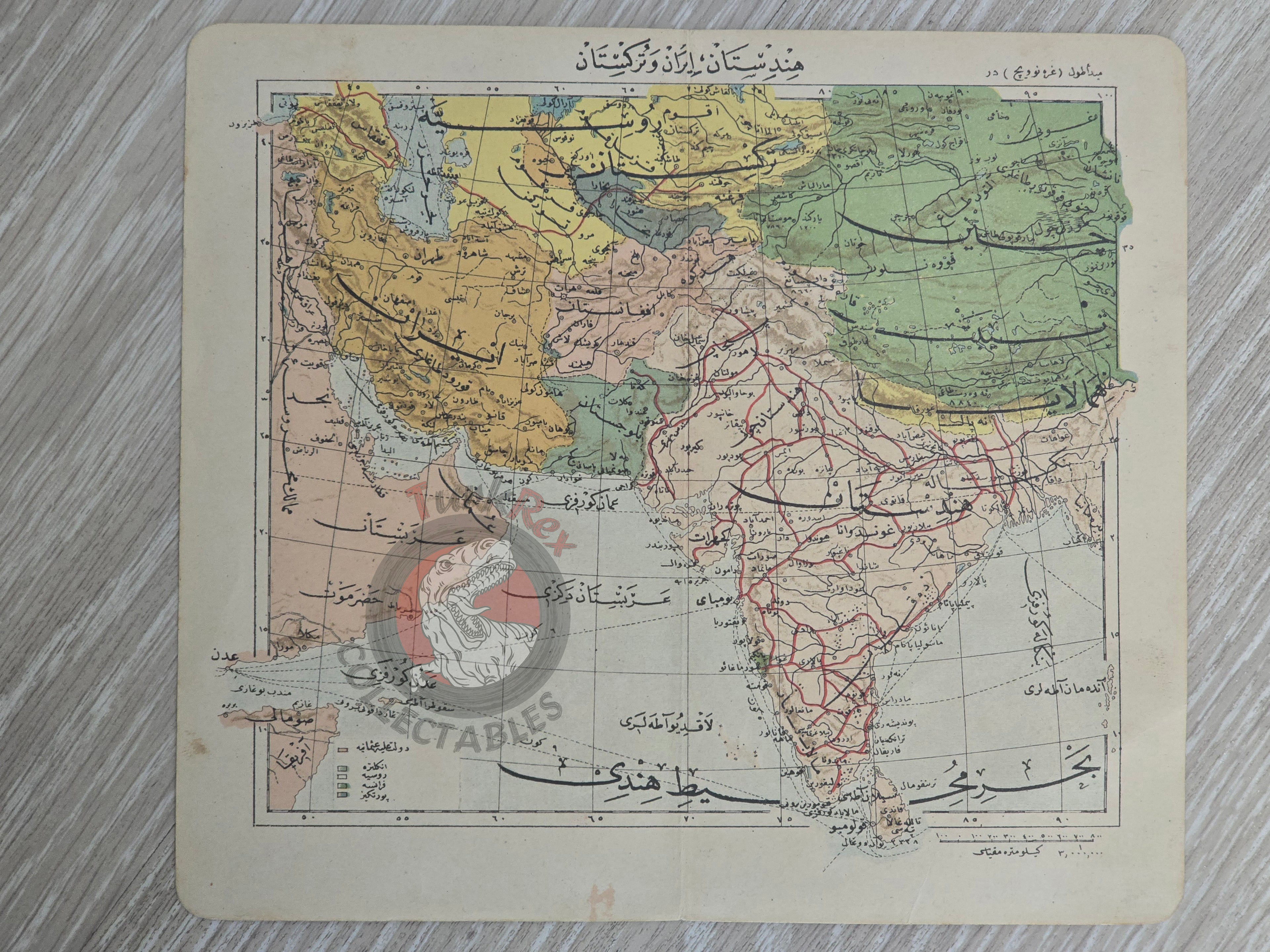
Ottoman Map - Hindistan, İran ve Türkistan from Tüccarzade İbrahim Hilmi’s “Umumi Cep Atlası”, 1906
Description:
An original Ottoman map titled “Hindistan, İran ve Türkistan”, published in 1324 AH (1906 AD) within Tüccarzade İbrahim Hilmi’s “Umumi Cep Atlası” (General Pocket Atlas). The map measures 19.3 × 17.1 cm.
The geographical scope covers India, Iran, and Turkistan, but also depicts adjacent regions including parts of China and the Arabian Peninsula. This reflects the Ottoman intellectual and educational interest in broader Asian territories during the late 19th–early 20th century, at a time when global trade, colonial competition, and Pan-Islamic thought made these regions highly relevant.
Tüccarzade İbrahim Hilmi (later İbrahim Hilmi Çığıraçan, 1876–1963) was a notable Ottoman-Turkish publisher, journalist, and intellectual who sought to popularize knowledge through affordable educational works. His Umumi Cep Atlası is among the rare Ottoman attempts to produce compact, accessible world atlases for students and the general public.
Key Features:
-
Title: Hindistan, İran ve Türkistan
-
Source: Tüccarzade İbrahim Hilmi, Umumi Cep Atlası
-
Date: 1324 AH / 1906 AD
-
Size: 19.3 × 17.1 cm
-
Coverage: India, Iran, Turkistan, with parts of China and the Arabian Peninsula
-
Language: Ottoman Turkish
-
Historical Significance: Rare Ottoman atlas map reflecting global geographical awareness; educational and cultural artifact of the late Hamidian / early Second Constitutional Era publishing world