


Iran Lorestan 1915 Ottoman WW1 Military Map Empire Middle East Bulgaria
Ottoman Military Map – Iran (Lorestan Province), General Staff (Erkan-ı Harbiye), 1915
Description:
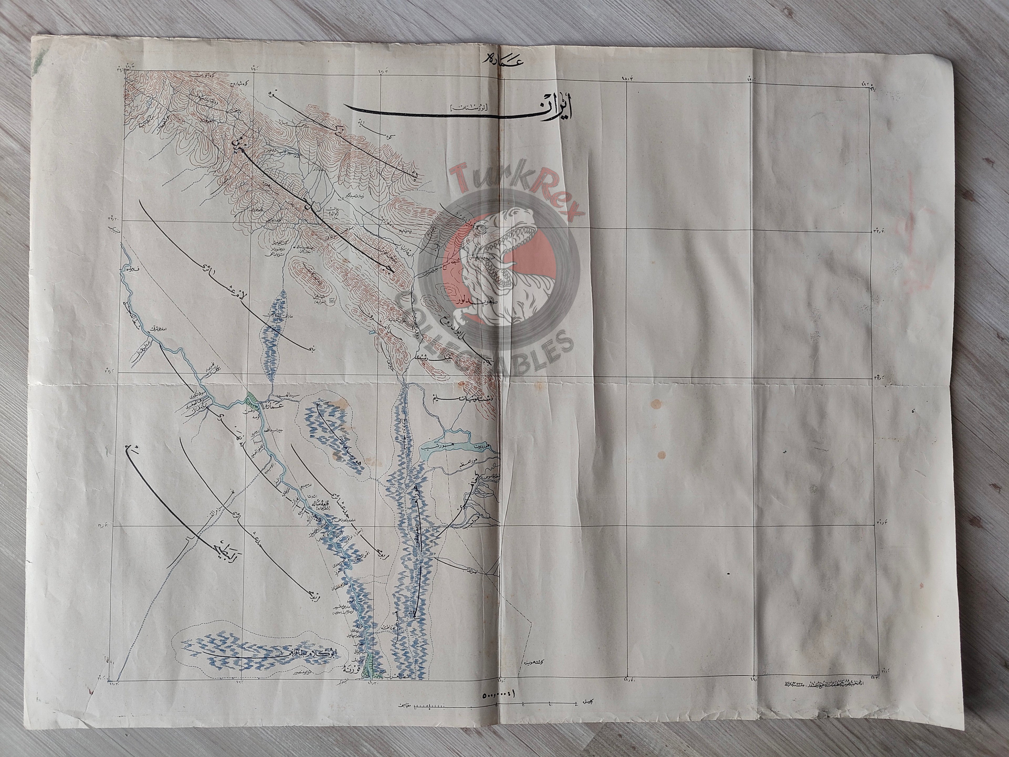
A rare Ottoman military map prepared by the General Staff (Erkan-ı Harbiye), dated 1333 AH (1915 AD), measuring 68 × 50 cm. Produced during the First World War, this map belongs to a series of detailed charts created for military operations and strategic planning.
The map depicts Lorestan (Luristan Province, Iran) and records the settlements of numerous tribal groups (aşiret) inhabiting the region. Among the names legible are Ebu Muhammed Aşireti, Elbattıh Aşireti, Beni Lam Aşireti, and others demonstrating the Ottoman military’s close attention to local tribal geography and demography, crucial for intelligence and logistics during wartime campaigns.
An extraordinary feature of this specimen is its reverse side: instead of being blank (as was standard for General Staff maps), it contains a Bulgarian map of Dupnitsa and Boboshevo, with Ottoman annotations. This unusual reuse of printed sheets reflects the severe shortages of paper and resources during World War I, when every material was repurposed for the war effort.
Historical Context:
The Erkan-ı Harbiye, originally founded as a military academy under Sultan Mahmud II in 1835 to train officers, played a vital role in producing cartographic material for the Ottoman army. By the early 20th century, it had developed into a modern institution, generating maps that combined field reconnaissance with adapted foreign sources.
This particular map is thus not only a wartime military artifact, but also a material witness to the resource constraints and improvisations of the Ottoman state during World War I. Its dual-sided printing makes it an exceptionally rare survival.
Key Features:
-
Type: Ottoman military map (Erkan-ı Harbiye haritası)
-
Date: 1333 AH (1915 AD)
-
Size: 68 × 50 cm
-
Region: Iran - Lorestan Province
-
Details: Locations and names of local tribes (e.g., Ebu Muhammed, Elbattıh, Beni Lam)
-
Reverse: Bulgarian map of Dupnitsa & Boboshevo, with Ottoman Turkish annotations
-
Context: First World War production; shows both strategic geographic intelligence and resource scarcity (dual-use paper)
-
Significance: Extremely rare example of an Ottoman General Staff map with reused reverse printing — blending military cartography, ethnographic intelligence, and wartime material culture