


Iraq Al-Jazira 1928 Ottoman Script Atlas Map Middle East Mosul Kirkuk
Ottoman Map of Al-Jazira (Mesopotamia) – From Mükemmel ve Mufassal Türkiye Cumhuriyeti Atlası (1928)
Description:
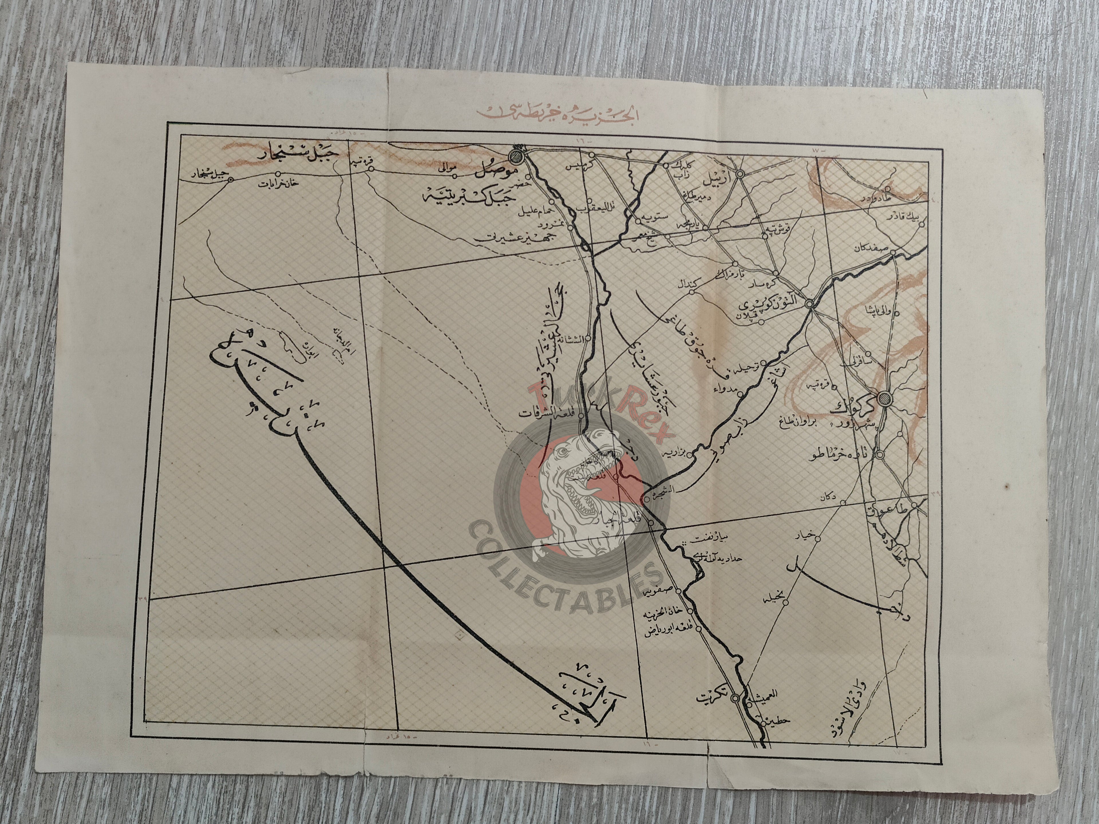
An Ottoman Turkish map titled “Elcezire Haritası”, depicting the Mosul and Kirkuk region of Mesopotamia, published in 1928 as part of Mükemmel ve Mufassal Türkiye Cumhuriyeti Atlası, authored by Mehmed Rüşdü.
This atlas was printed just before the Turkish Alphabet Reform of 1 November 1928, when the Arabic-based Ottoman script was replaced with the Latin-based Turkish alphabet. As such, it stands as one of the last examples of cartographic works produced in Ottoman Turkish script.
Measuring 33.5 × 23.8 cm, the map illustrates northern Mesopotamia and its surroundings, offering a valuable geographic reference from the transitional period between the late Ottoman cartographic tradition and the early Turkish Republic.
Key Features:
-
Title/Region: Elcezire (Mesopotamia – Mosul, Kirkuk region)
-
Date: 1928
-
Source: Mükemmel ve Mufassal Türkiye Cumhuriyeti Atlası
-
Author: Mehmed Rüşdü
-
Dimensions: 33.5 × 23.8 cm
-
Historical Context: Printed before the Alphabet Reform of 1928, marking the end of Ottoman script use
-
Cultural Significance: Rare example of early Republican-era cartography in Ottoman Turkish