


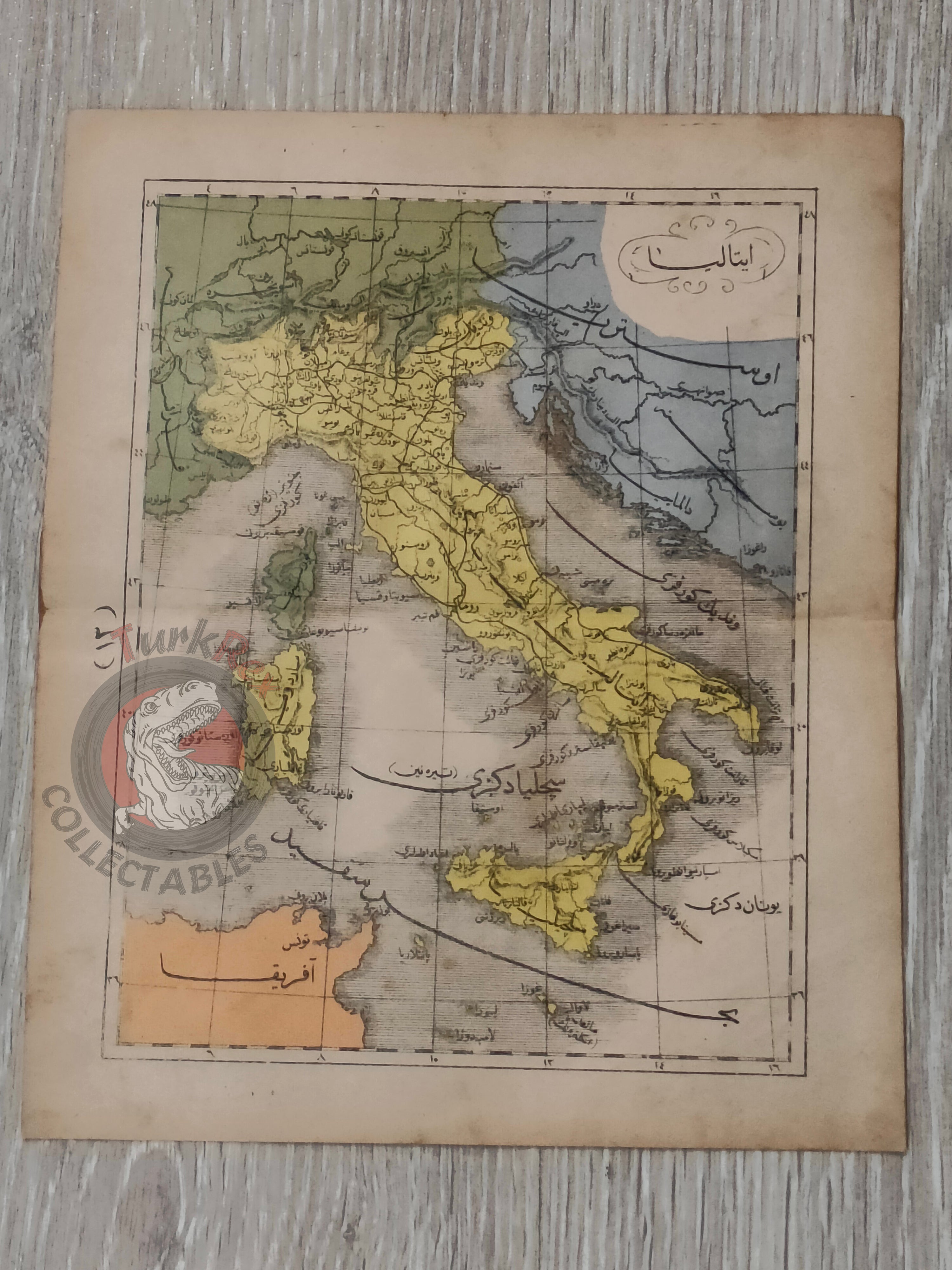


Italy 1867 Ottoman Atlas Map Ottoman Empire Europe Bosnia Sardegna
Ottoman Map of Italy from Sağir Coğrafya Atlası by Mustafa Hami Pasha – 1284 AH (1867)
Description:
This original Ottoman Turkish map depicts Italy and was published in 1284 AH (1867 AD) as part of the Sağir Coğrafya Atlası, authored by Mustafa Hami Pasha and printed in Istanbul. Measuring 23.5 × 19.5 cm, the map is presented in color and illustrates the full territory of Italy along with portions of its surrounding regions. The depiction includes parts of Bosnia, Dalmatia, Austria, and France, as well as key maritime features such as the Adriatic Sea and the island of Sardinia, placing Italy within its broader Mediterranean and Central European context.
The atlas itself is considered among the earliest examples of Ottoman educational cartography, created with the purpose of introducing modern geographic knowledge to students. At a time when the Ottoman Empire was actively reforming its educational system, works like this played a crucial role in bridging traditional learning with contemporary European scientific approaches.
Mustafa Hami Pasha, originally a military physician (Mirliva) and a graduate of the Mekteb-i Tıbbiye-i Şahane, was a prolific and versatile Ottoman intellectual. He authored more than thirty works across disciplines such as medicine, military science, and education. In preparing this atlas, he drew extensively from French geographical sources, adapting Western cartographic techniques into an Ottoman educational framework. This synthesis of knowledge is clearly visible in the structure, clarity, and geographic scope of the map.
Beyond its educational function, this map presents Italy as a geographically central Mediterranean power, whose connections extend into both Central Europe and the Balkans. The inclusion of Bosnia and Dalmatia highlights the historical importance of the Adriatic coastline, while Austria and France’s partial depiction situates Italy within a wider European balance of power. For collectors, this piece offers a visually rich and historically layered representation of 19th-century European geography as seen through Ottoman educational cartography.
Key Features:
• Type: Ottoman printed map
• Title: Italy
• Source: Sağir Coğrafya Atlası
• Author: Mustafa Hami Pasha
• Date: 1284 AH (1867 AD)
• Place of Publication: Istanbul
• Language: Ottoman Turkish (Arabic script)
• Region Depicted: Italy with parts of Bosnia, Dalmatia, Austria, and France
• Maritime Features: Adriatic Sea and Sardinia Island
• Color: Original colored map
• Dimensions: 23.5 × 19.5 cm
• Cartographic Context: Early Ottoman educational atlas influenced by French geographic sources
• Historical Significance: Reflects Italy’s geopolitical position within Mediterranean and European geography in the 19th century
• Collectible Significance: Rare Ottoman map illustrating Italy and surrounding regions in a detailed educational format