


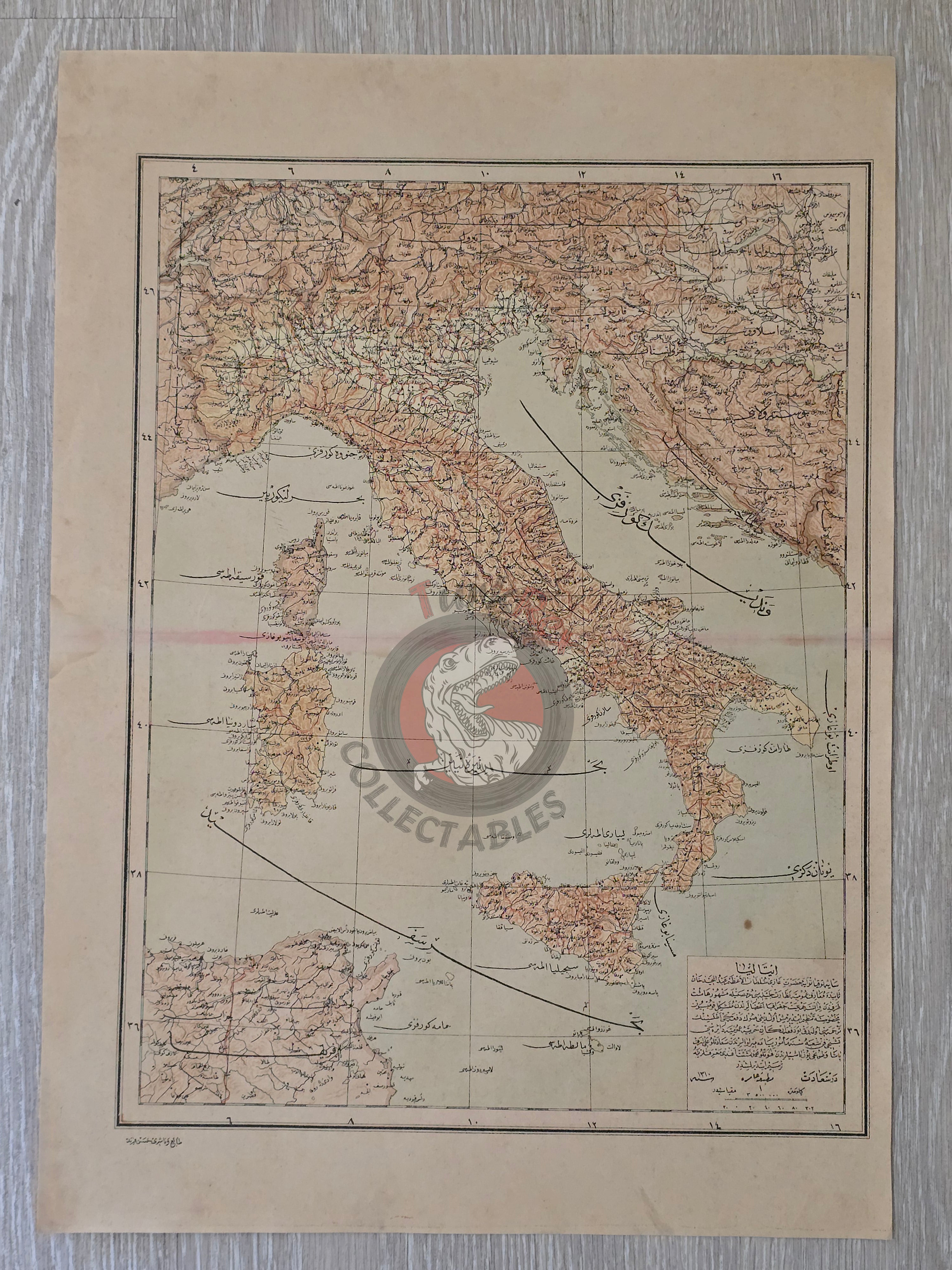


Italy 1894 Ottoman Atlas Map Empire Sardegna Corsica
Ottoman Turkish Map of Italy - from Yeni Coğrafya Atlasi (1894)
Description:
A large Ottoman Turkish map of Germany, also depicting the entirety of Italy , measuring 51 × 36.3 cm. The map was published in 1310 AH (1894 CE) as part of the “Yeni Coğrafya Atlasi” (New Geographical Atlas), edited by Ali Şeref Paşa and Hafız Ali Eşref. It was issued by the Matbaa-i Âmire and printed by Hasan Ferid.
The Yeni Coğrafya Atlasi was a landmark Ottoman atlas, comprising 42 double-page lithographed color maps published between 1309–1314 AH (1893–1898 CE). Covering diverse world regions, it reflects the Ottoman Empire’s broad geographic interests at the end of the 19th century.
Ali Şeref Paşa, one of the editors, was a former soldier who trained as a cartographer in Paris and later became chief cartographer at Matbaa-i Âmire, successor to İbrahim Müteferrika’s pioneering press founded in 1727. His work illustrates the influence of European scientific training and techniques on late Ottoman cartography.
Key Features:
-
Title/Subject: Germany, Holland, and Belgium
-
Publication Date: 1310 AH (1894 CE)
-
Atlas: Yeni Coğrafya Atlasi (New Geographical Atlas)
-
Editors: Ali Şeref Paşa & Hafız Ali Eşref
-
Printer: Hasan Ferid
-
Publisher: Matbaa-i Âmire, Istanbul
-
Dimensions: 51 × 36 cm
-
Content: Detailed depiction of Italy, with complete coverage of Sardegna and Corsica
-
Technique: Lithographed color map
-
Significance: Rare Ottoman atlas map reflecting modernization, European influence, and global geographic scope of the late Ottoman Empire