


Skip to product information


Japan 1905 Ottoman Atlas Map Ottoman Empire China Korea Asia
$180.00
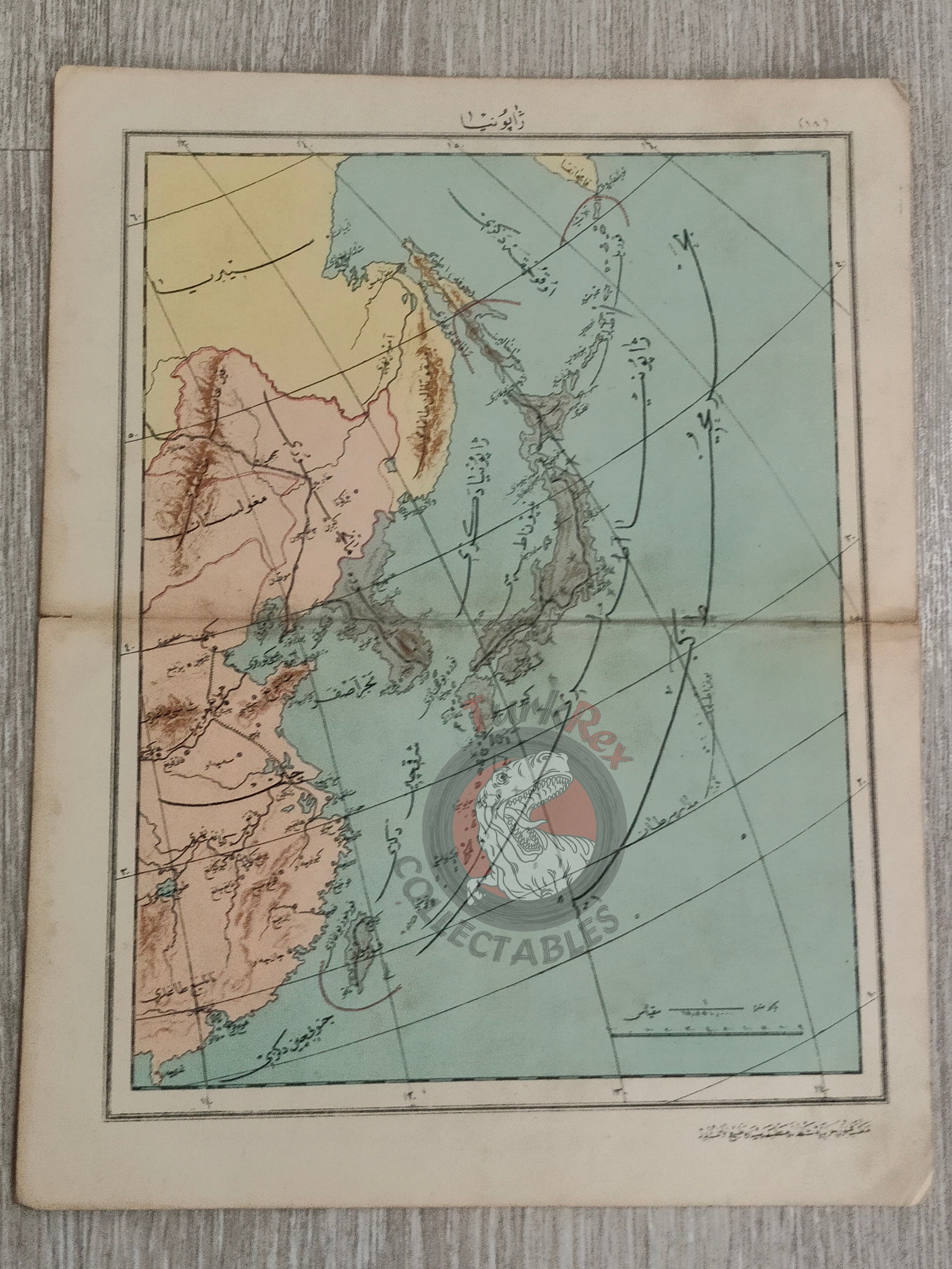
Ottoman Map of Japan – From Mekâtib-i Rüşdiye-i Askeriye-i Şahane Umumi Coğrafya Atlası (1323 AH / 1905 CE)
Description:
A rare Ottoman Turkish map of Japan, published in 1323 AH (1905 CE) in Muhammed Remzi’s Mekâtib-i Rüşdiye-i Askeriye-i Şahane Üçüncü Seneleri Şakirdanına Mahsus Umumi Coğrafya Atlası. This atlas was printed by the Mekteb-i Fünun-i Harbiye-i Şahanesi Matbaası in Istanbul and used as a teaching resource in Ottoman military schools.
Measuring 31.7 × 24.6 cm, the map provides detailed geographic representation of Japan, reflecting the Ottoman Empire’s approach to international geography education in the early 20th century.
Key Features:
- Region: Japan
- Date: 1323 AH / 1905 CE
- Source: Mekâtib-i Rüşdiye-i Askeriye-i Şahane Umumi Coğrafya Atlası by Muhammed Remzi
- Target Audience: Students of the Imperial Military Rüşdiye Schools
- Publisher: Mekteb-i Fünun-i Harbiye-i Şahanesi Matbaası, Istanbul
- Dimensions: 31.7 × 24.6 cm
- Significance: Ottoman military school atlas map used for geographic education