


Jerusalem Ottoman Postcard Map Middle East Ibrahim Hilmi Military Israel Palestine
Ottoman Map Postcard – District of Jerusalem (Kudüs-ü Şerif Mutasarrıflığı)
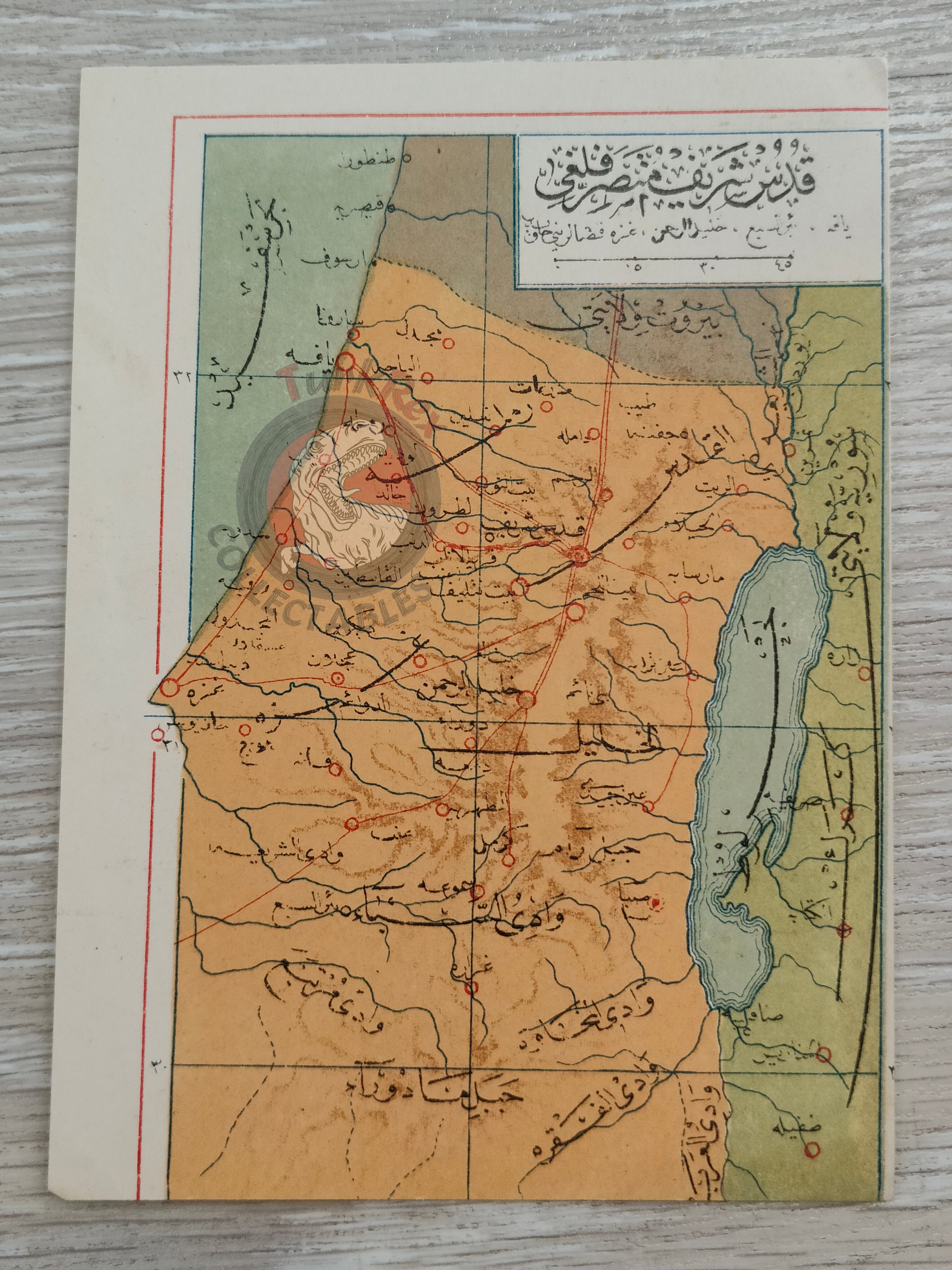
Description:
A rare Ottoman Turkish postcard depicting the District of Jerusalem (Kudüs-ü Şerif Mutasarrıflığı), highlighting its southern borders near the Sinai Desert and featuring the Jerusalem–Jaffa railway marked in red. Measuring 13.7 × 10 cm, it was published in Istanbul by Tüccarzade İbrahim Hilmi’s Military Press (Kitaphane-yi Askeri) as part of a historical postcard series.
Tüccarzade İbrahim Hilmi was a prominent Ottoman publisher and intellectual who played a key role in popularizing geography, history, and educational materials in the late 19th and early 20th centuries. His press produced a variety of atlases, maps, and political writings aimed at spreading knowledge to a wide audience.
This postcard offers valuable insight into how the Ottoman public engaged with geographical knowledge and stands as an important example of early 20th-century Ottoman cartography and publishing.
Key Features:
- Region: District of Jerusalem (Kudüs-ü Şerif Mutasarrıflığı)
- Date: Early 20th century
- Publisher: Tüccarzade İbrahim Hilmi, Kitaphane-yi Askeri, Istanbul
- Dimensions: 13.7 × 10 cm
- Highlights: Southern borders near Sinai, Jerusalem–Jaffa railway marked in red
- Significance: Early 20th-century Ottoman postcard integrating geography and public education