


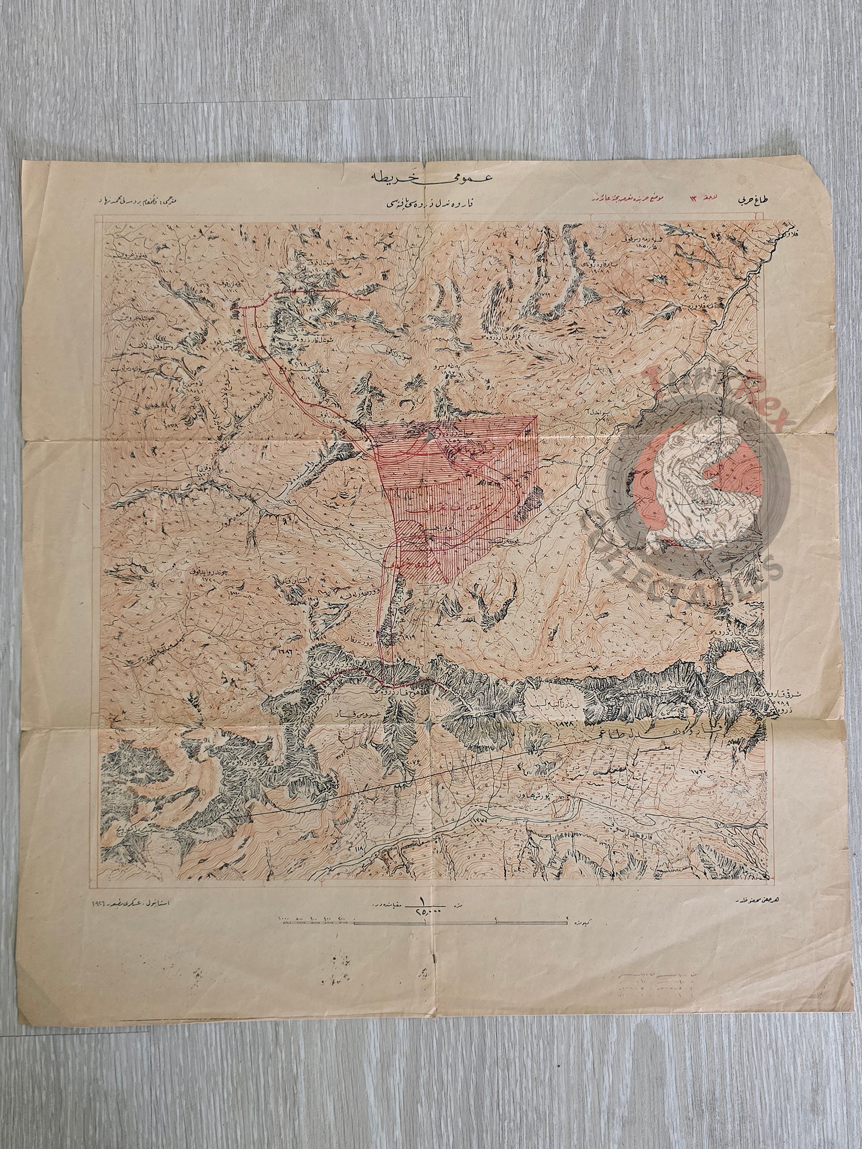


Karwendel Summit Sheet Ottoman Script 1926 Military Map Austria Tactics Rudolf OberHauser
Umumi Harita - Karwendel Zirvesi Paftası (General Map – Karwendel Summit Sheet)
Description:
An Ottoman Turkish military map from the 1926 book “Dağ Harbi” (Mountain Warfare) authored by Rudolf OberHauser and translated by Mehmed Nihad from Bursa. The map focuses on the attack section of positional warfare (Mevzi harbinde taaruz bahsine aittir). Despite being published during the early Republic of Turkey, the map is in Ottoman Turkish using Arabic script, as it predates the alphabet reform (Harf Devrimi).
Key Features:
-
Dimensions: 48.4 × 46 cm
-
Publisher: Askeri Matbaa, Istanbul
-
Purpose: Educational map for military schools
-
Condition: Preserved; text and tactical details clearly legible
-
Significance: Offers a rare insight into early 20th-century Turkish military training and mountain warfare tactics, reflecting transitional period cartography and Ottoman Turkish usage