


Mediterranean Sea Libya Greece 1898 Ottoman Atlas Map Empire Crete
Ottoman Turkish Map of the Mediterranean Sea, Greece and Libya – from Yeni Coğrafya Atlasi (1898)
Description:
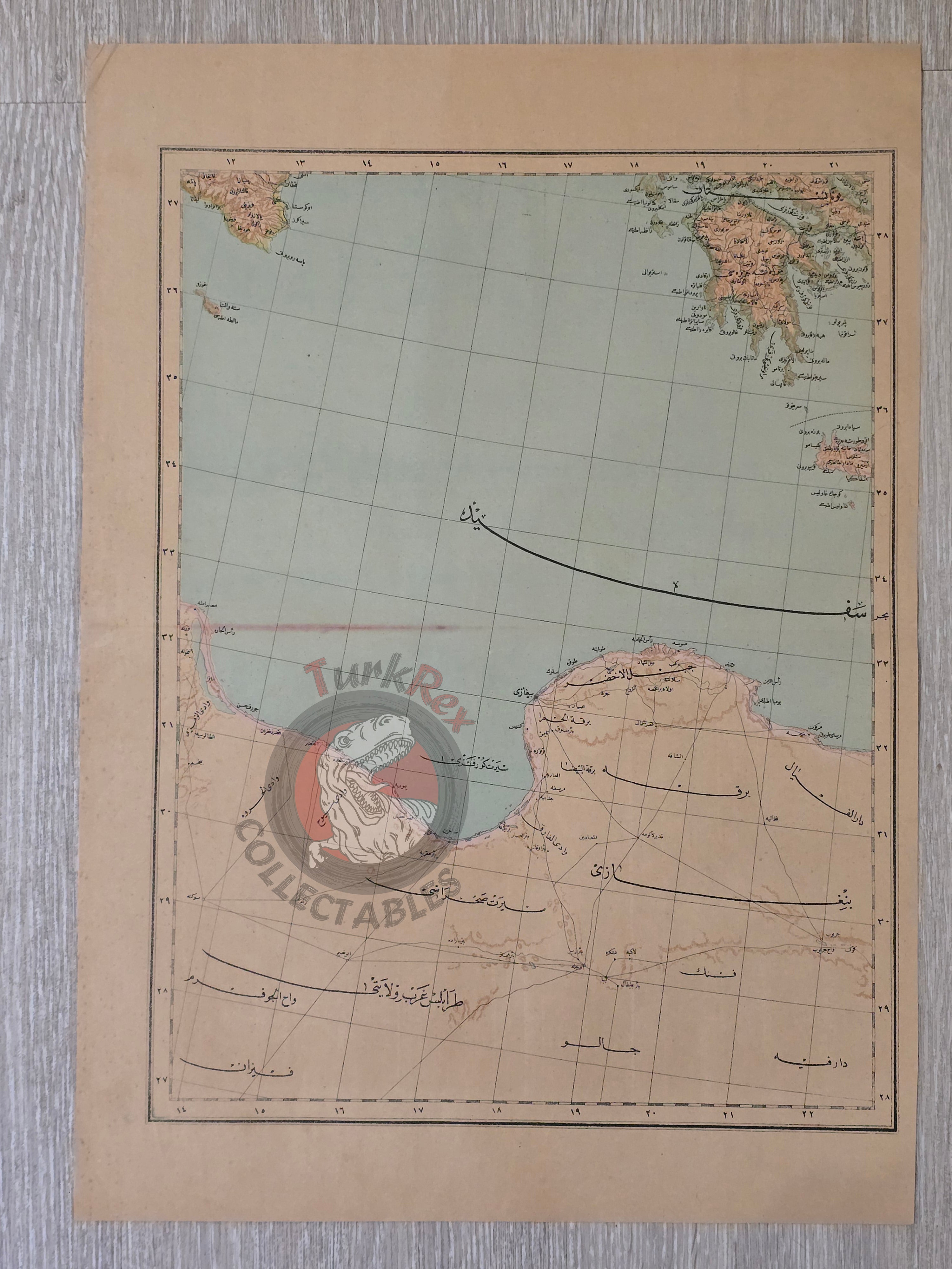
A fine Ottoman Turkish map of the Mediterranean region, measuring 51 × 36 cm, published in 1314 AH (1898 CE). The map depicts the eastern Mediterranean sea region, including parts of Greece and Libya. This sheet is part of the “Yeni Coğrafya Atlasi” (New Geographical Atlas), edited by Ali Şeref Paşa and *Hafız Ali Eşref, printed by Hasan Ferid at the Matbaa-i Âmire in Istanbul.
The Yeni Coğrafya Atlasi was one of the most important cartographic publications of the late Ottoman period, comprising 42 double-page lithographed color maps issued between 1893–1898 (1309–1314 AH). It reflects the empire’s growing scientific, educational, and geopolitical interest in world geography.
Ali Şeref Paşa, a former soldier educated as a cartographer in Paris, later became chief cartographer at Matbaa-i Âmire, the successor of İbrahim Müteferrika’s pioneering Ottoman press. His European training strongly influenced the atlas, which combined modern European cartographic techniques with Ottoman perspectives on world regions.
Key Features:
-
Title/Subject: Mediterranean Sea Region (Libya, Benghazi, Greece, Crete)
-
Publication Date: 1314 AH (1898 CE)
-
Atlas: Yeni Coğrafya Atlasi (New Geographical Atlas)
-
Editors: Ali Şeref Paşa & Hafız Ali Eşref
-
Printer: Hasan Ferid
-
Publisher: Matbaa-i Âmire, Istanbul
-
Dimensions: 51 × 36 cm
-
Technique: Lithographed color map
-
Significance: An Ottoman atlas map emphasizing the strategic Mediterranean sea at the turn of the 20th century, produced during the empire’s push for modern cartography and geographic education.