


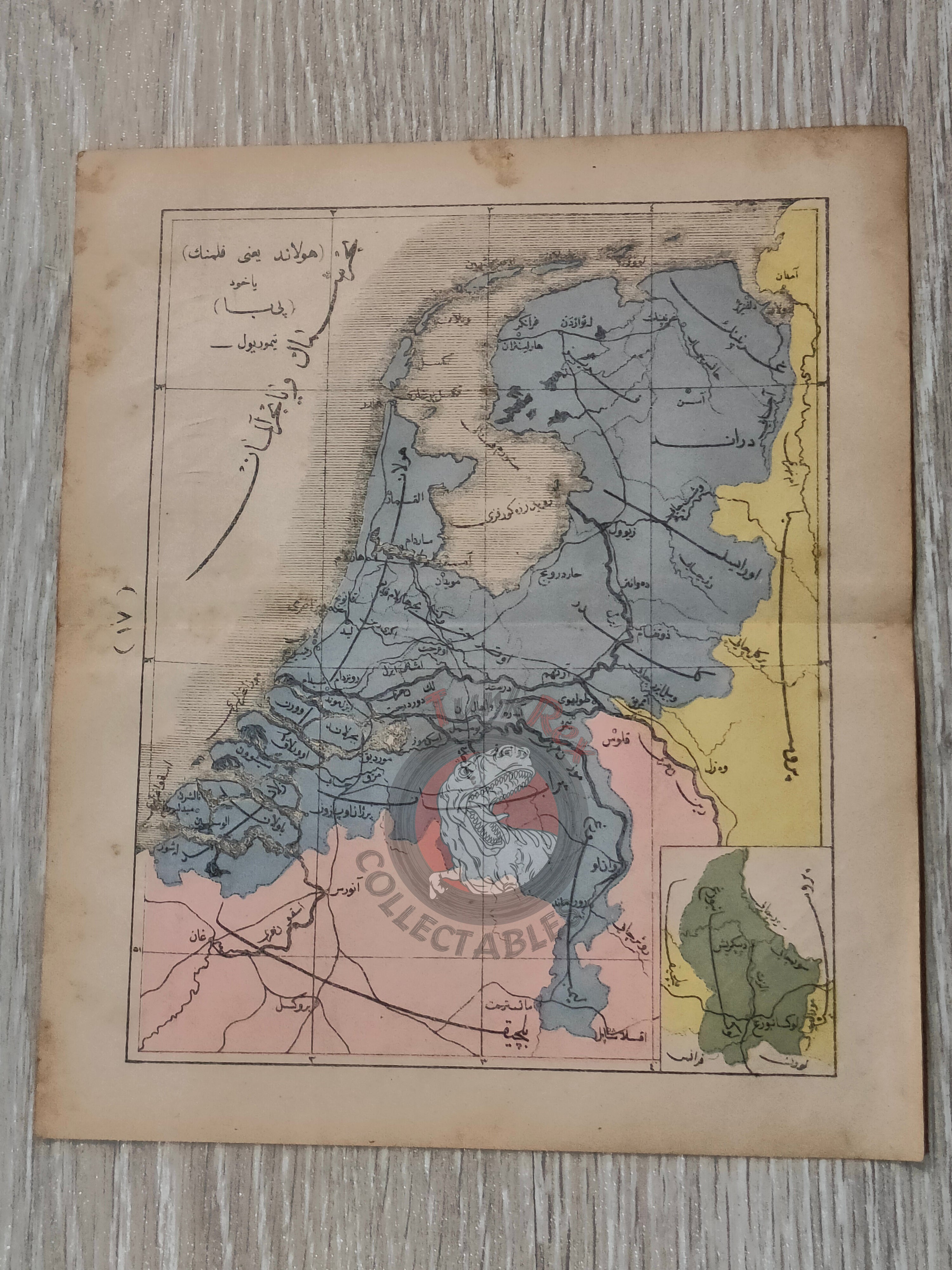


Netherlands 1867 Ottoman Atlas Map Ottoman Empire Europe Belgium Prussia
Ottoman Map of the Netherlands – From Sağir Coğrafya Atlası by Mustafa Hami Pasha (1284 AH / 1867 CE)
Description:
An early Ottoman Turkish map of the Netherlands, published in 1284 AH (1867 CE) as part of Mustafa Hami Pasha’s Sağir Coğrafya Atlası. Printed in Istanbul, this atlas is among the earliest examples of Ottoman educational cartography, designed to introduce modern geographic knowledge to Ottoman students.
Measuring 22.7 × 19.9 cm, the map not only depicts the Netherlands but also shows portions of Belgium and Prussia, reflecting the interconnected geography of northwestern Europe during the mid-19th century.
Key Features:
-
Region: Netherlands, with parts of Belgium and Prussia visible
-
Date: 1284 AH / 1867 CE
-
Source: Sağir Coğrafya Atlası by Mustafa Hami Pasha
-
Publisher: Istanbul (Ottoman Empire)
-
Dimensions: 22.7 × 19.9 cm
-
Significance: Early Ottoman atlas map, part of the empire’s efforts to modernize education through geography