


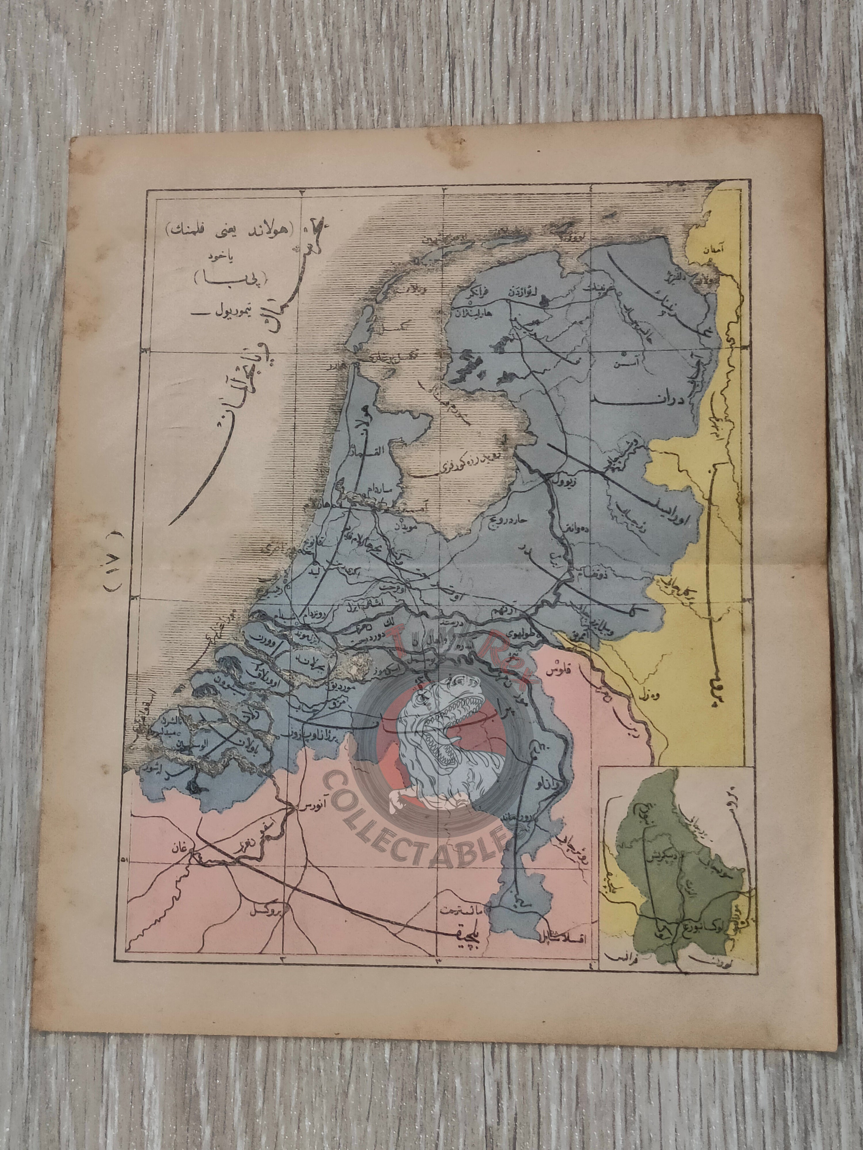


Netherlands 1867 Ottoman Atlas Map Ottoman Empire Europe Belgium Prussia
Ottoman Map of the Netherlands (Felemenk) from Sağir Coğrafya Atlası by Mustafa Hami Pasha – 1284 AH (1867)
Description:
This original Ottoman Turkish map depicts the Netherlands (Felemenk) and was published in 1284 AH (1867 AD) as part of the Sağir Coğrafya Atlası, authored by Mustafa Hami Pasha and printed in Istanbul. Measuring 22.7 × 19.9 cm, the map is presented in color and illustrates the Netherlands along with portions of its neighboring regions, including Belgium and Prussia. A notable feature of this map is the inclusion of railway lines, reflecting the growing importance of modern transportation networks in 19th-century Europe.
The atlas itself is considered among the earliest examples of Ottoman educational cartography, created with the purpose of introducing modern geographic knowledge to students. At a time when the Ottoman Empire was actively reforming its educational system, works like this played a crucial role in bridging traditional learning with contemporary European scientific approaches.
Mustafa Hami Pasha, originally a military physician (Mirliva) and a graduate of the Mekteb-i Tıbbiye-i Şahane, was a prolific and versatile Ottoman intellectual. He authored more than thirty works across disciplines such as medicine, military science, and education. In preparing this atlas, he drew extensively from French geographical sources, adapting Western cartographic techniques into an Ottoman educational framework. This synthesis of knowledge is clearly visible in the structure, clarity, and geographic scope of the map.
Beyond its educational function, this map provides a compelling snapshot of a rapidly modernizing Europe. The presence of railway lines highlights the technological transformation of the period and offers insight into how infrastructure was integrated into geographic education. The inclusion of neighboring territories such as Belgium and parts of Prussia further situates the Netherlands within its broader political and economic environment. For collectors, this piece stands out as both a visually engaging and historically informative example of Ottoman engagement with modern European developments.
Key Features:
• Type: Ottoman printed map
• Title: Felemenk (Netherlands)
• Source: Sağir Coğrafya Atlası
• Author: Mustafa Hami Pasha
• Date: 1284 AH (1867 AD)
• Place of Publication: Istanbul
• Language: Ottoman Turkish (Arabic script)
• Region Depicted: Netherlands with parts of Belgium and Prussia
• Map Details: Includes railway lines indicating 19th-century transportation networks
• Color: Original colored map
• Dimensions: 22.7 × 19.9 cm
• Cartographic Context: Early Ottoman educational atlas influenced by French geographic sources
• Historical Significance: Reflects the integration of modern infrastructure such as railways into geographic representation
• Collectible Significance: Rare Ottoman map highlighting both regional geography and early industrial-era developments