


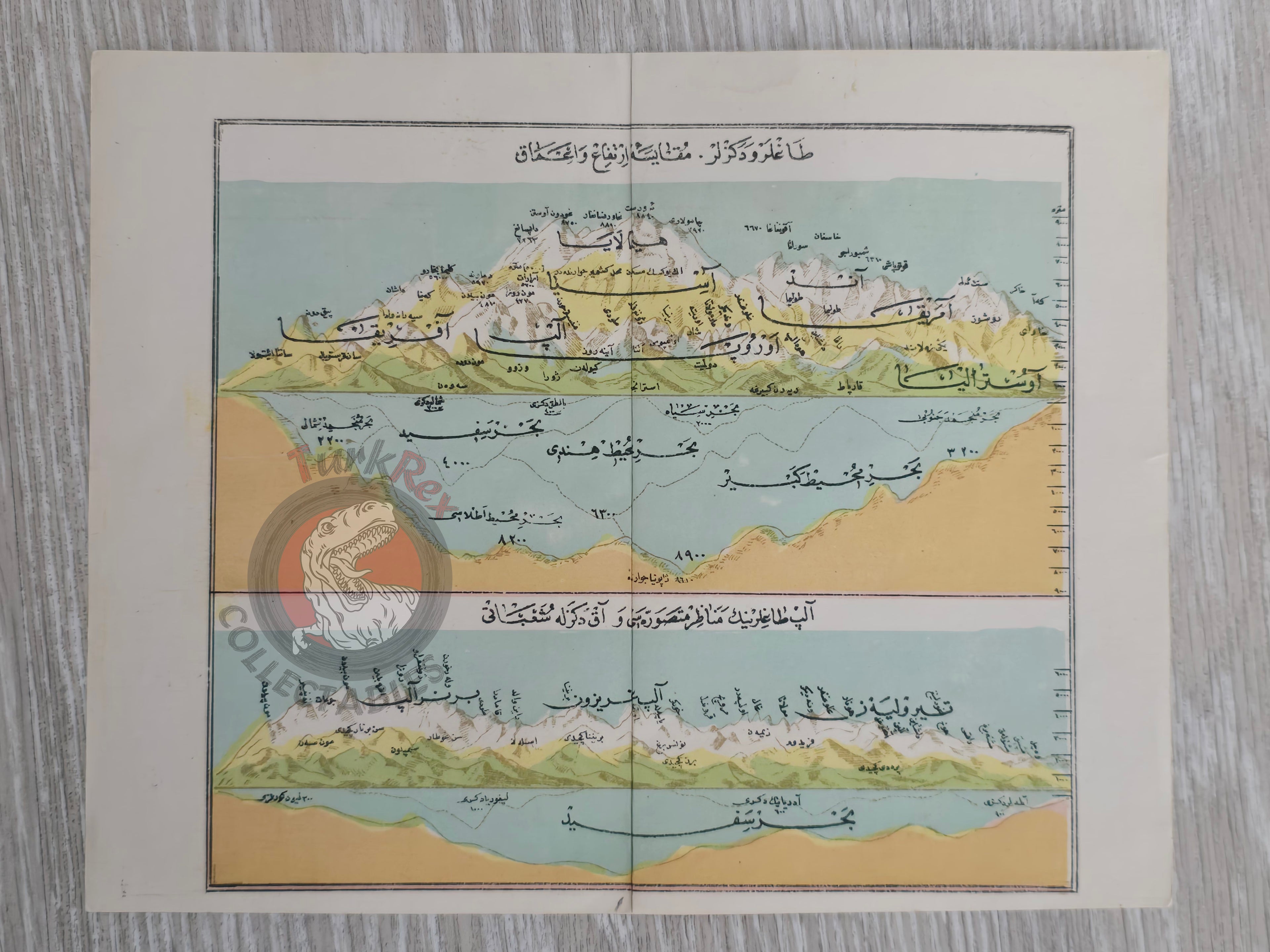


Ottoman Diagram World's Highest Mountains and Deepest Points of the Oceans Alps Himalayas
Ottoman Diagram of Mountains & Seas – Heights and Depths (ca. 1910s)
Description:
An original Ottoman Turkish comparative diagram , likely dating from the 1910s, and drawn from an Ottoman atlas of the late imperial period. The sheet is divided into two sections:
- “Dağlar ve Denizler Mükayese, İrtifa ve Amak” (Comparison of Mountains and Seas Heights and Depths): A visual diagram comparing the world’s highest mountains and the deepest points of the oceans, presenting side-by-side the elevations of major peaks (including the Himalayas) and the depths of seas across Europe, Asia, Africa, Australia, and the Americas.
- “Alp Dağlarının Menazır Mütesavviresi ve Akdeniz’le Teşaubatı” (Profile of the Alps and Their Relation to the Mediterranean): A schematic depiction of the Alpine range, showing its comparative profile in relation to the Mediterranean basin.
The map is printed in Ottoman Turkish script and was designed for educational use. The terminology “irtifa” (altitude/height) and “amak” (depth) reflects the Ottoman adoption of modern scientific vocabulary at the turn of the 20th century.
Such comparative charts were inspired by European 19th-century cartography and adapted for the Ottoman educational context. They are historically significant as they demonstrate the Ottoman engagement with scientific geography, while also serving as visual teaching aids for students.
Key Features:
- Date: ca. 1910s
- Title: Dağlar ve Denizler – Mükayese, İrtifa ve Amak
- Format: Comparative chart (double-section: mountains & seas / Alps profile)
- Dimensions: 22 × 17.8 cm
- Content:
- Visual diagram comparing the world’s highest mountains with the deepest ocean points
- Comparative heights of major mountains (Europe, Asia, Africa, Australia, Americas)
- Comparative depths of seas
- Alpine range profile with Mediterranean relation
- Language: Ottoman Turkish
- Historical Context: Produced during the Ottoman modernization of education, influenced by European scientific diagrams
- Cultural Significance: Rare survival of an Ottoman educational comparative geography chart, bridging modern science with Ottoman pedagogy