


Ottoman Empire 1876 Map Asia Europe Middle East Palestine Syria Iraq Iran Greece
Ottoman Map of the Ottoman Empire - From Muhtasar Coğrafya Risalesi by Selim Sabit (1293 AH / 1876 CE)
Description:
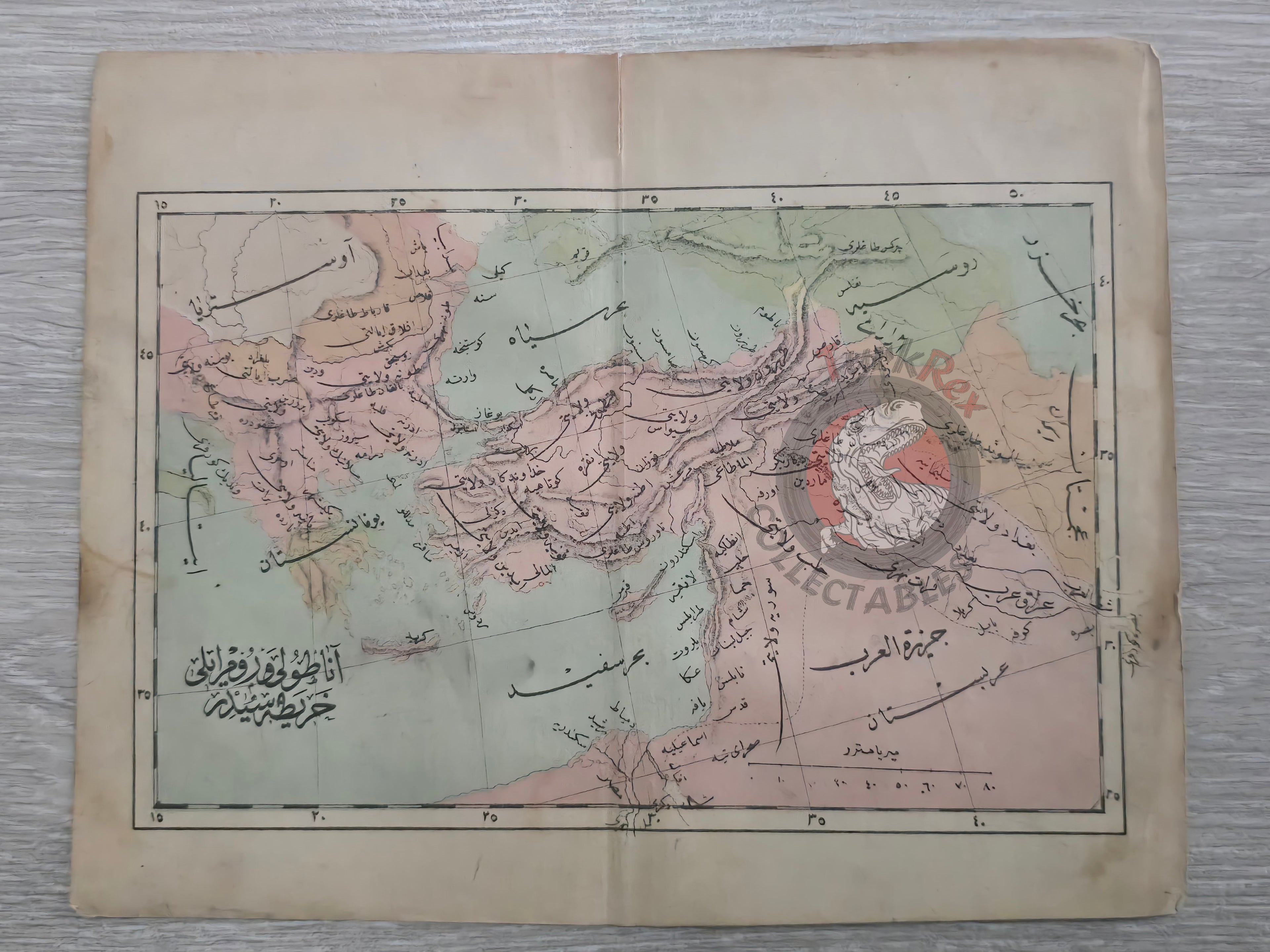
An Ottoman Turkish school map of the Ottoman Empire, published in 1293 AH (1876 CE) in Selim Sabit’s Muhtasar Coğrafya Risalesi. This work was printed in Istanbul as a geography textbook prepared for Ottoman primary schools (Sıbyan mektepleri), designed to introduce students to both world and imperial geography.
The map, measuring 22.7 × 18.2 cm, shows the Ottoman Empire’s territories in Asia and Europe, with provincial names clearly marked, including Syria (Suriye Vilayeti), Danube (Tuna Vilayeti), Aleppo (Halep Vilayeti), and Ankara (Ankara Vilayeti).
As one of the earliest Ottoman school atlases, this map represents the modernization of geography education in the empire during the late 19th century.
Key Features:
-
Region: Ottoman Empire – European and Asian provinces
-
Date: 1293 AH / 1876 CE
-
Source: Muhtasar Coğrafya Risalesi by Selim Sabit
-
Publisher: Istanbul, Ottoman Empire
-
Dimensions: 22.7 × 18.2 cm
-
Content: Includes provinces such as Syria, Danube, Aleppo, and Ankara
-
Purpose: Educational textbook map for Ottoman primary schools (Sıbyan mektepleri)
-
Significance: Rare 19th-century Ottoman school atlas map, showing the empire’s extent for classroom use