


Ottoman Empire 1916 Map Anatolia Middle East Arabian Peninsula Palestine Israel Hejaz Railway
Ottoman Turkish Map - Boundaries of the Ottoman Empire (from Küçüklere Coğrafya Dersleri, 1916)
Description:
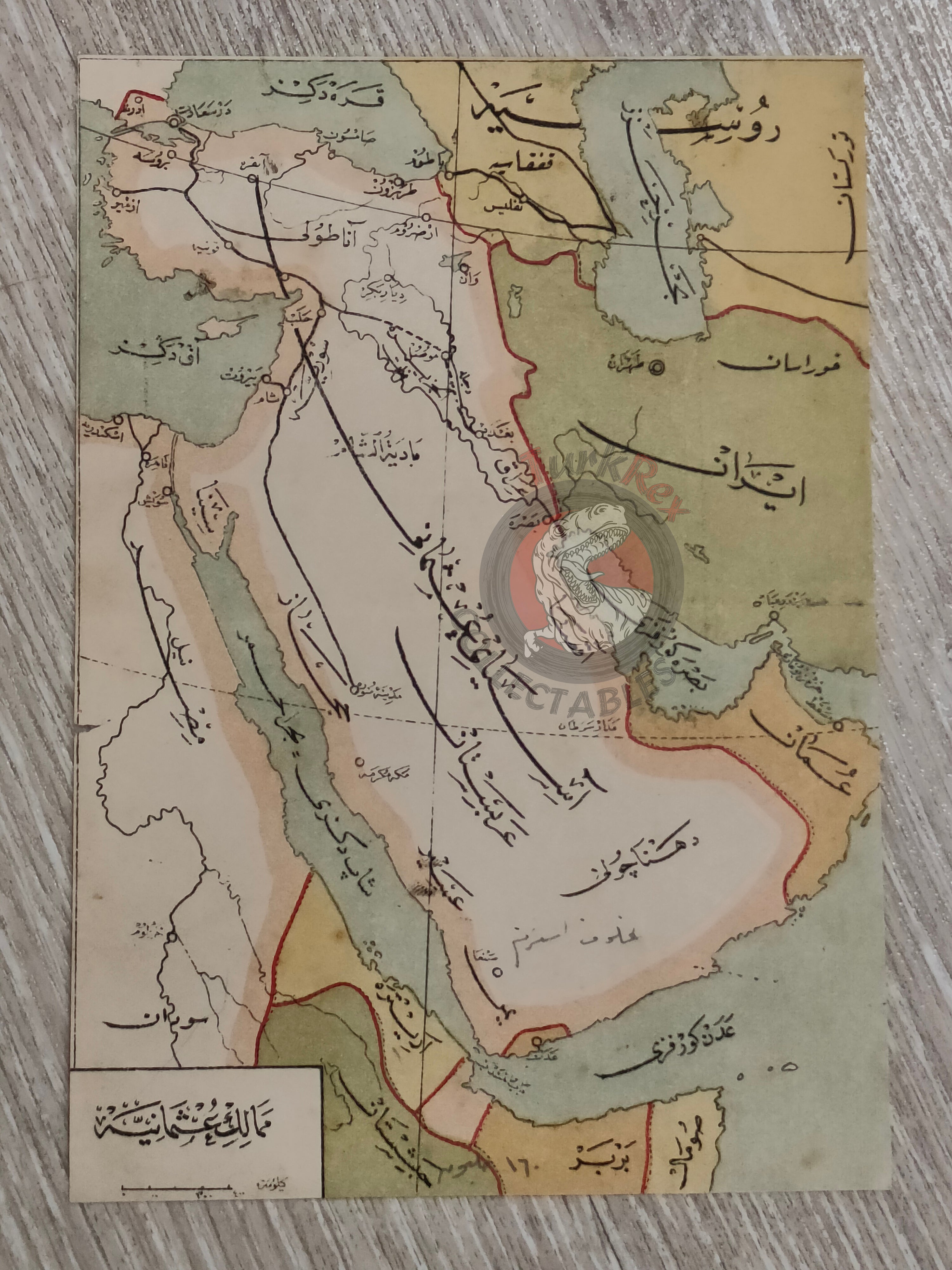
A school atlas map in Ottoman Turkish showing the boundaries of the Ottoman Empire from Küçüklere Coğrafya Dersleri (Geography Lessons for Children), written by Safvet Geylangil and published in 1339 AH (1916 CE) by the Matbaa-i Amire (Imperial Printing Press, Istanbul).
The map measures 18.2 × 12.7 cm and was prepared for use in elementary-level schools (Mekatib-i İbtidaiye, devre-i mutavassıta, 1st grade), reflecting the Ottoman state’s efforts to provide modern geography education to young students during the late empire.
The map depicts the Ottoman Empire’s core territories, including Anatolia, the Arabian Peninsula, and Egypt, as well as its borders with Iran and Russia. The Hejaz Railway route is clearly marked, symbolizing one of the empire’s most significant infrastructural and strategic projects of the early 20th century.
Today, the lands shown within Ottoman boundaries encompass many modern states, including Saudi Arabia, Iraq, Lebanon, Syria, Jordan, Palestine, Israel, Egypt, and Kuwait.
Key Features:
-
Title: Ottoman Empire – School Geography Map
-
Author: Safvet Geylangil
-
Source: Küçüklere Coğrafya Dersleri, Mekatib-i İbtidaiye devre-i mutavassıta 1. sınıfa mahsus
-
Publisher: Matbaa-i Amire, Istanbul
-
Date: 1339 AH / 1916 CE
-
Dimensions: 18.2 × 12.7 cm
-
Content: Boundaries of the Ottoman Empire; Anatolia, Arabian Peninsula, Egypt, Iran and Russian borders
-
Special Feature: Hejaz Railway route marked
-
Historical Significance: Produced as an educational tool for Ottoman schools, this map illustrates not only the empire’s geography but also the modernizing reforms in education before the collapse of the empire.