


Ottoman Empire under Sultan Mehmed II 1913 Atlas Map France Sultan Murad II Anatolia
Ottoman Turkish Map – Ottoman Empire under Sultan Mehmed II (from Tarih-i Umumi ve Osmani Atlası, 1913)
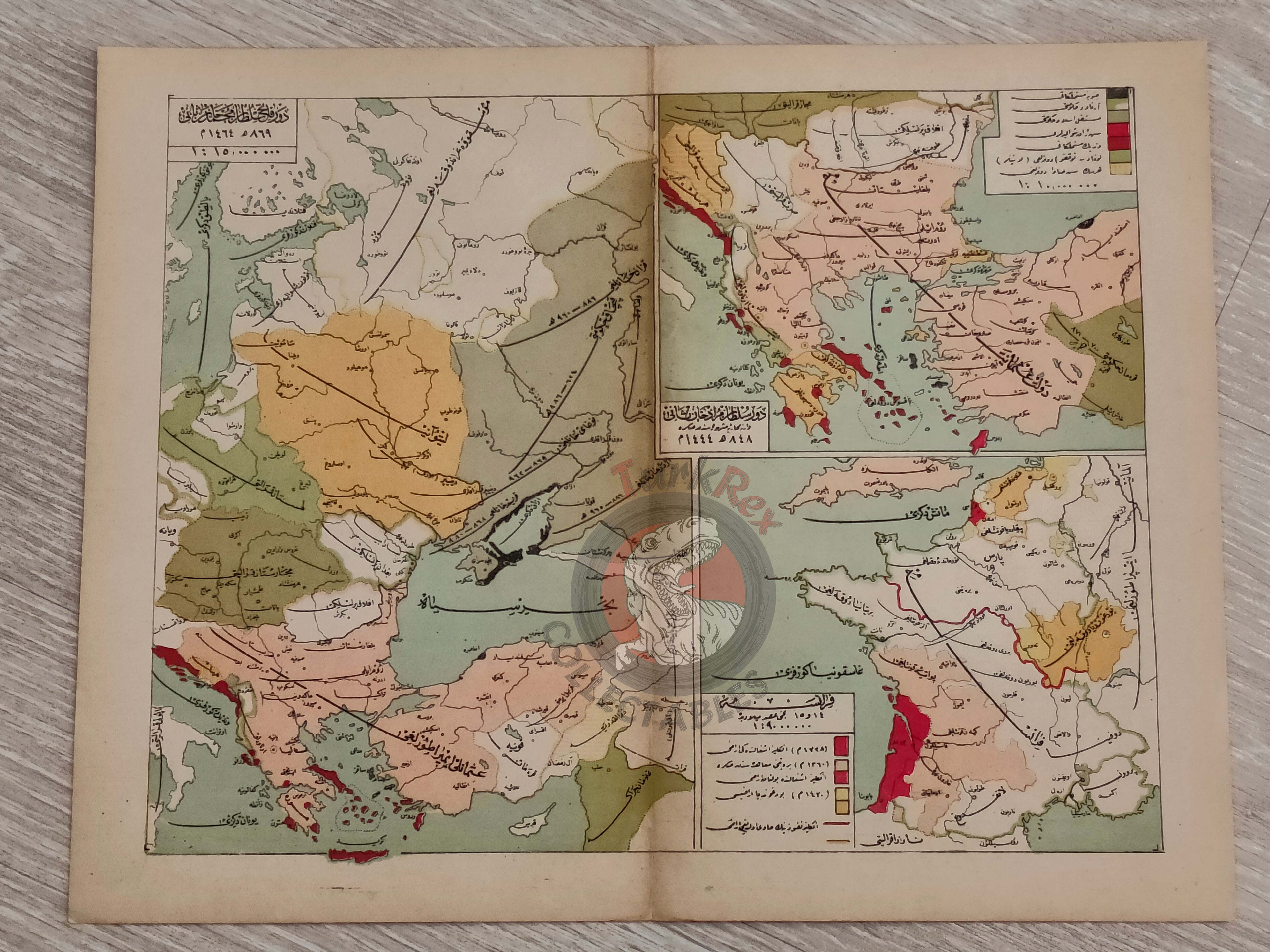
Description:
A double-page Ottoman Turkish historical map from Mehmed Eşref’s Tarih-i Umumi ve Osmani Atlası, published in 1329 AH (1913 CE) by the Mekteb-i Harbiye Matbaası (Ottoman Military Academy Press).
The map measures 33 × 25.7 cm and is one of the 138 maps contained in 32 double-page color lithographed plates that make up the atlas.
This sheet presents the Ottoman Empire during the reign of Sultan Mehmed II (Mehmed the Conqueror). It also features an inset map showing France and the Ottoman Empire during the reign of Sultan Murad II, with a color-coded reference system to distinguish political and territorial divisions.
Key Features:
-
Title/Subject: Ottoman Empire under Sultan Mehmed II
-
Inset: France and the Ottoman Empire during Sultan Murad II
-
Source: Mehmed Eşref, Tarih-i Umumi ve Osmani Atlası
-
Date: 1329 AH / 1913 CE
-
Publisher: Mekteb-i Harbiye Matbaası, Istanbul
-
Format: Color lithographed double-page map (one of 32 plates, containing 138 maps)
-
Dimensions: 33 × 25.7 cm
-
Features: Color-coded reference for territorial distinctions
-
Significance: A rare Ottoman atlas map illustrating the empire at the height of its expansion under Mehmed II, with comparative context from Murad II’s reign.