


Ottoman Map of Greece and the Aegean Islands 1915 Ottoman Empire Crete Rhodes
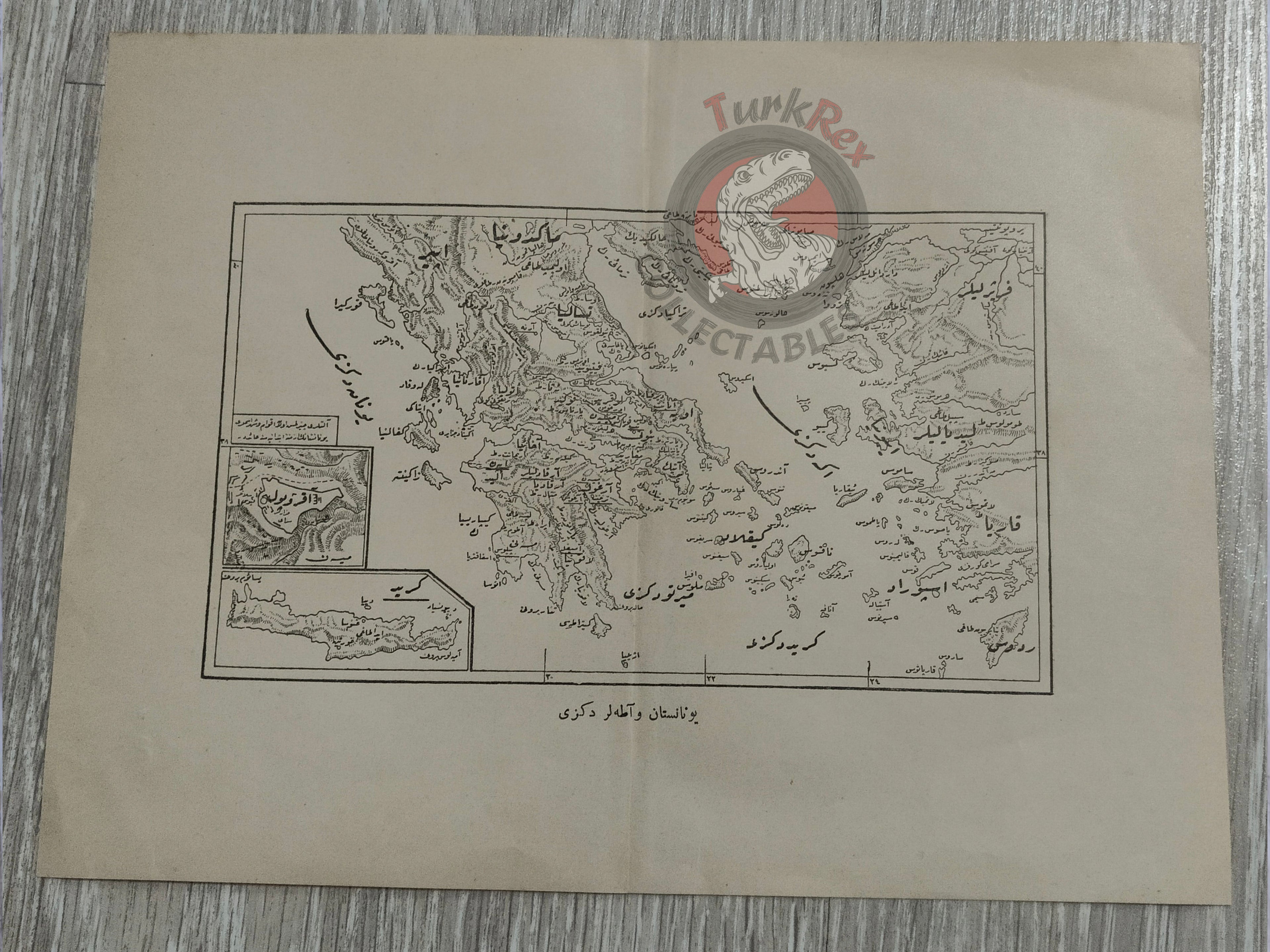
Ottoman Map of Greece and the Islands – From Tarih-i Kadim Akvâm-ı Kadime-i Şarkiye ve Yunaniler (1915)
Description:
An original Ottoman Turkish map of Greece and the Aegean Islands, published in 1331 AH (1915 CE) as part of Tarih-i Kadim Akvâm-ı Kadime-i Şarkiye ve Yunaniler (“Ancient History of Eastern Nations and the Greeks”), authored by Ali Reşad and printed in Istanbul.
The map, in black and white and measuring 25.6 × 19.4 cm, depicts Greece along with the surrounding Aegean islands. Produced during World War I, it reflects both the Ottoman scholarly interest in antiquity and the geopolitical significance of Greece and the islands at the time.
The book in which this map appeared was an educational and historical work, part of a broader Ottoman effort to publish accessible histories of ancient civilizations for a modern readership. Surviving maps separated from these volumes are uncommon, especially in good condition.
Key Features:
- Date: 1331 AH (1915 CE)
- Title/Region: Greece and the Aegean Islands (Yunanistan ve Adalar)
- Source: Tarih-i Kadim Akvâm-ı Kadime-i Şarkiye ve Yunaniler
- Author: Ali Reşad
- Publisher: Istanbul, 1915
- Dimensions: 25.6 × 19.4 cm
- Printing: Black and white
- Historical Context: Issued during WWI, illustrating Greece and the islands at a time of regional transformation
- Cultural Significance: Rare survival from an Ottoman historical work, combining scholarship with cartographic illustration