


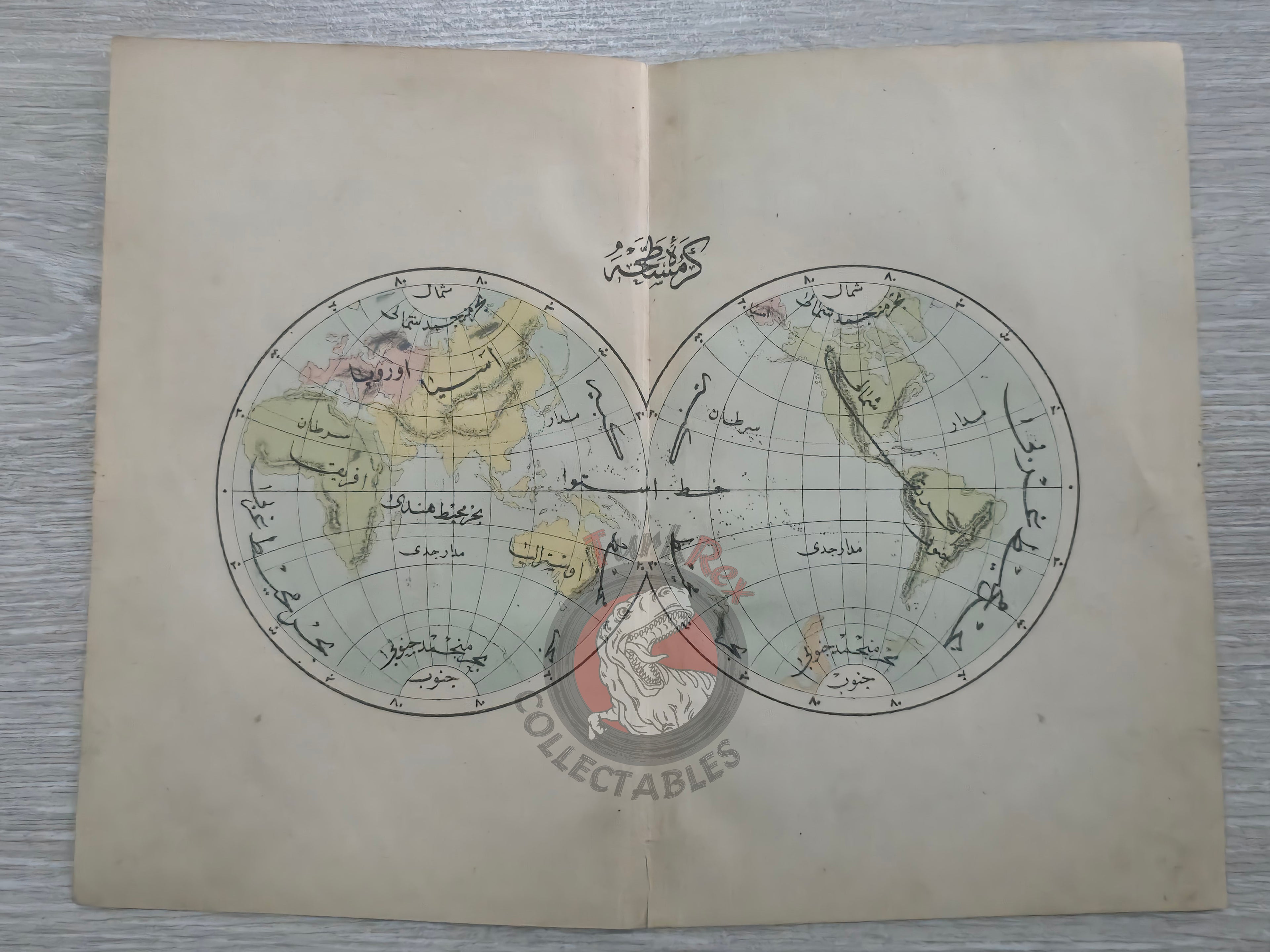


Ottoman Map of the World Hemispheres 1876 Ottoman Empire Continents Asia Europe
Ottoman Map of the World Hemispheres - From Muhtasar Coğrafya Risalesi (1876)
Description:
An original Ottoman Turkish map showing the Hemispheres of the World, published in 1293 AH (1876 CE) as part of Muhtasar Coğrafya Risalesi (“Concise Treatise on Geography”), authored by Selim Sabit and printed in Istanbul.
The map, measuring 23.4 × 18.3 cm, presents the two hemispheres. It was issued in a geography textbook specifically prepared for Ottoman primary schools (sıbyan mektepleri), making it one of the earliest examples of modern geography education maps produced for children in the late Ottoman Empire.
This piece is historically significant as it reflects the early integration of European cartographic methods into Ottoman pedagogy, at a time when geography was becoming a standard subject in the reformed school curriculum of the Tanzimat and post-Tanzimat eras. Surviving examples are rare, as such textbooks were heavily used by students and few copies remained intact.
Key Features:
- Date: 1293 AH (1876 CE)
- Title/Region: World Hemispheres
- Source: Muhtasar Coğrafya Risalesi
- Author: Selim Sabit
- Publisher: Istanbul
- Dimensions: 23.4 × 18.3 cm
- Format: Colored school atlas map
- Audience: Prepared for Ottoman primary schools (sıbyan mektepleri)
- Historical Context: Early Ottoman adoption of modern geography education; produced just after the Tanzimat era reforms
- Cultural Significance: Rare survival of a 19th-century Ottoman school map, bridging education and cartographic modernization