


Ottoman Turkish Physical Map Orestiada Greece Region Balkans Evros
Ottoman Turkish Physical Map – Edirne / Orestiada Region
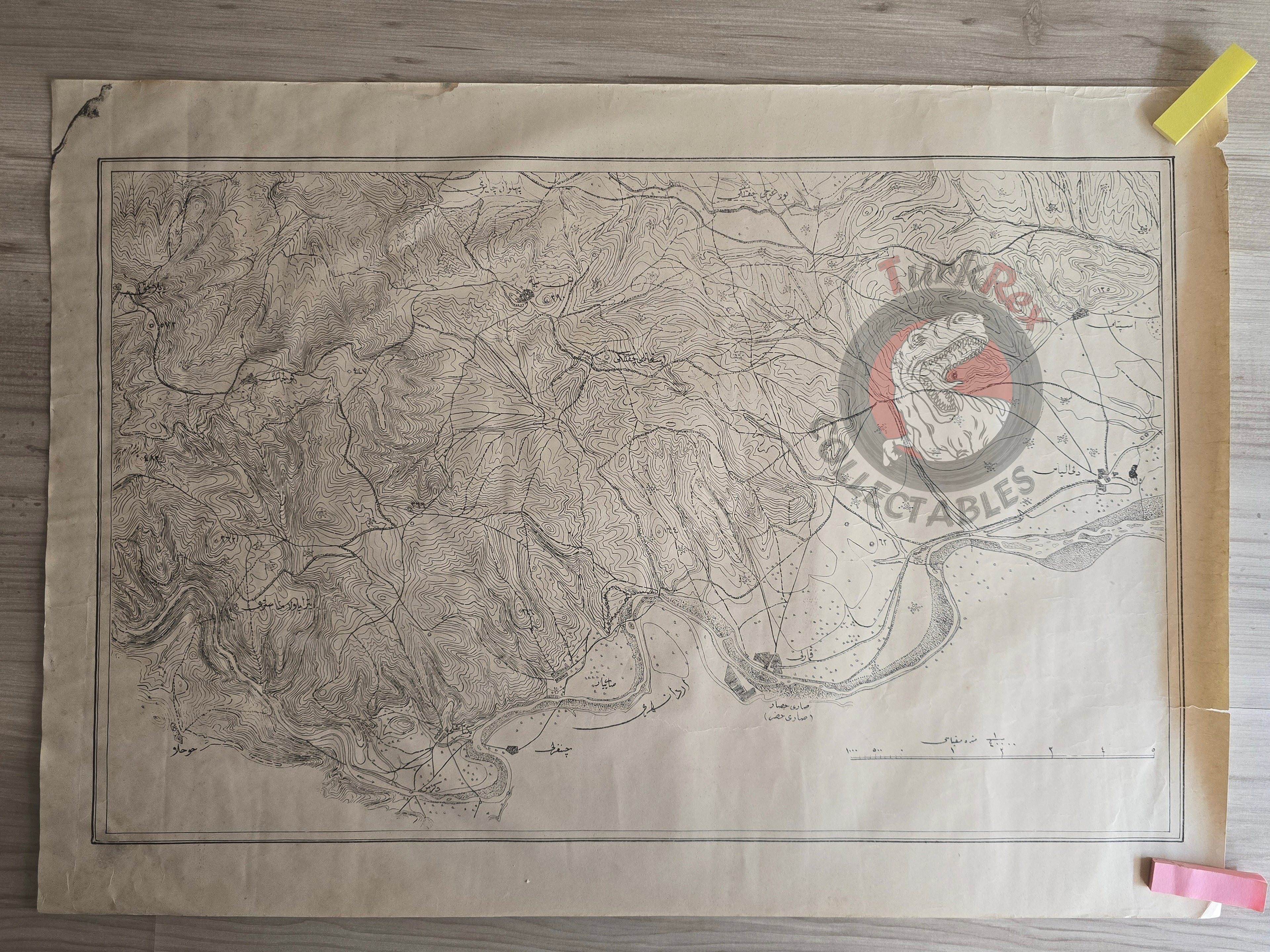
Description:
A large Ottoman Turkish physical map measuring 58 × 41 cm, showing elevations and topography. Geographic features such as the Arda River, Deli İlyas Köyü, Sarı Hisar, Sarı Pınar, and Pehlivan Çayırı are labeled.
The map likely represents the Edirne region, specifically the area around today’s Orestiada (Greece), near the modern Turkish-Greek border. It illustrates both natural features and settlements, providing a valuable look at the late Ottoman cartographic record of this frontier area.
Key Features:
-
Language: Ottoman Turkish (Arabic script)
-
Dimensions: 58 × 41 cm
-
Content: Physical map with elevation markings, rivers, villages, and landmarks
-
Region: Edirne / Orestiada borderland (modern Greece)
-
Significance: Rare Ottoman Turkish map of the Thrace frontier region, showing both natural and human geography