


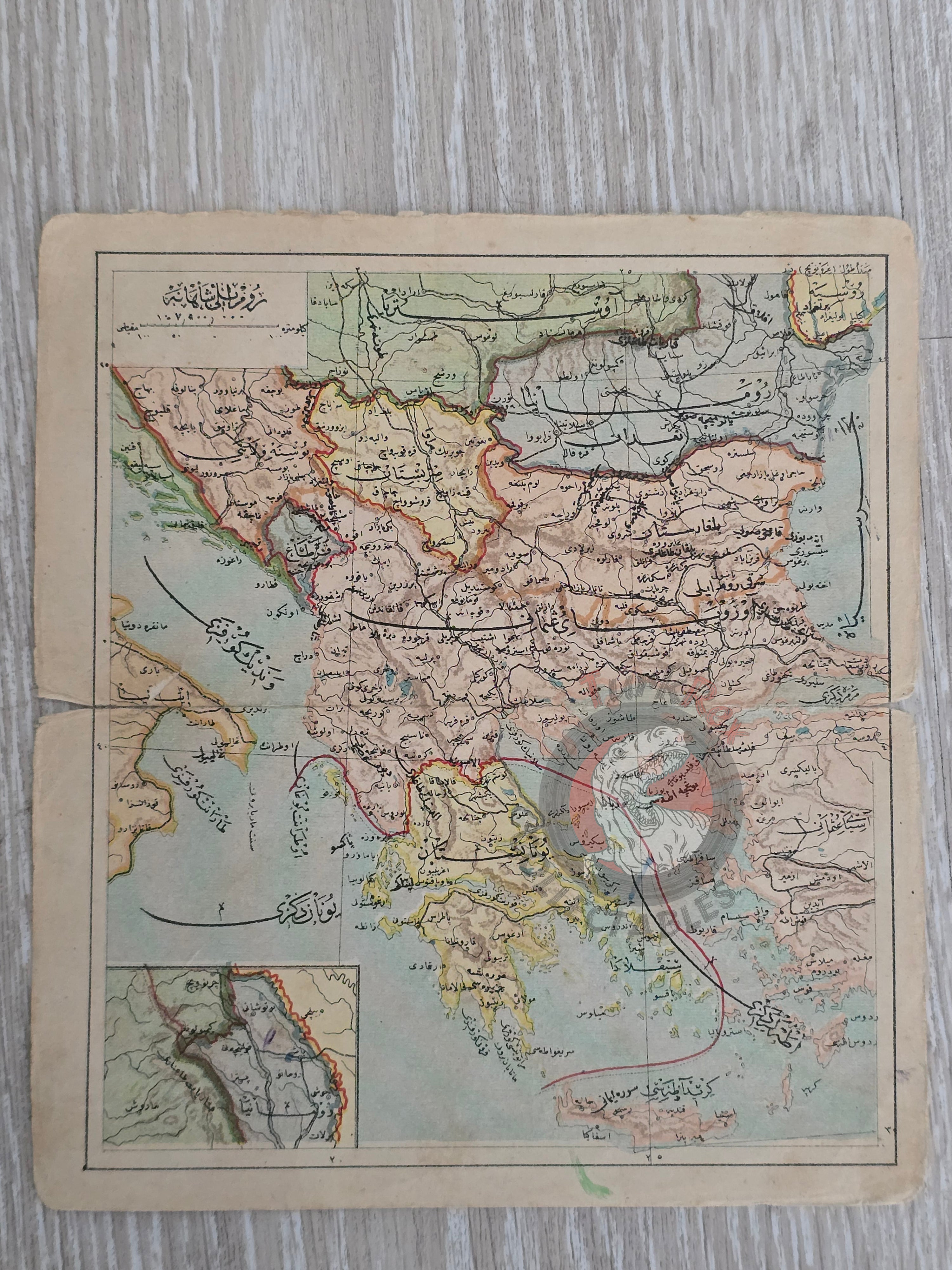


Rumelia 1906 Ottoman Atlas Map Empire Greece Bulgaria Albenia Crete Balkans Aegean
Title: Ottoman Map of Rumelia (Rumeli-i Şahane) - From Tüccarzade İbrahim Hilmi’s Umumi Cep Atlası (1906)
Description:
An original Ottoman map titled “Rumeli-i Şahane”, published in 1324 AH (1906 CE) as part of Tüccarzade İbrahim Hilmi’s Umumi Cep Atlası (Universal Pocket Atlas). Printed in Istanbul, the map measures 19.1 × 17.2 cm and depicts the territories of Greece, Bulgaria, Albania, and the Aegean islands, illustrating the Balkan region during a period of profound political change in the late Ottoman Empire.
Tüccarzade İbrahim Hilmi was one of the most prolific Ottoman publishers of the late 19th and early 20th centuries, producing accessible atlases and educational works that introduced modern cartography to a broad audience. The Umumi Cep Atlası was designed as a compact reference, making its surviving maps relatively rare today.
This piece captures not only the geopolitical layout of the Balkans on the eve of the Balkan Wars, but also the Ottoman Empire’s cultural investment in popularizing geography through portable, affordable atlases.
Key Features:
- Date: 1324 AH (1906 CE)
- Title: Rumeli-i Şahane
- Source: Umumi Cep Atlası by Tüccarzade İbrahim Hilmi
- Publisher: Istanbul
- Dimensions: 19.1 × 17.2 cm
- Region Depicted: Greece, Bulgaria, Albania, Aegean Islands (Balkans)
- Historical Context: Shows the Ottoman conception of Rumelia at a time of rising nationalism and imminent territorial loss
- Cultural Significance: A fine example of late Ottoman educational publishing and pocket atlases