


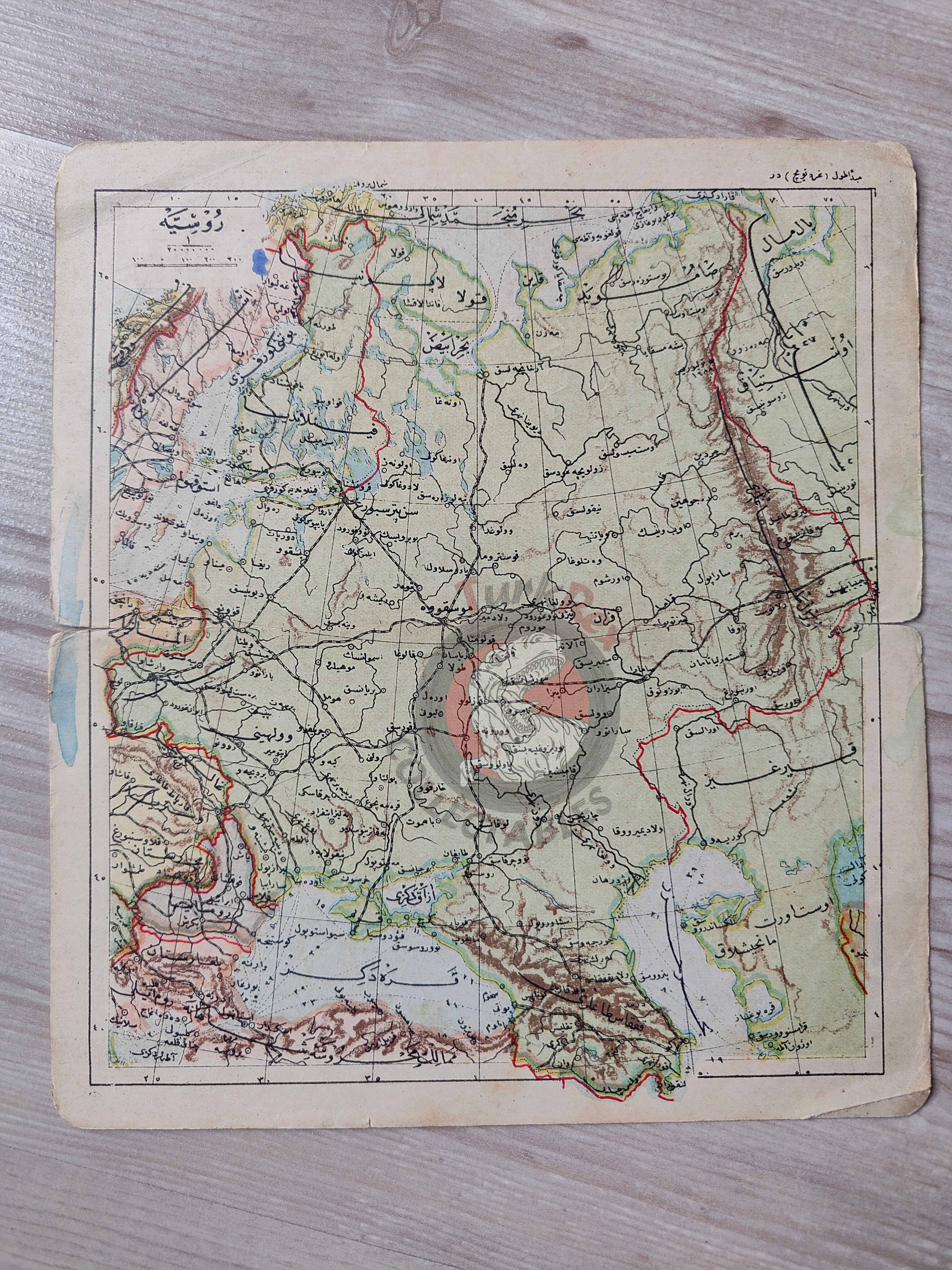


Russia 1906 Ottoman Atlas Map Empire Finland Black Sea Georgia
Ottoman Turkish Map – Russia (from Umumi Cep Atlası, 1906)
Description:
An Ottoman Turkish map of Russia, taken from Umumi Cep Atlası (General Pocket Atlas), compiled and published by Tüccarzade İbrahim Hilmi in 1324 AH (1906 CE).
The map measures 19.4 × 17.2 cm and provides a detailed representation of the Russian Empire and its surrounding regions in the early 20th century. In addition to Russian territories, the map depicts Finland, the Black Sea, the Caspian Sea, parts of Sweden, and a portion of Germany, offering a broader geographical context.
This atlas is notable for being one of the most widely circulated Ottoman pocket atlases of the late empire, reflecting the Ottoman intellectual engagement with global geography.
Key Features:
-
Title/Subject: Russia (Rusya Haritası)
-
Author/Publisher: Tüccarzade İbrahim Hilmi
-
Source: Umumi Cep Atlası
-
Date: 1324 AH / 1906 CE
-
Dimensions: 19.4 × 17.2 cm
-
Coverage: Russian Empire with adjacent regions (Finland, Black Sea, Caspian Sea, parts of Sweden and Germany)
-
Format: Color lithographed atlas map
-
Significance: A rare Ottoman pocket atlas map illustrating the Russian Empire at the dawn of the 20th century, reflecting the empire’s engagement with global political geography.