


Russia 1906 Ottoman Atlas Map Empire St. Petersburg Finland Black Sea Georgia
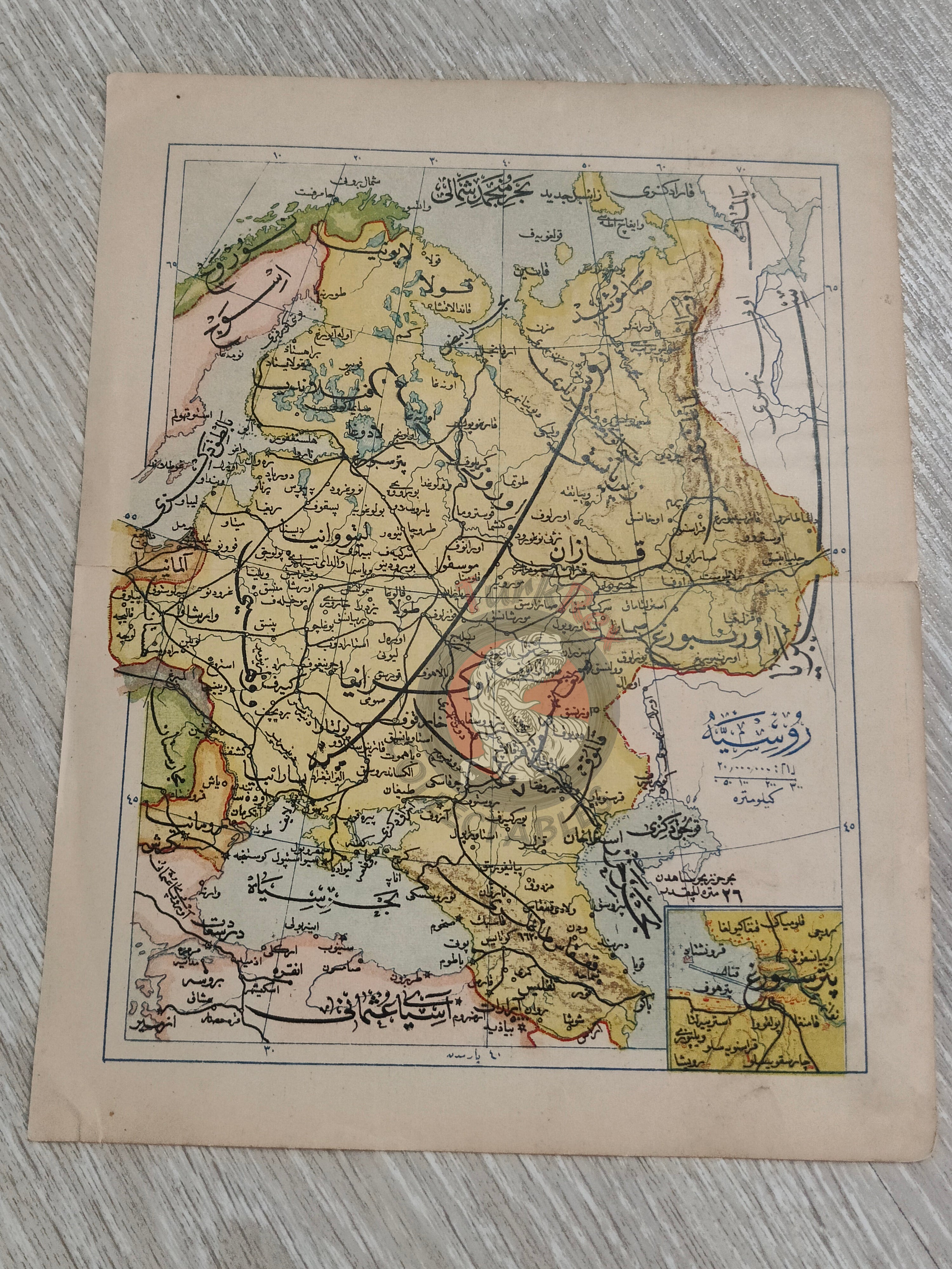
Ottoman Turkish Map - Russia with Inset of St. Petersburg (from Mükemmel ve Mufassal Coğrafya-yı Umumi Atlası, 1908)
Description:
An Ottoman Turkish map of Russia, published in Mükemmel ve Mufassal Coğrafya-yı Umumi Atlası, authored by Mehmed Eşref and printed in 1324 AH (1908 CE).
The map measures 22.7 × 17.4 cm and provides a detailed representation of the Russian Empire and its surrounding regions at the beginning of the 20th century. A distinctive feature of this map is a small inset map of St. Petersburg, located in the lower right corner.
In addition to Russian territories, the map depicts Finland, the Black Sea, the Caspian Sea, as well as parts of Sweden, Norway, and Germany, offering a comprehensive regional context.
Key Features:
-
Title/Subject: Russia with inset of St. Petersburg (Rusya Haritası – Petersburg ile birlikte)
-
Author: Mehmed Eşref
-
Source: Mükemmel ve Mufassal Coğrafya-yı Umumi Atlası
-
Date: 1324 AH / 1908 CE
-
Dimensions: 22.7 × 17.4 cm
-
Coverage: Russian Empire, Finland, Black Sea, Caspian Sea, Sweden, Norway, parts of Germany
-
Inset: St. Petersburg (lower right corner)
-
Format: Color lithographed atlas map
-
Significance: A rare Ottoman atlas map, notable for its inclusion of St. Petersburg inset, reflecting Ottoman interest in Russian geography during a politically turbulent period.