


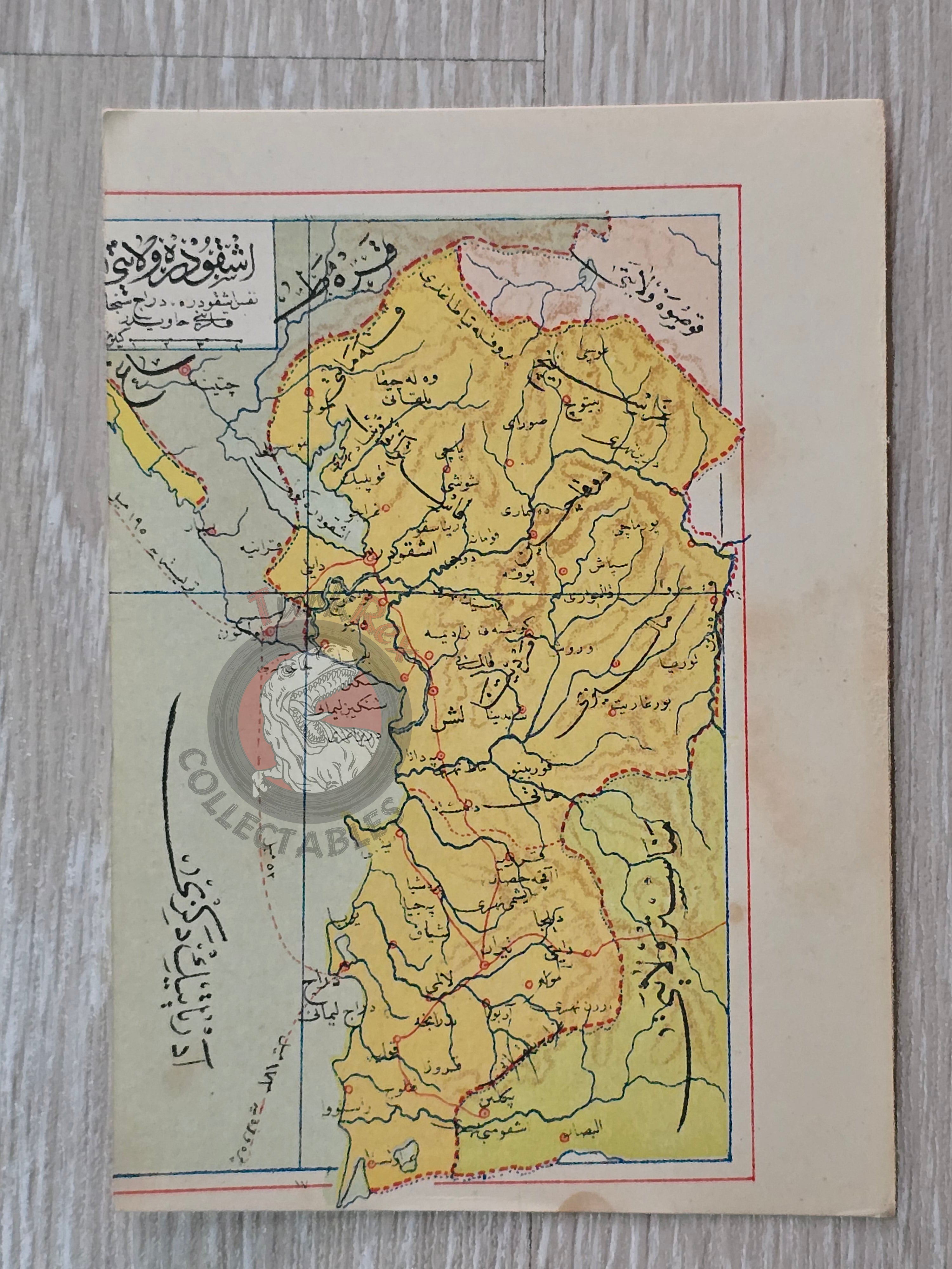

Scutari Vilayet 1907 Ottoman Atlas Map Albania Montenegro Empire Mehmed Eşref Europe Balkans
Ottoman Turkish Map - Scutari Vilayet (from Umum-i Vilayet-i Şahane’yi Havi Küçük Atlas, 1907)
Description:
A rare Ottoman Turkish map of Scutari Vilayet, published in Umum-i Vilayet-i Şahane’yi Havi Küçük Atlas, authored by Mehmed Eşref and printed in 1325 AH (1907 CE). Scutari Vilayet was a first-level administrative division (vilayet) of the Ottoman Empire that existed from 1867 to 1913, located in parts of what today is Montenegro and Albania.
The map measures 14.5 × 10.3 cm and was part of a unique atlas that included a 32-page Ottoman script brochure and 128 maps (some composed of two parts), printed on thick paper and loosely inserted after the text.
This atlas is considered one of the most significant late Ottoman cartographic works, as many of its maps were the first and possibly only Ottoman-produced maps of certain world regions.
Key Features:
-
Title/Subject: Scutari Vilayet (Albania, Montenegro)
-
Author: Mehmed Eşref
-
Source: Umum-i Vilayet-i Şahane’yi Havi Küçük Atlas
-
Date: 1325 AH / 1907 CE
-
Format: Loose-leaf map, thick paper
-
Dimensions: 14.5 × 10.3 cm
-
Content: Ottoman Turkish map of Scutari Vilayet, produced as part of a global atlas
-
Significance: A rare atlas plate; many maps in this collection represent the first and only Ottoman cartographic depictions of specific regions, making it highly valuable for collectors of Ottoman and Balkan history.