


Skip to product information


Spain and Portugal Ottoman Script Atlas Map Empire Europe
$140.00
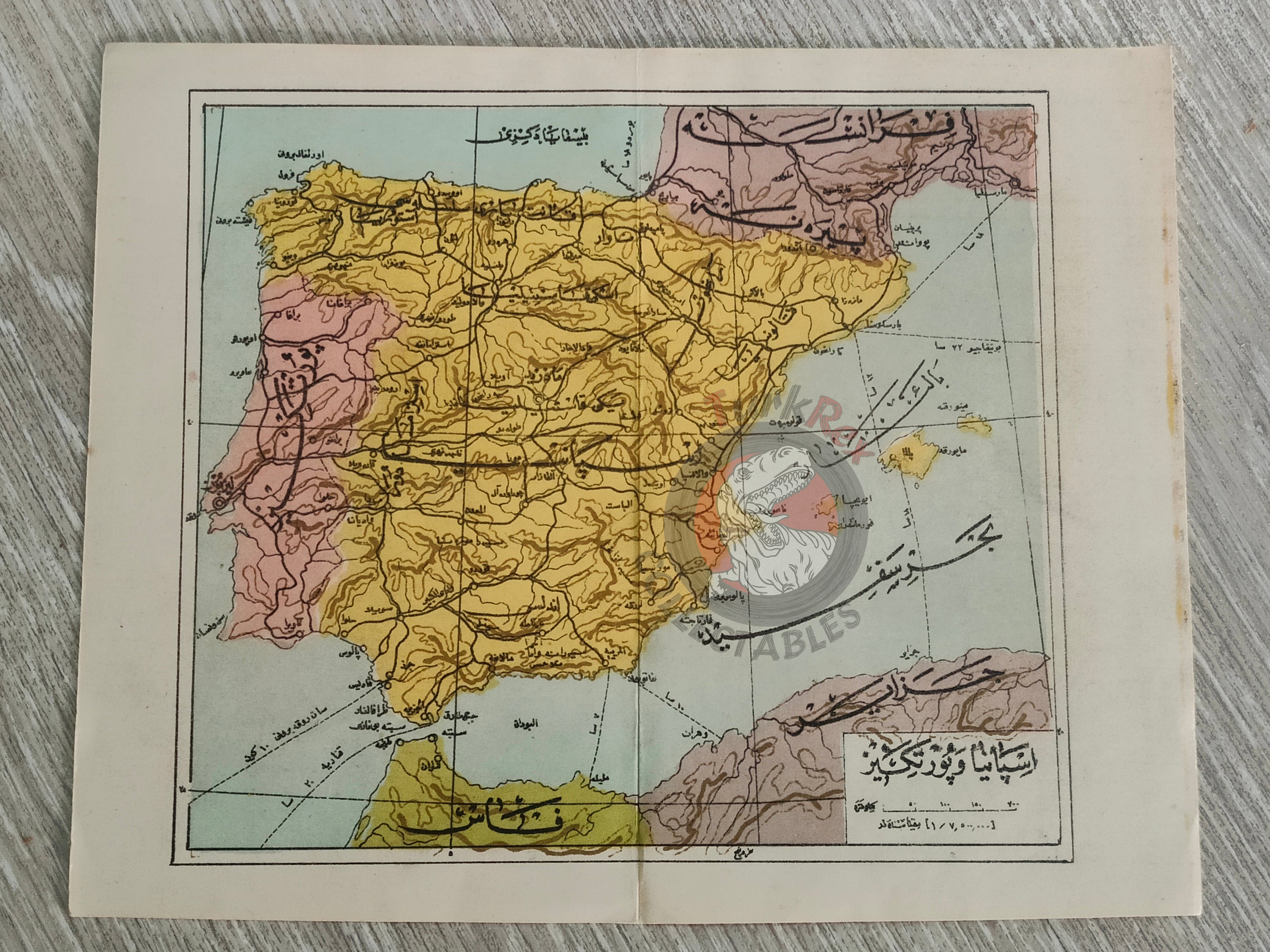
Ottoman Turkish Map – Spain and Portugal
Description:
An Ottoman Turkish map of Spain and Portugal. It was likely published in the early 20th century as part of an Ottoman historical or educational work, though the exact source volume is not identified.
The map measures 22 × 17.7 cm and shows the Iberian Peninsula, including Spain, Portugal, and surrounding regions. The Strait of Gibraltar is clearly visible, along with portions of Morocco (Fas) and southern France.
Key Features:
-
Title/Subject: Spain and Portugal (Iberian Peninsula)
-
Source: Early 20th century (exact source unidentified)
-
Dimensions: 22 × 17.7 cm
-
Geographic Coverage: Spain, Portugal, Strait of Gibraltar, parts of Morocco and France
-
Language: Ottoman Turkish (Arabic script)