


Skip to product information


Spread Of Islam 1910 Ottoman Map Middle East Muslim Saudi Arabia Palestine Iran Greece
$200.00
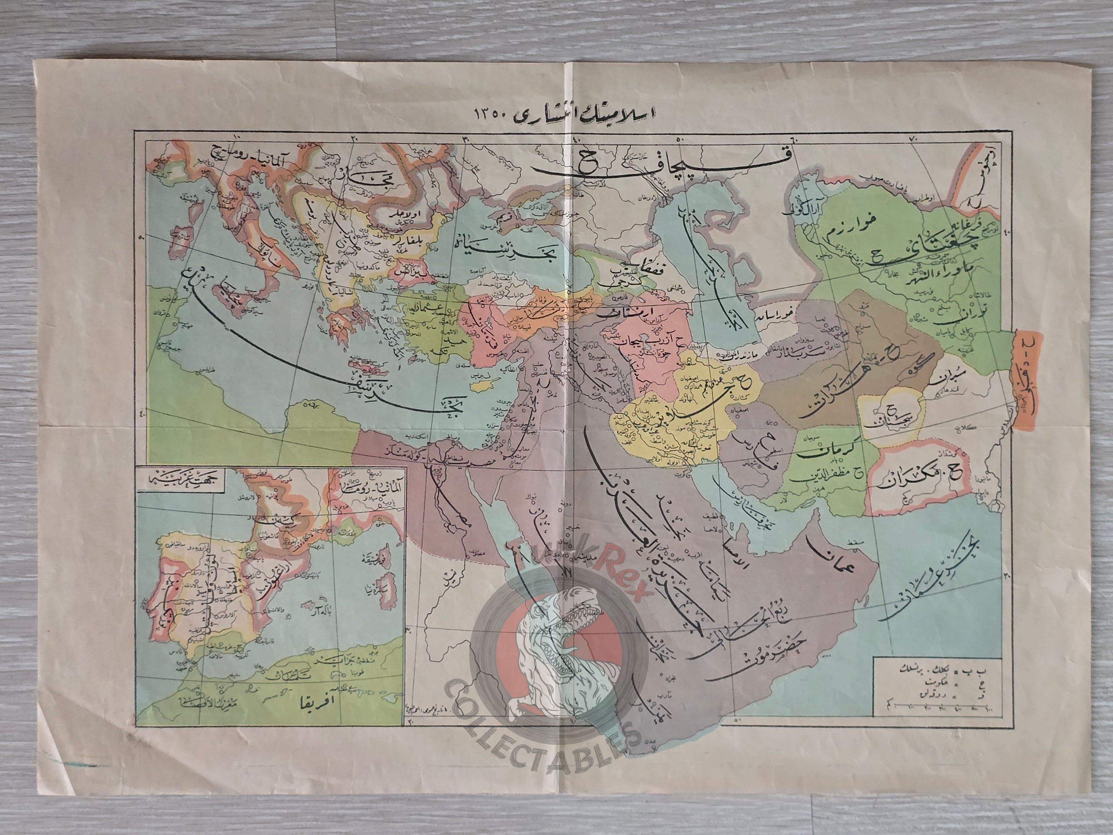
Ottoman Map - Islamiyetin Yayılması 1350 (Spread of Islam, 1350) - From Büyük Tarih-i Umumi (1328 AH / 1910)
Description:
An Ottoman Turkish historical map titled “İslamiyetin Yayılması 1350” (The Spread of Islam in 1350), published in 1328 AH (1910 CE) as part of Büyük Tarih-i Umumi, authored by Ahmed Refik. The work was printed by the Agop Matyosyan Press, a publishing house run by an Ottoman Armenian citizen.
Measuring 40.9 × 28.7 cm, the map illustrates the expansion of Islam across Europe and Asia by the mid-14th century, offering both historical and geographical context. As part of a major general history book, this map was designed as an educational tool to accompany the narrative of Islamic history.
Key Features:
- Title/Region: İslamiyetin Yayılması 1350 – Spread of Islam (Europe and Asia)
- Date: 1328 AH (1910 CE)
- Source: Büyük Tarih-i Umumi Book
- Author: Ahmed Refik
- Publisher: Agop Matyosyan Press (Ottoman Armenian publisher)
- Dimensions: 40.9 × 28.7 cm
- Significance: Rare example of Ottoman historical cartography, reflecting both religious and cultural expansion across continents