


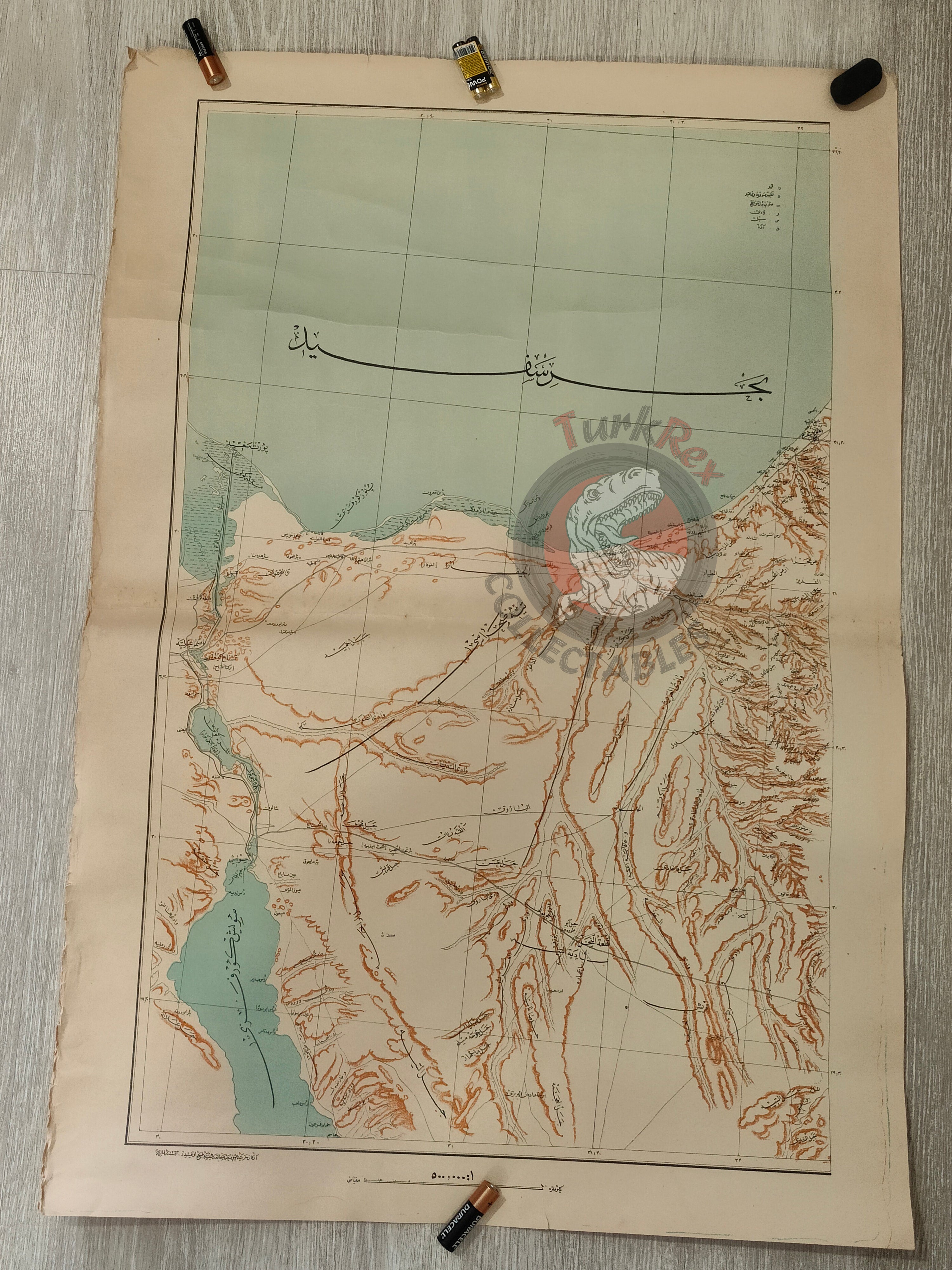


Suez Canal and Egypt Region WW1 Ottoman Empire 1917 Military Map
Ottoman Military Map - Suez Canal and Egypt Region (WWI, 1917)
Description:
A large Ottoman military map (Erkan-ı Harbiye Haritası) depicting the Suez Canal and surrounding Egyptian region, produced in 1333 AH (1917 CE) during the First World War.
Measuring 82.2 × 56.8 cm, this is one of the most detailed Ottoman maps of the area, prepared specifically for military use on the battlefield. Such maps were crucial during the Ottoman campaigns in the Sinai and Palestine fronts and represent an important aspect of the empire’s cartographic and military history.
As a product of the Ottoman General Staff (Erkan-ı Harbiye), this map exemplifies the high level of precision and detail dedicated to strategic geographies during the war. Its size and accuracy make it a rare survival from the period.
Key Features:
-
Title/Subject: Suez Canal and Egypt region
-
Type: Ottoman Military Map (Erkan-ı Harbiye Haritası)
-
Date: 1333 AH / 1917 CE
-
Dimensions: 82.2 × 56.8 cm
-
Publisher/Authority: Ottoman Imperial General Staff
-
Content: Detailed topographical representation of the Suez Canal and surrounding regions
-
Historical Context: Produced during WWI for Ottoman military campaigns in the region
-
Significance: Among the most detailed Ottoman maps of the Suez region; rare WWI military issue
-
Condition: Light creasing on the left side