


Switzerland 1910s Ottoman Atlas Map Empire Europe
Ottoman Turkish Map – Switzerland (ca. 1910s)
Description:
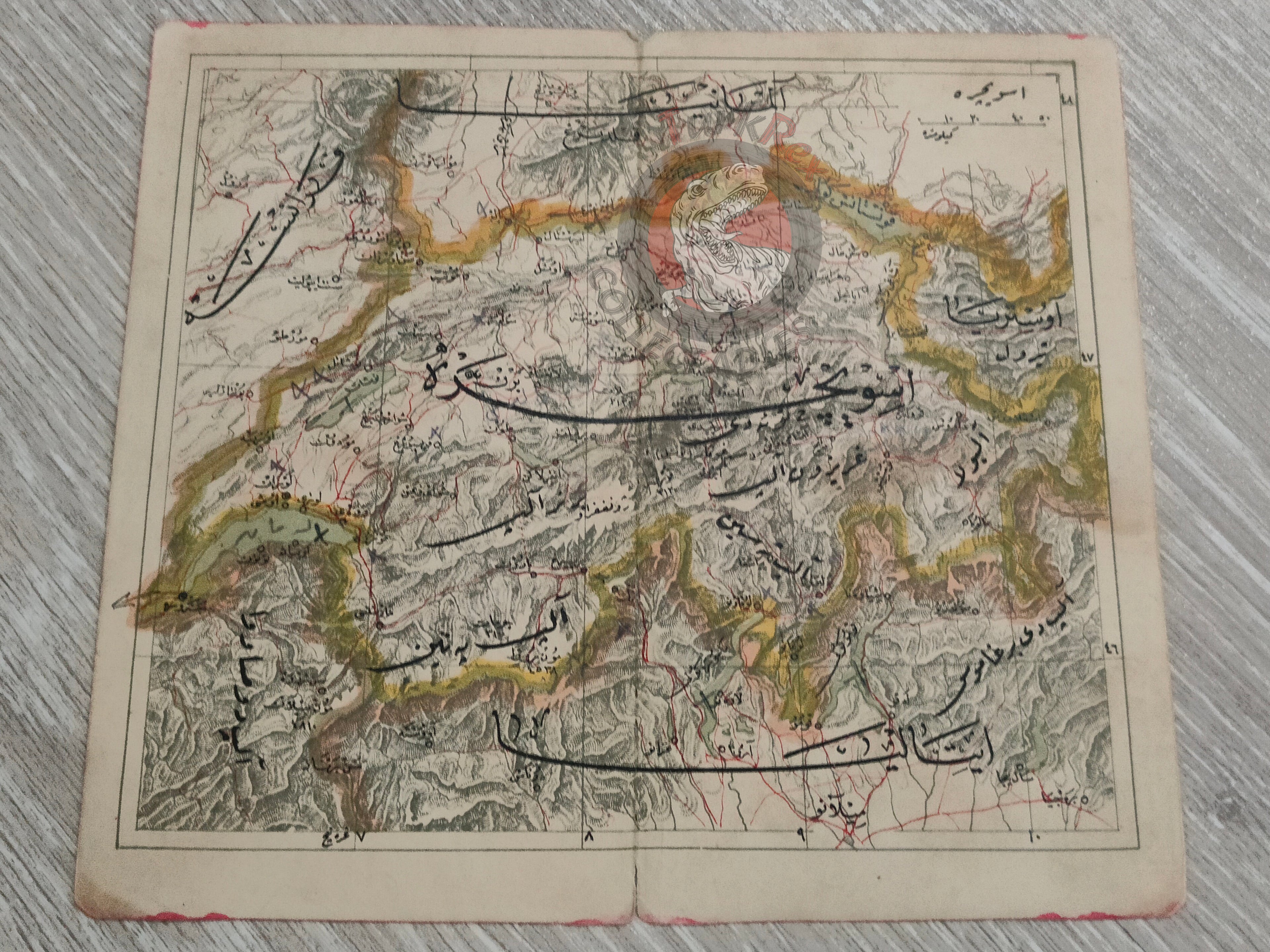
An Ottoman Turkish map of Switzerland, likely extracted from an early 20th-century Ottoman atlas (ca. 1910s). The map measures 19.4 × 17.2 cm and depicts Switzerland together with its borders, showing surrounding regions of Italy, Germany, and France.
While the exact source atlas is not identified, stylistically it is consistent with Ottoman atlases of the early 20th century, which sought to present both the Empire’s territories and broader world geography to an educated readership.
This map reflects the Ottoman intellectual and cartographic interest in European geography, and serves as a rare survival from the period when world atlases in Ottoman Turkish were still printed in Arabic script before the alphabet reform.
Key Features:
-
Title/Subject: Switzerland and neighboring borders
-
Language: Ottoman Turkish (Arabic script)
-
Date: ca. 1910s (exact atlas unidentified)
-
Dimensions: 19.4 × 17.2 cm
-
Geographic Coverage: Switzerland, with borders of Italy, Germany, and France
-
Significance: Rare Ottoman map of Switzerland; illustrates Ottoman engagement with European geography in the early 20th century