


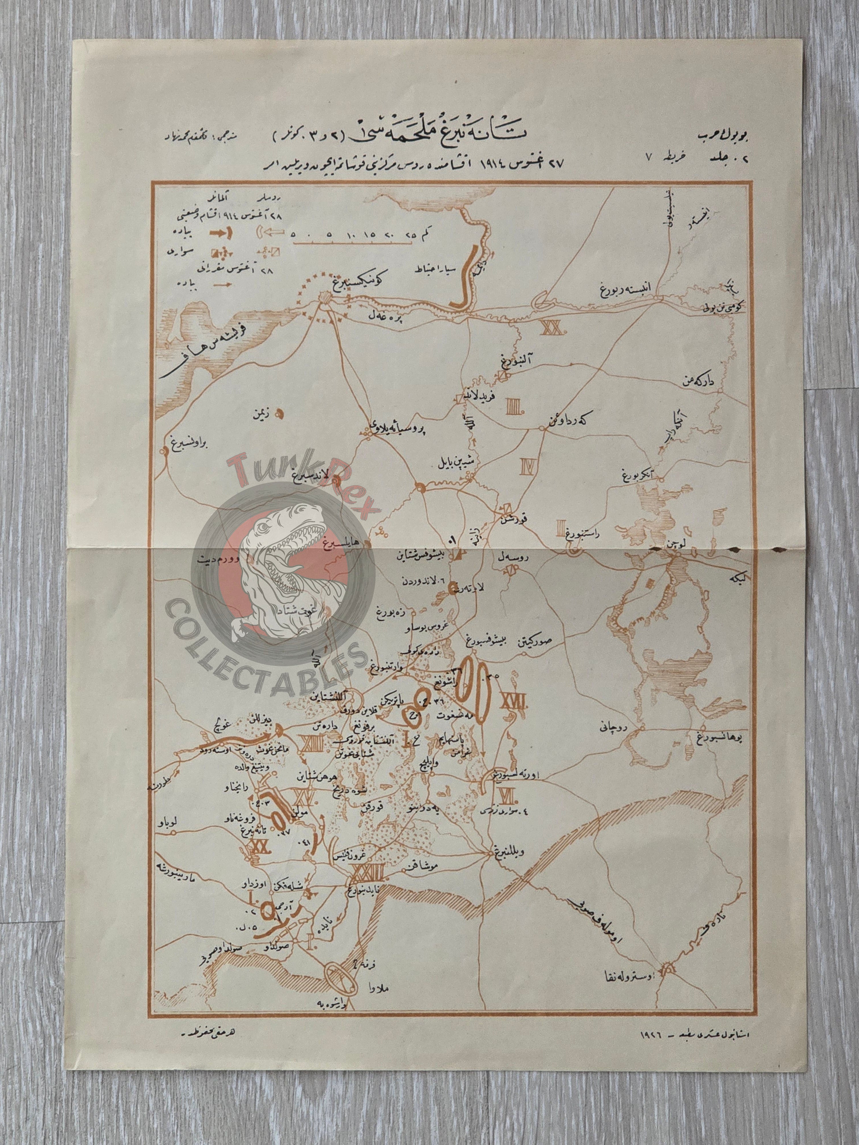


Tannenberg Battle WW1 Military Map Ottoman Script Germany Russia Königsberg 1926
Tannenberg Melhamesi - 2nd & 3rd Days
Description:
An Ottoman Turkish military map depicting the Tannenberg Battle during World War I, showing orders issued on the evening of 27 August 1914 for the encirclement of the Russian center. The Tannenberg battle, fought from 23–30 August 1914, was Germany’s decisive victory, halting the Russian advance at the very beginning of the war.
This map was published in 1926 in Istanbul by İstanbul Askeri Matbaası, as part of the book Büyük Harp 1914-1918, translated by Mehmed Nihad. It served as an educational tool for military schools.
Key Features:
-
Dimensions: 35.5 × 25.2 cm
-
Region Shown: Königsberg and surrounding areas
-
Condition: Well-preserved; clear tactical markings and Ottoman Turkish text
-
Significance: Illustrates Ottoman military pedagogy and historical WWI operations, providing insight into early 20th-century military cartography