


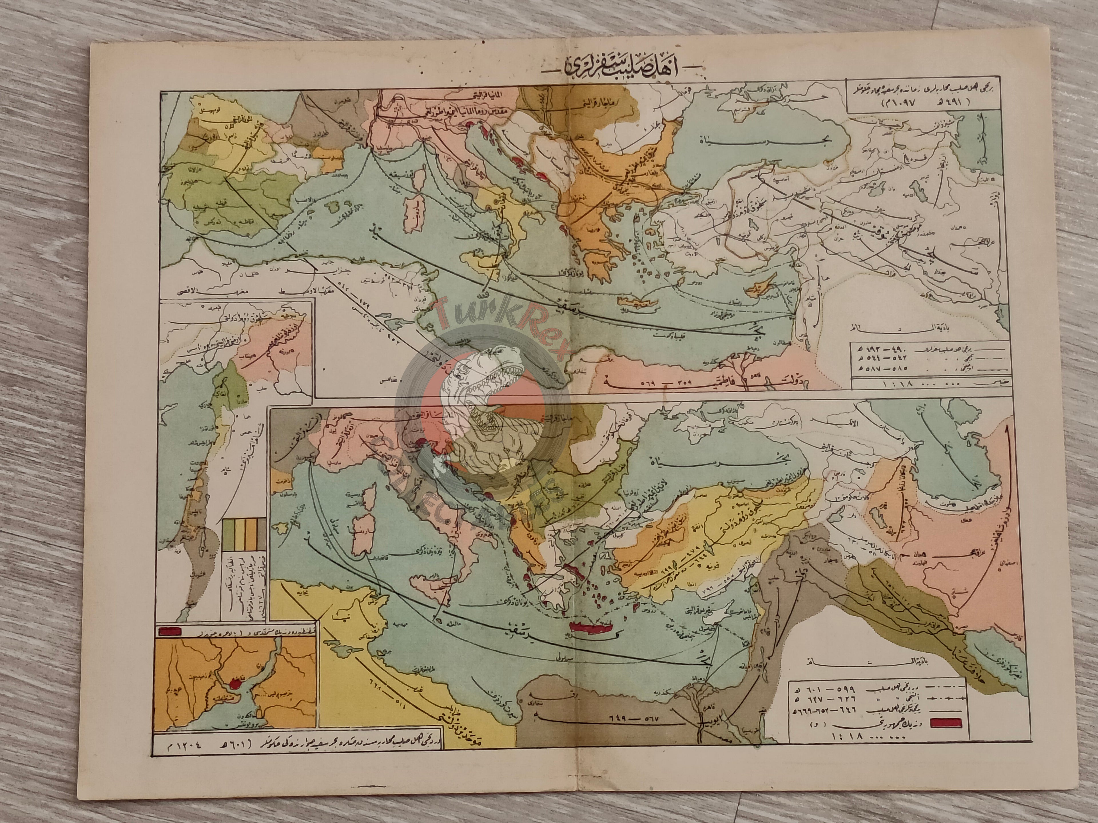


The Crusades 1913 Ottoman Map Middle East Palestine Israel Iraq Iran
Ottoman Turkish Map - The Crusades (from Tarih-i Umumi ve Osmani Atlası, 1913)
Description:
A double-page Ottoman Turkish historical map titled “The Crusades”, from Mehmed Eşref’s Tarih-i Umumi ve Osmani Atlası, published in 1329 AH (1913 CE) by the Mekteb-i Harbiye Matbaası (Ottoman Military Academy Press).
This sheet contains two color lithographed maps with insets, illustrating the Crusader campaigns across Asia Minor and the Eastern Mediterranean between 1096 and 1271, depicting the conflicts between Christian and Muslim powers during the era of the Crusades.
The atlas itself comprised 138 maps in 32 double-page color plates, making this one of the rare Ottoman cartographic depictions of medieval European and Near Eastern history.
Key Features:
-
Title: The Crusades (Haçlı Seferleri)
-
Period Covered: 1096–1271
-
Source: Mehmed Eşref, Tarih-i Umumi ve Osmani Atlası
-
Publication Date: 1329 AH / 1913 CE
-
Publisher: Mekteb-i Harbiye Matbaası, Istanbul
-
Format: 2 color lithographed maps on a double-page sheet, with insets
- Atlas Content: One of 138 maps in 32 double-page plates
-
Dimensions: 32.7x25.7cm
-
Significance: A rare Ottoman-produced historical map illustrating the Crusades, combining Ottoman educational cartography with global medieval history.