


WW1 Western Front 1914 Turkish Military Map 1932 Germany France Belgium
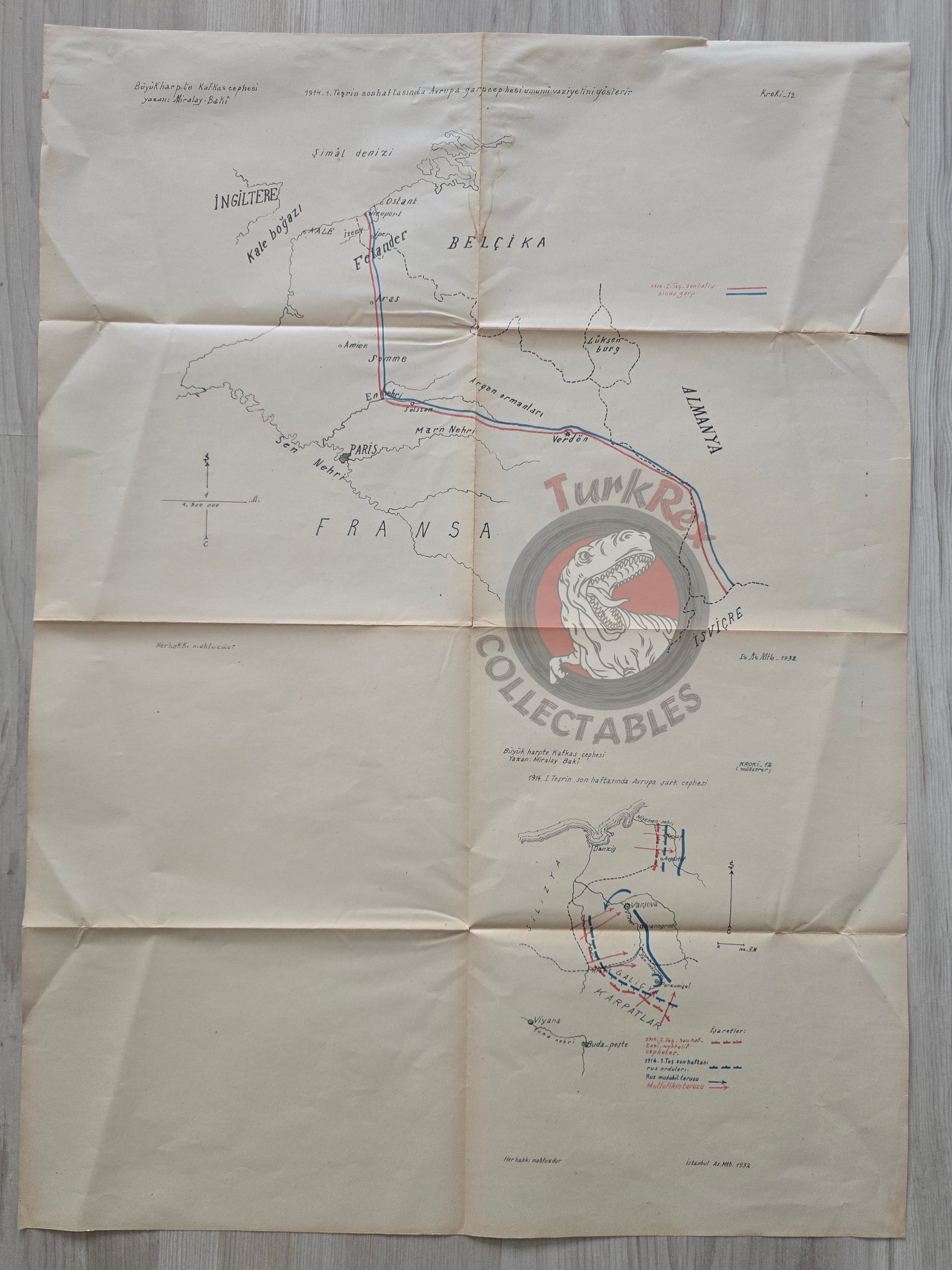
Turkish Military Map – Western Front in WWI (Late October 1914)
Description:
A Turkish military map from the book “Büyük Harpde Kafkas Cephesi”, authored by Miralay Baki and published by the Istanbul Military Press (Askeri Matbaa) in 1932.
Measuring 68 × 50 cm, this map illustrates the general situation on the Western Front (Europe) during the last week of 1 Teşrin 1914 (late October 1914). It shows the frontlines and positions along the borders of Belgium, France, and Germany, providing a detailed view of troop deployments and the strategic situation at the onset of World War I.
Produced as part of a military textbook, the map was intended for officer training and educational purposes in Turkish military schools. Its original binding in the book leaves visible fold lines across the map.
Key Features:
-
Title/Subject: Western Front, WWI (late October 1914 situation)
-
Author: Miralay Baki
-
Publisher: Istanbul Military Press (Askeri Matbaa)
-
Date: 1932 CE
-
Dimensions: 68 × 50 cm
-
Content: Depicts troop positions and borders of Belgium, France, and Germany during early WWI
-
Context: Military educational map for officer training
-
Condition: Fold lines from original book binding