Maps
-
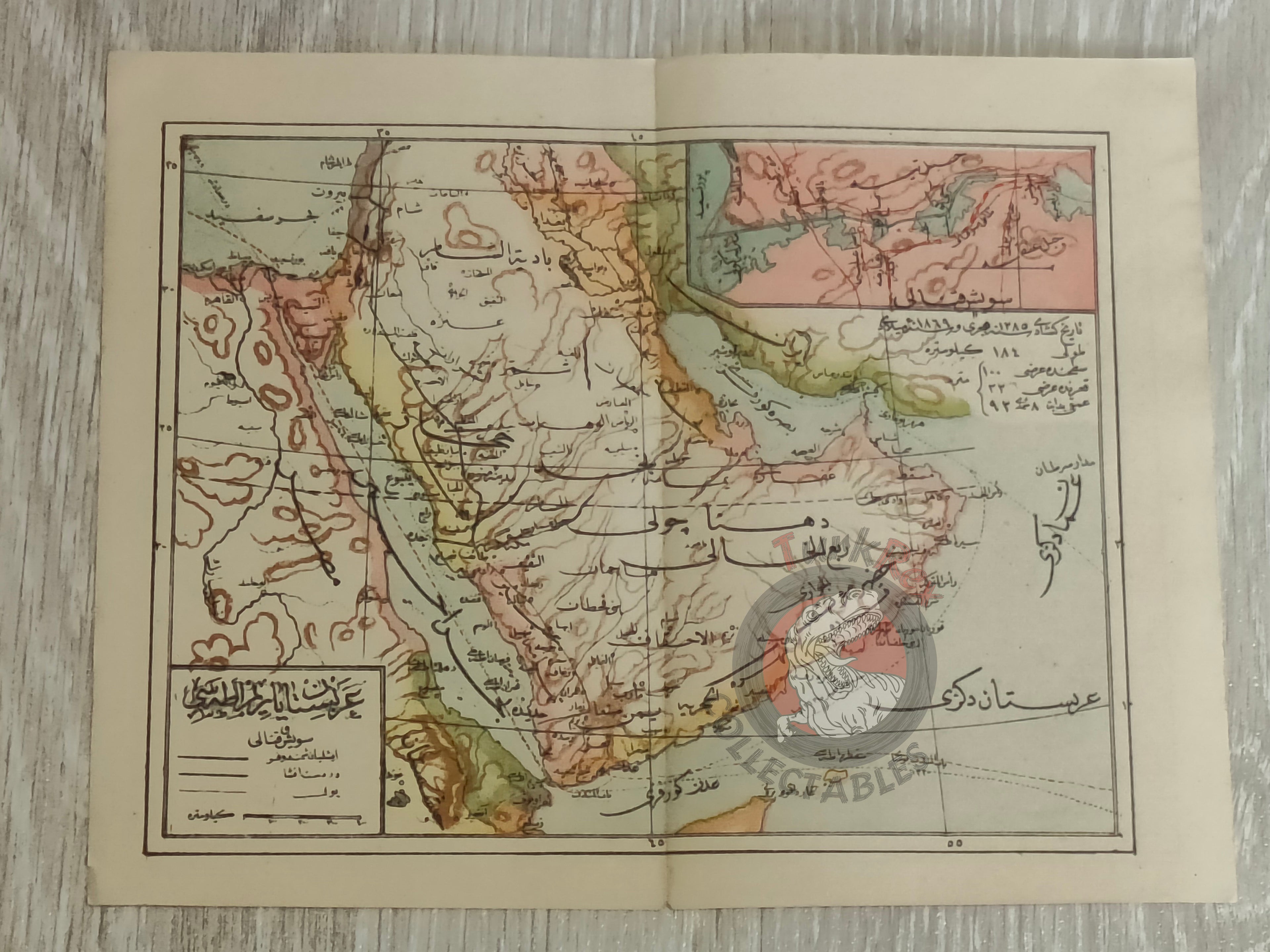
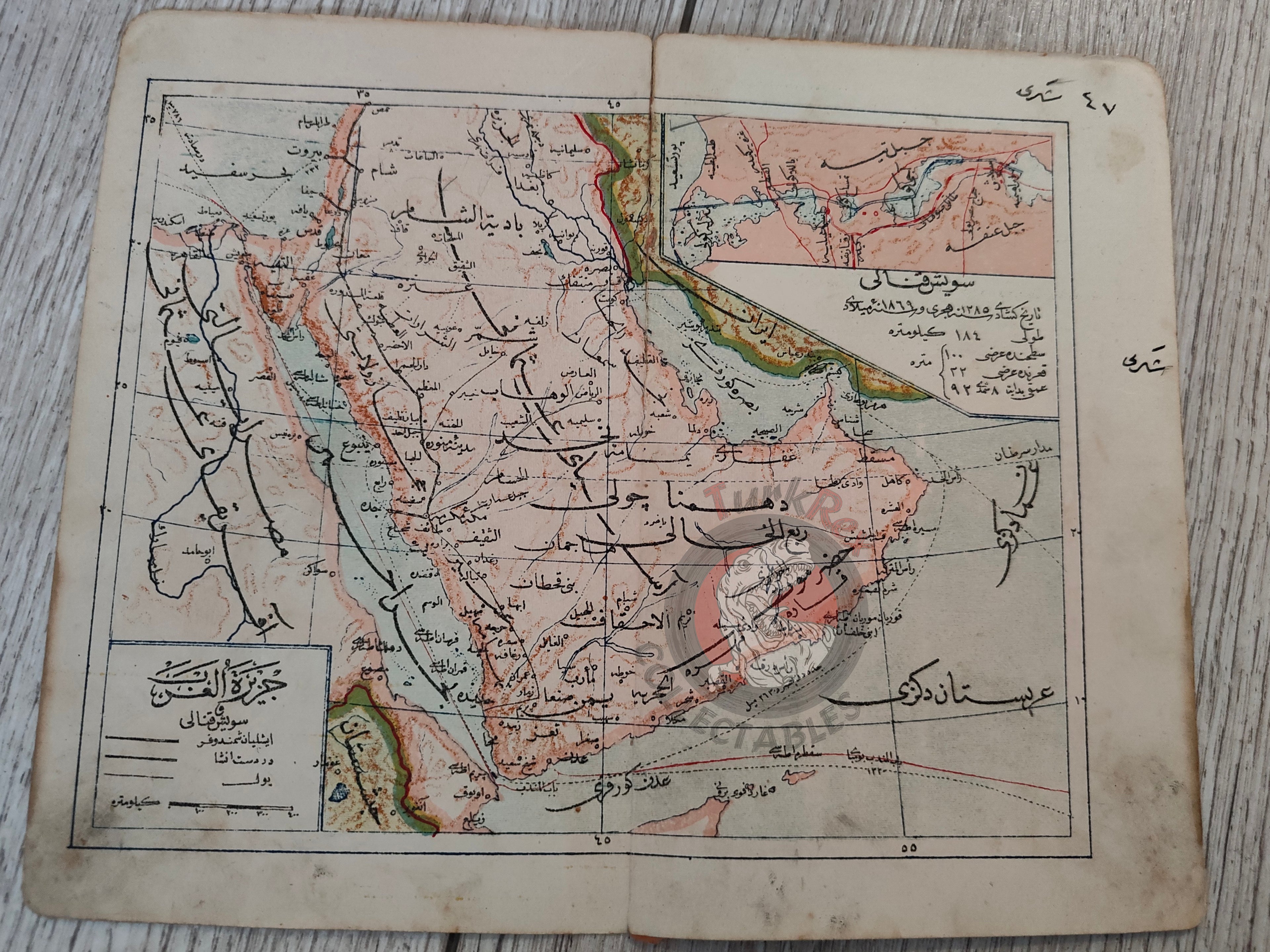
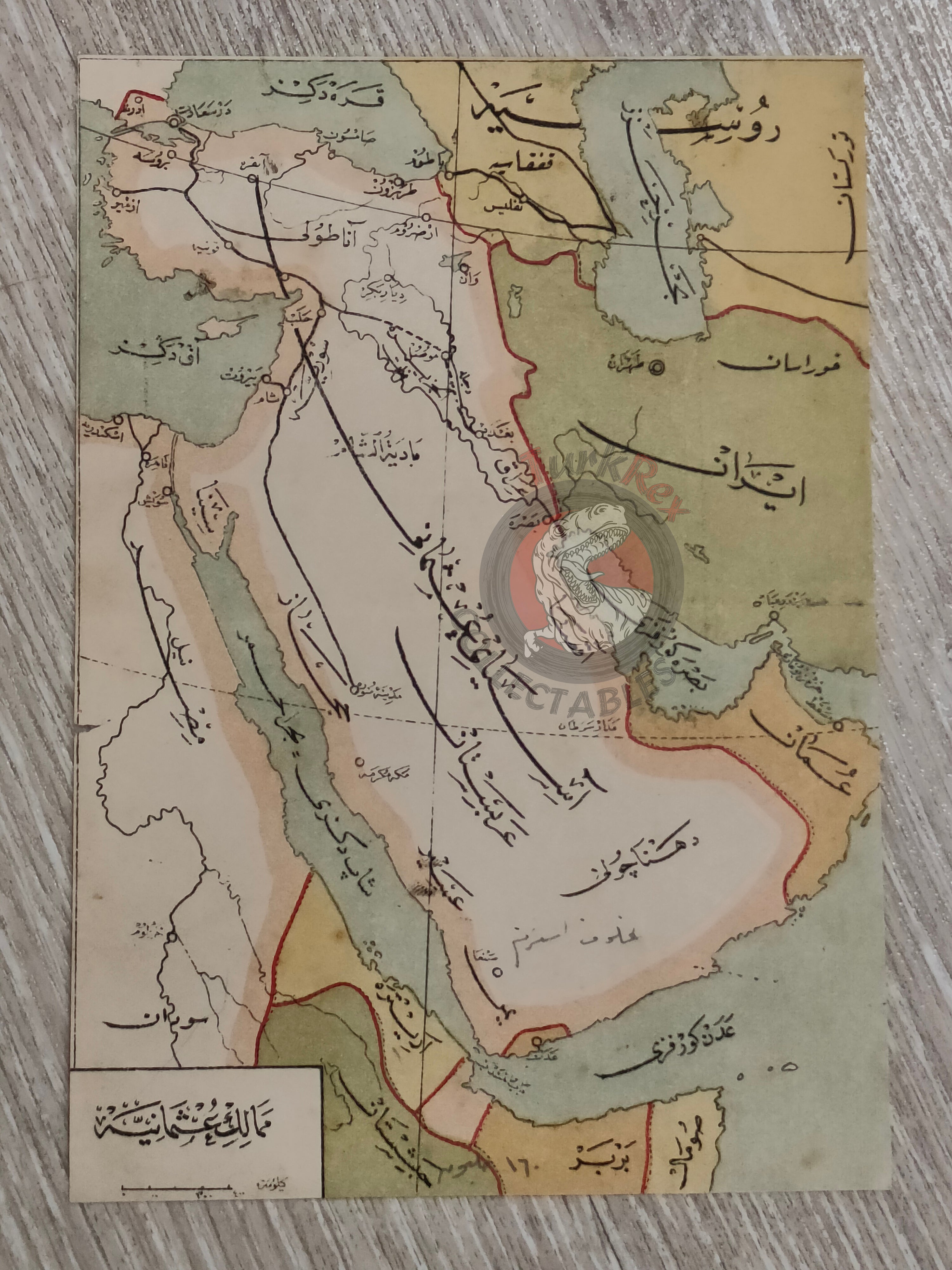
Arabian Peninsula with Suez Canal Inset Ottoman Atlas Map Saudi Arabia Palestine Hejaz Railway Empire -
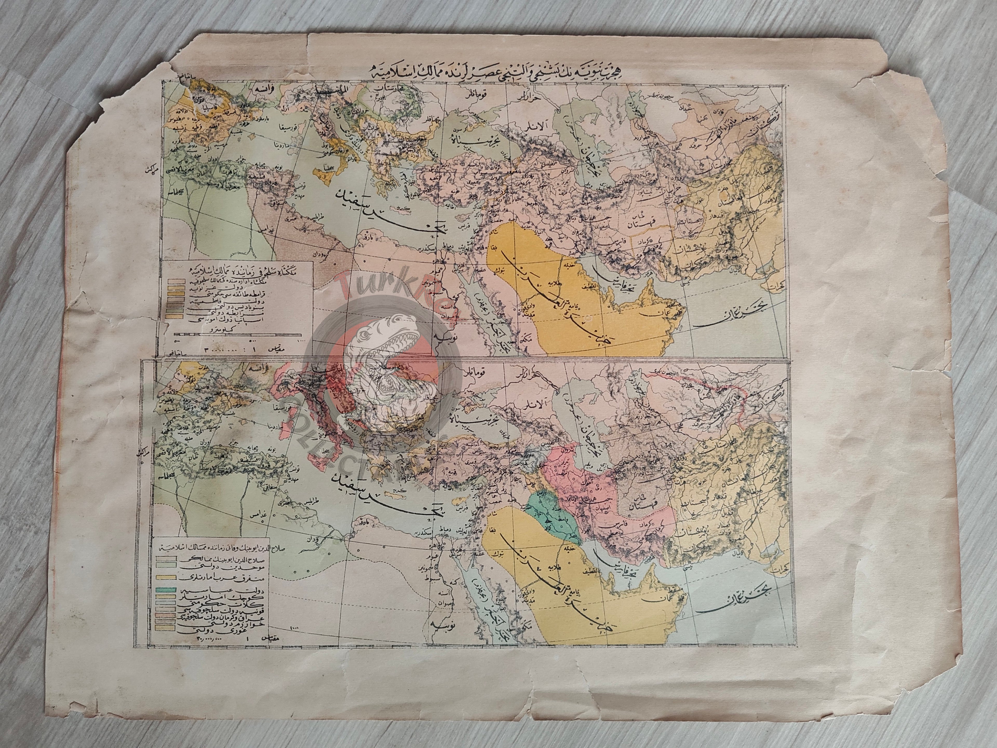
Expansion of Islam in the 5th and 6th Centuries Ottoman Map Arabian Peninsula Anatolia -
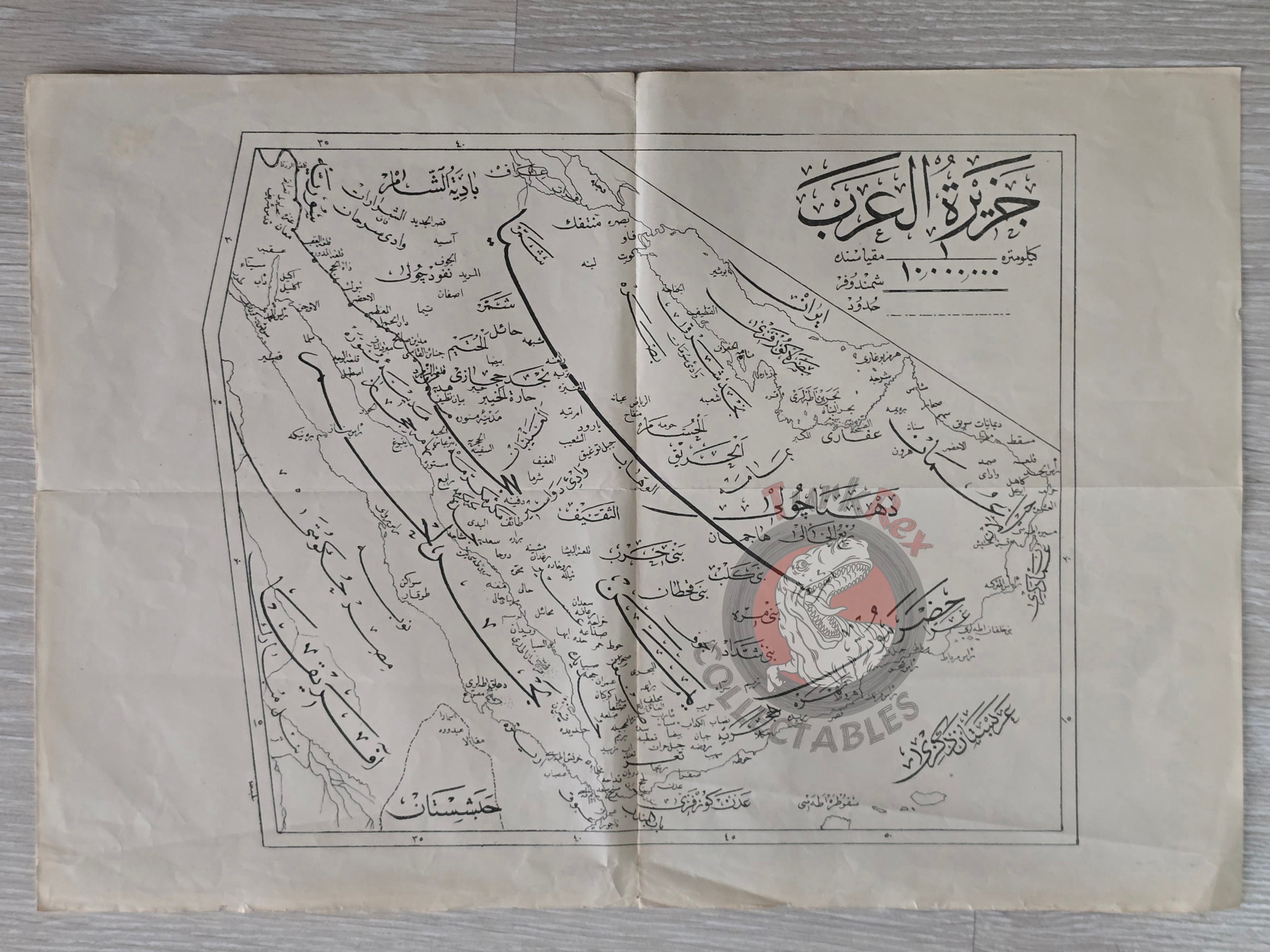
Arabian Peninsula 1922 Ottoman Map Saudi Arabia Palestine Qatar Empire Islam History -
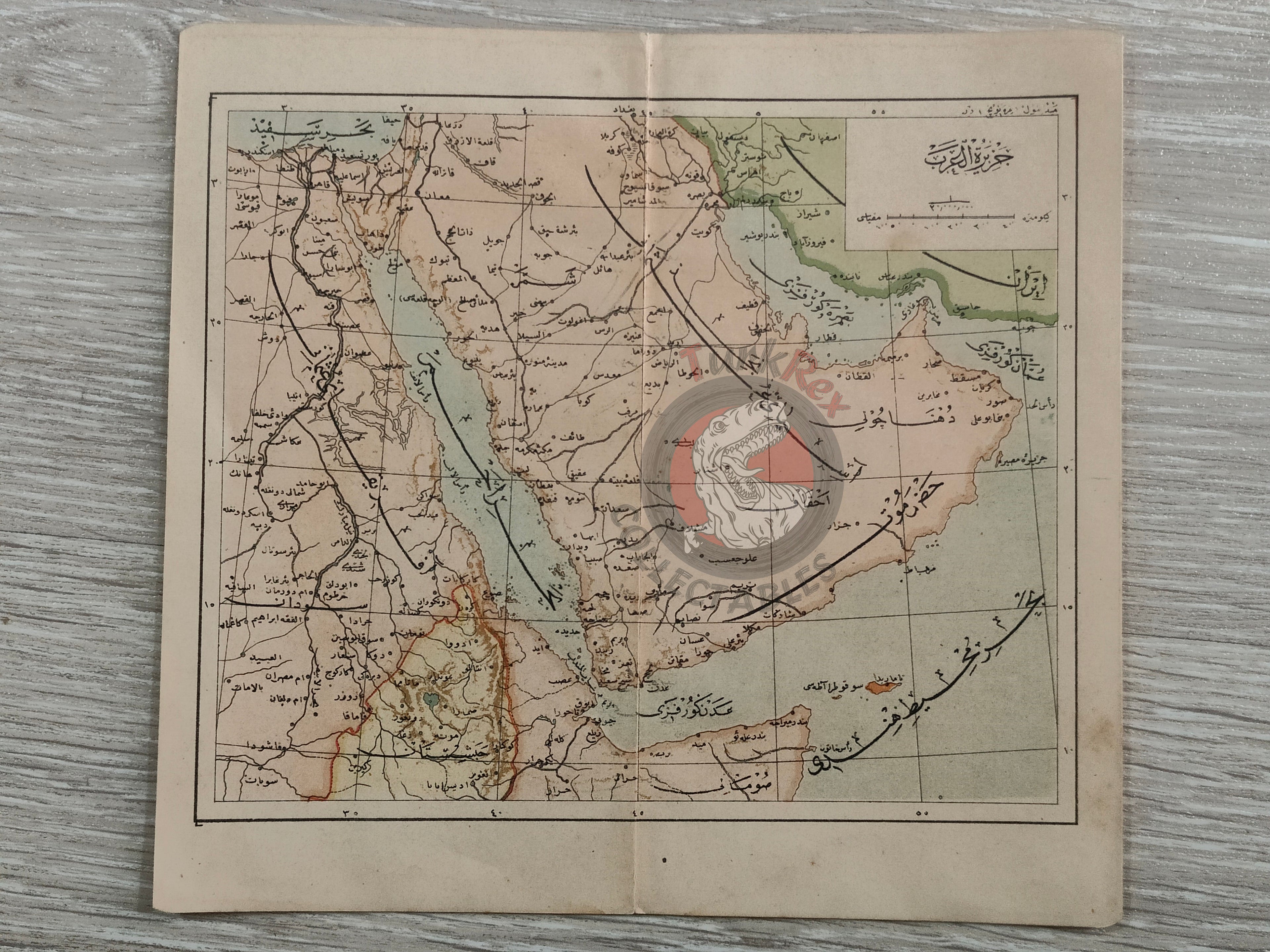
Arabian Peninsula 1916 Ottoman Map Saudi Arabia Palestine Qatar Hejaz Railway Empire -
Arabian Peninsula with Suez Canal Inset 1908 Ottoman Atlas Map Saudi Arabia Palestine Hejaz Railway Empire -
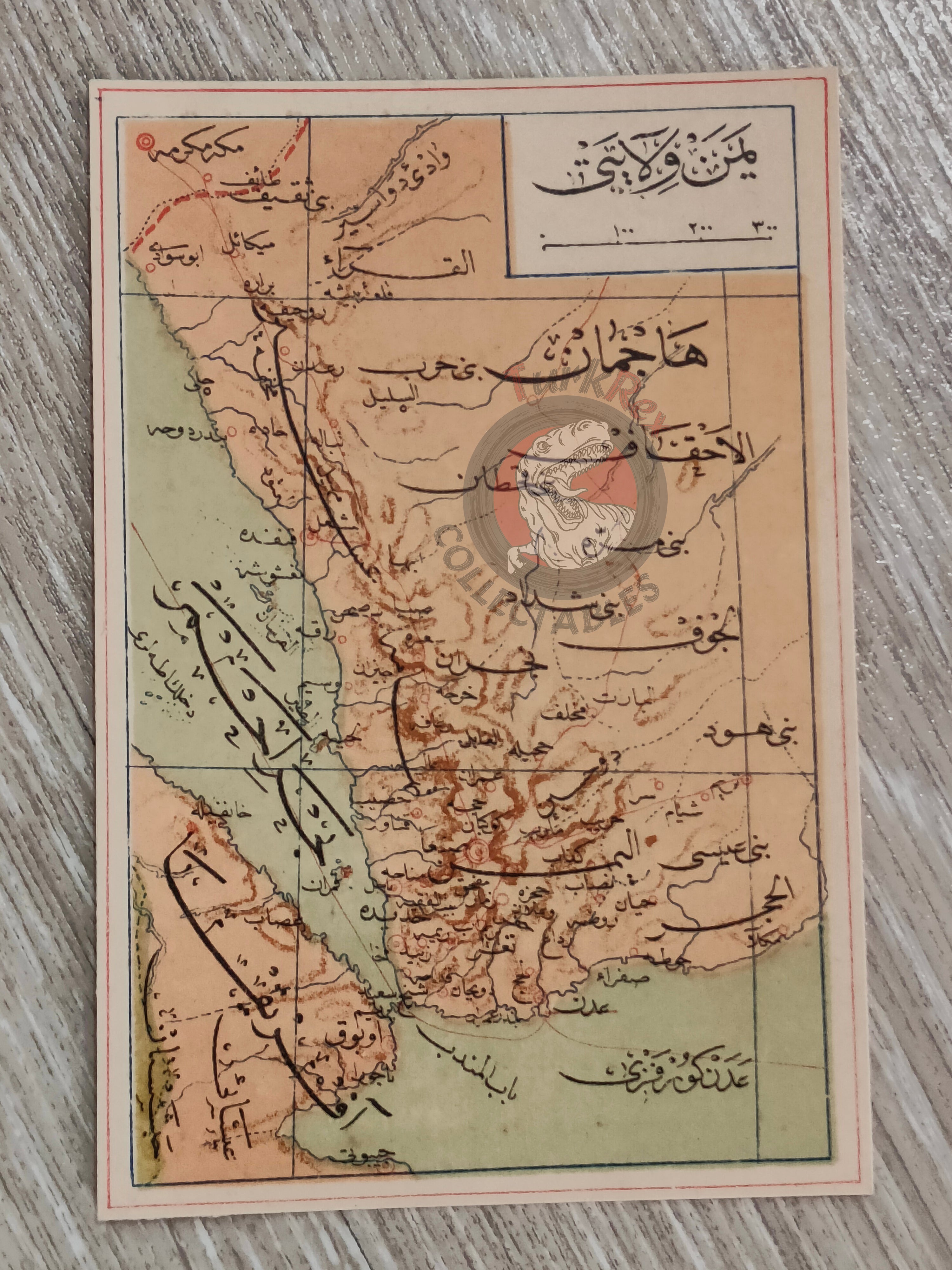
Yemen Saudi Arabia 1907 Ottoman Atlas Map Mecca Empire -
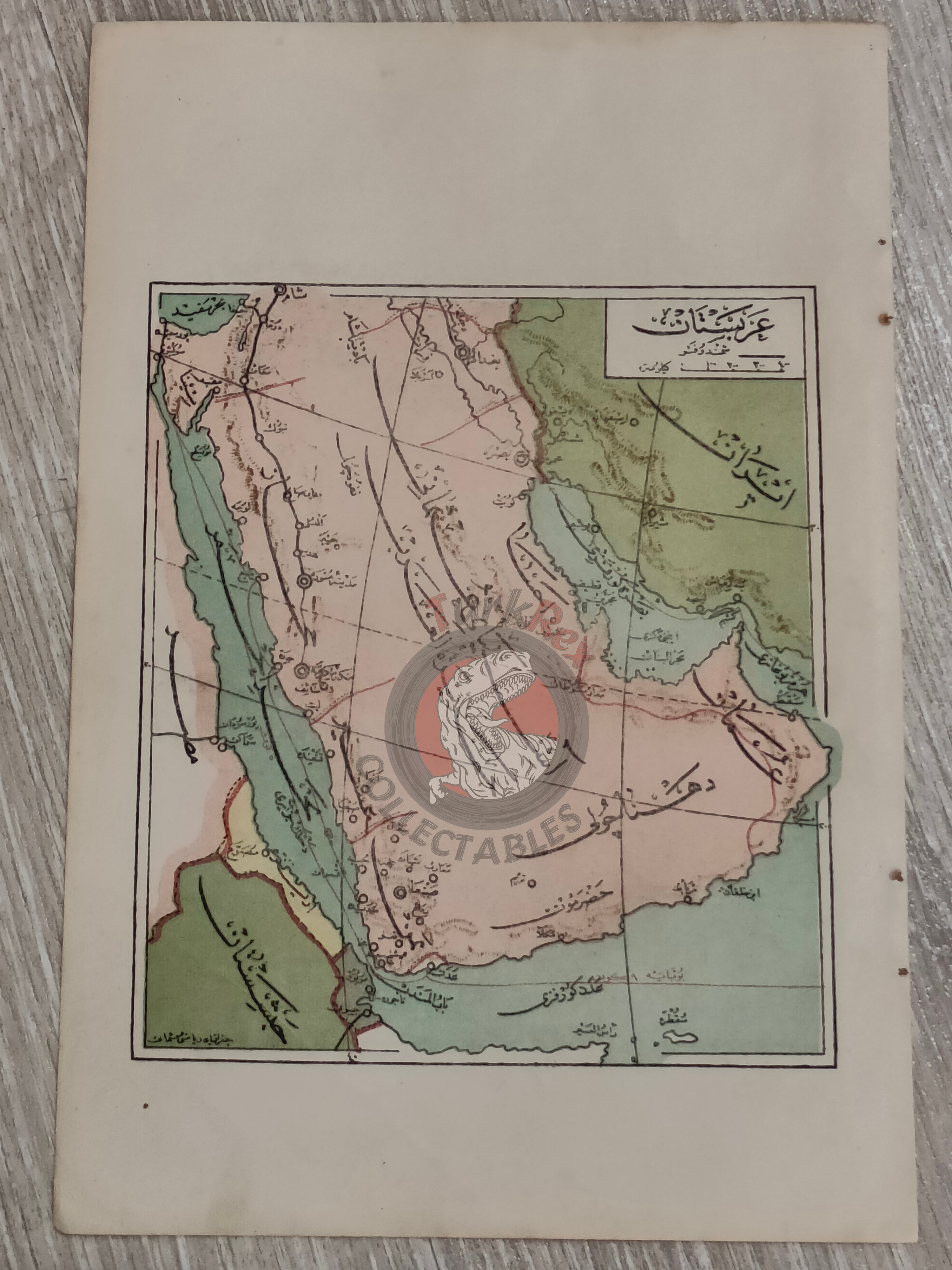
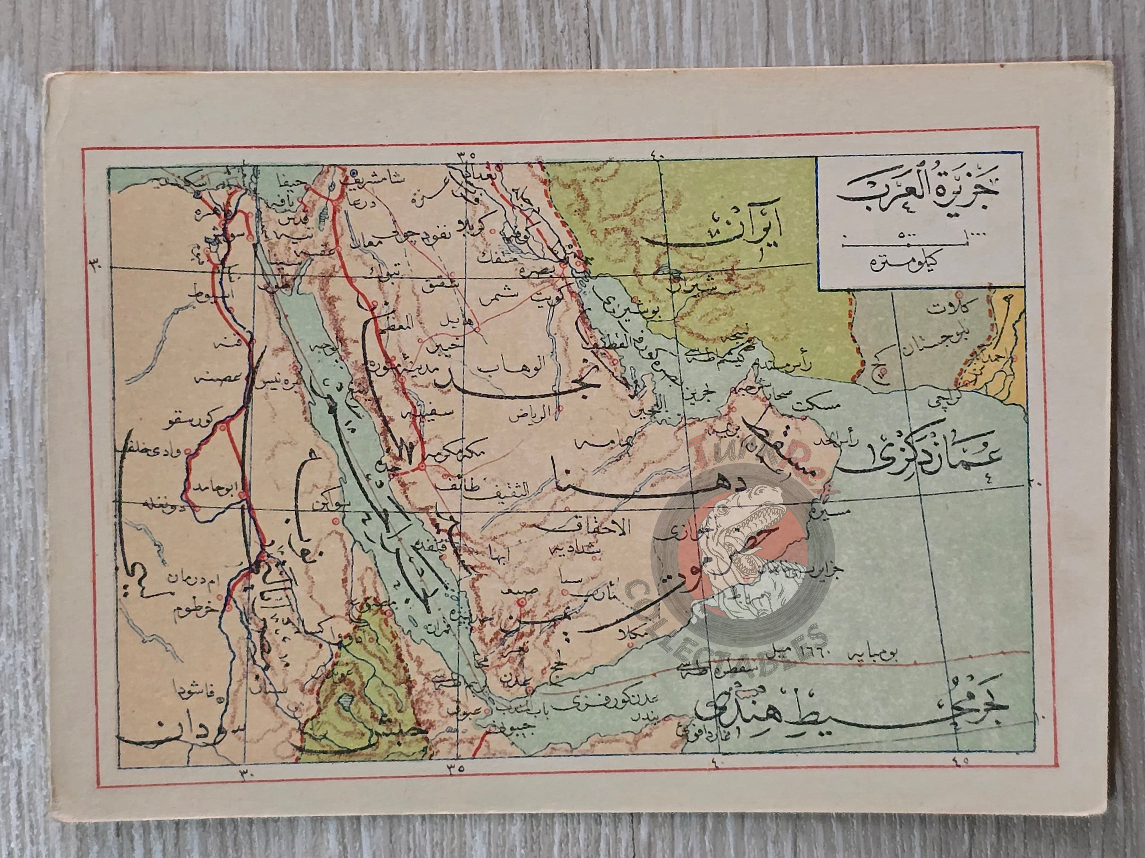
Arabian Peninsula 1907 Ottoman Atlas Map Saudi Arabia Palestine Qatar Hejaz Railway Empire -
Arabian Peninsula 1906 Ottoman Atlas Map Saudi Arabia Palestine Qatar Hejaz Railway Empire -
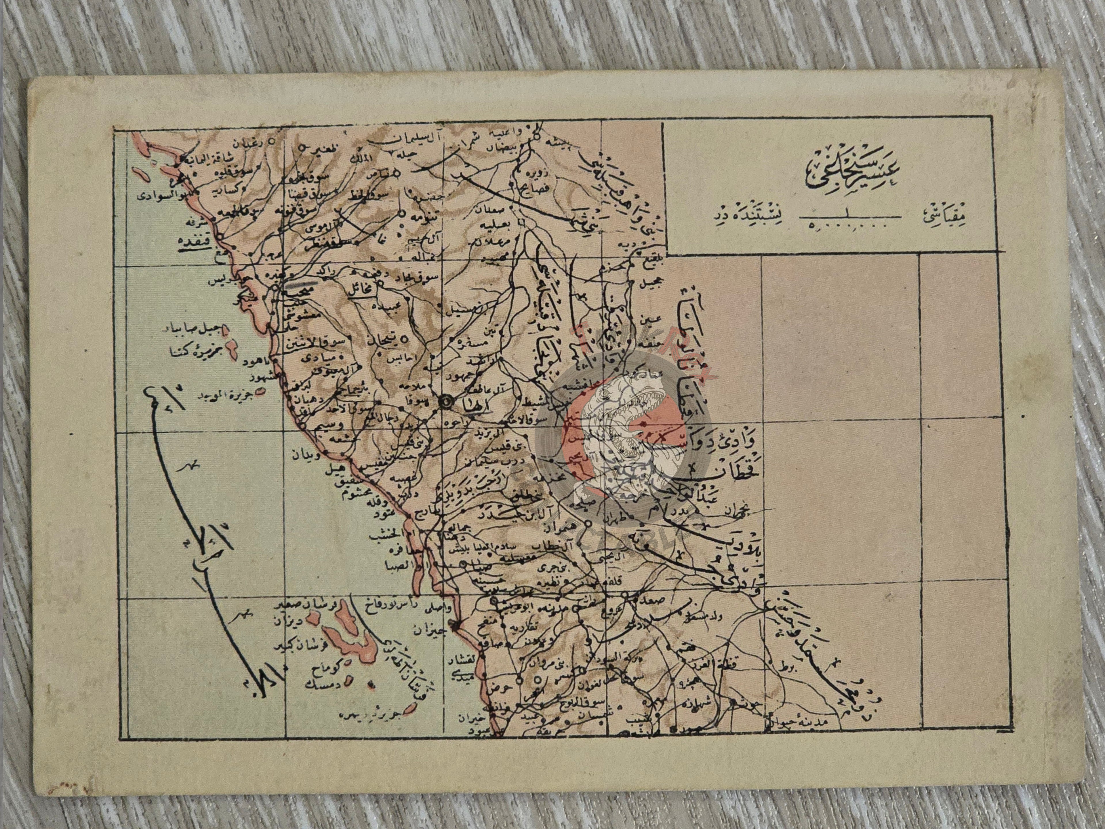
Asir Saudi Arabia Ottoman Postcard Map Middle East Ibrahim Hilmi Military Aseer -
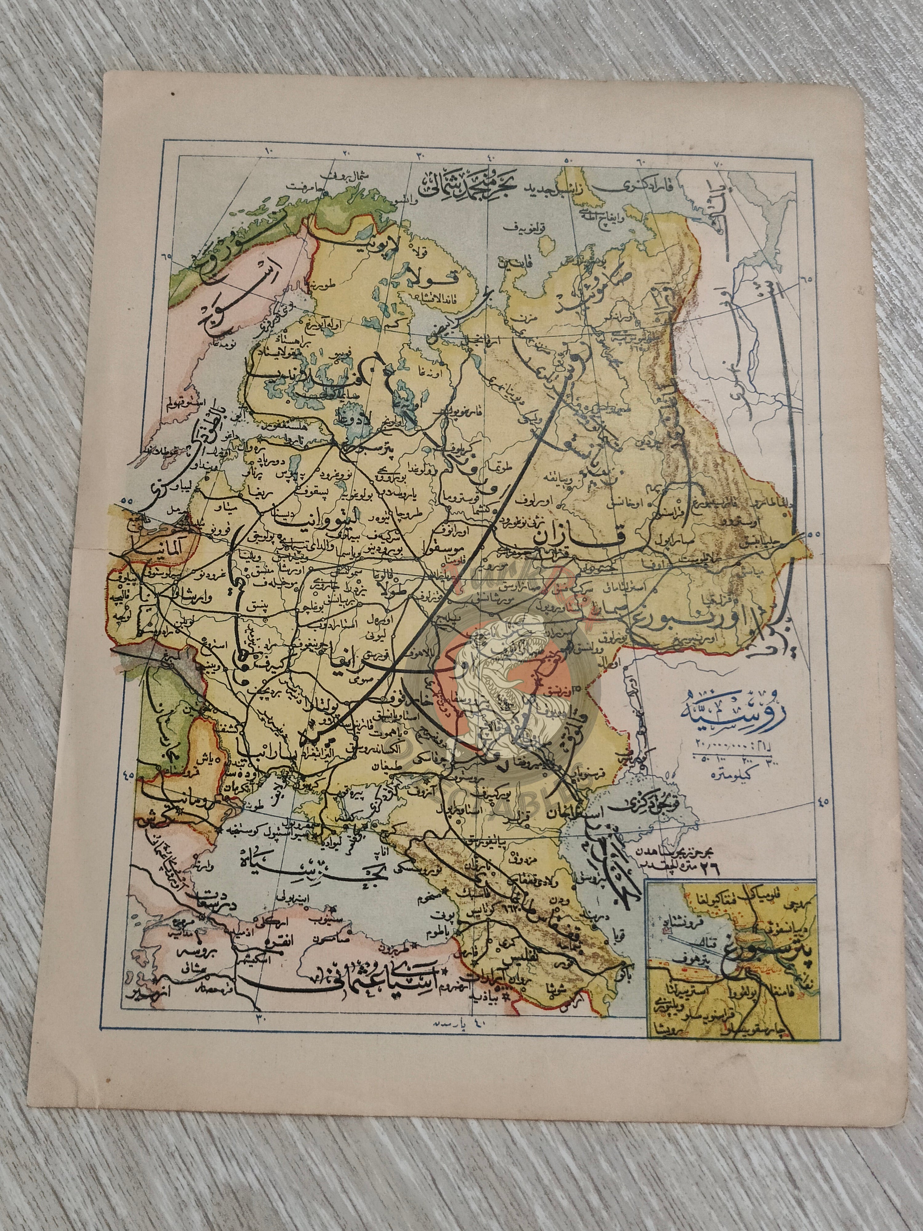
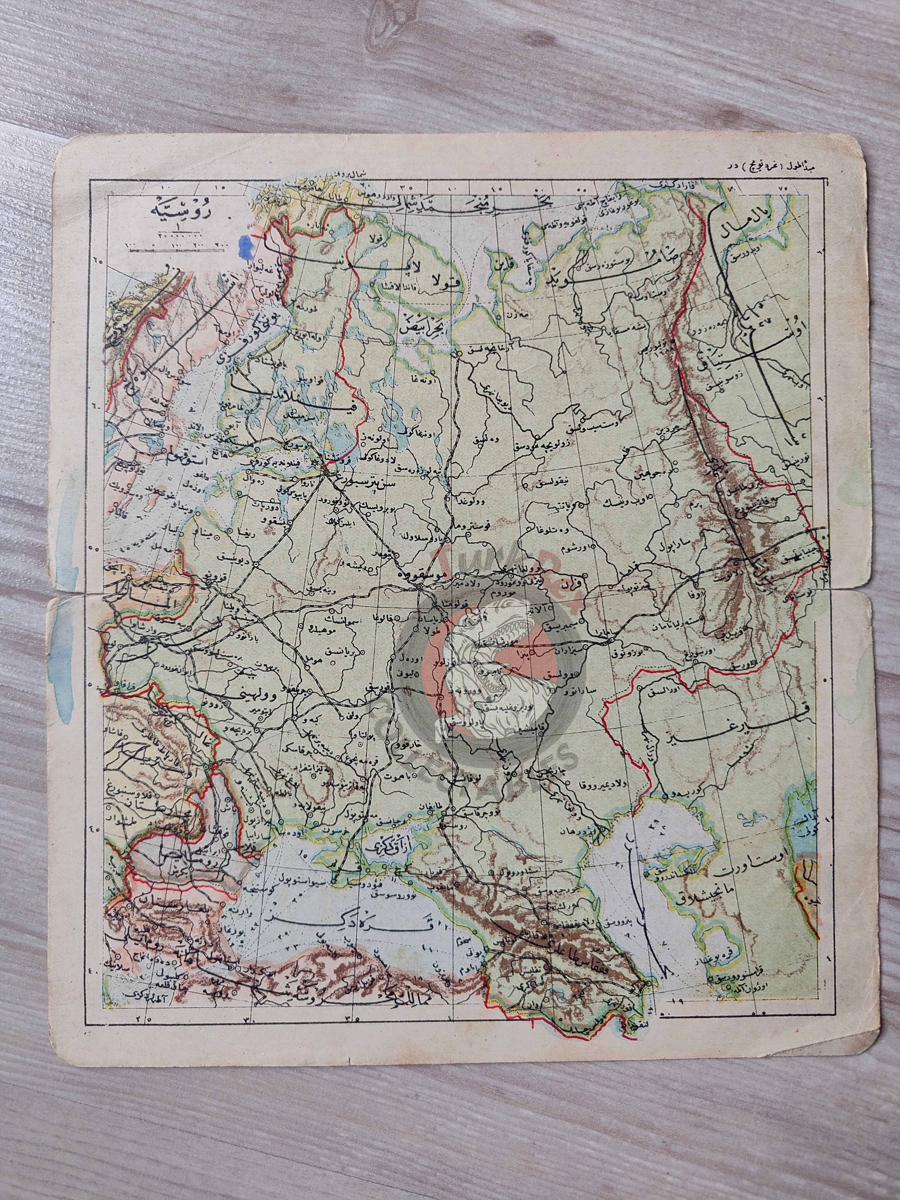
Russia 1906 Ottoman Atlas Map Empire St. Petersburg Finland Black Sea Georgia -
Russia 1906 Ottoman Atlas Map Empire Finland Black Sea Georgia -
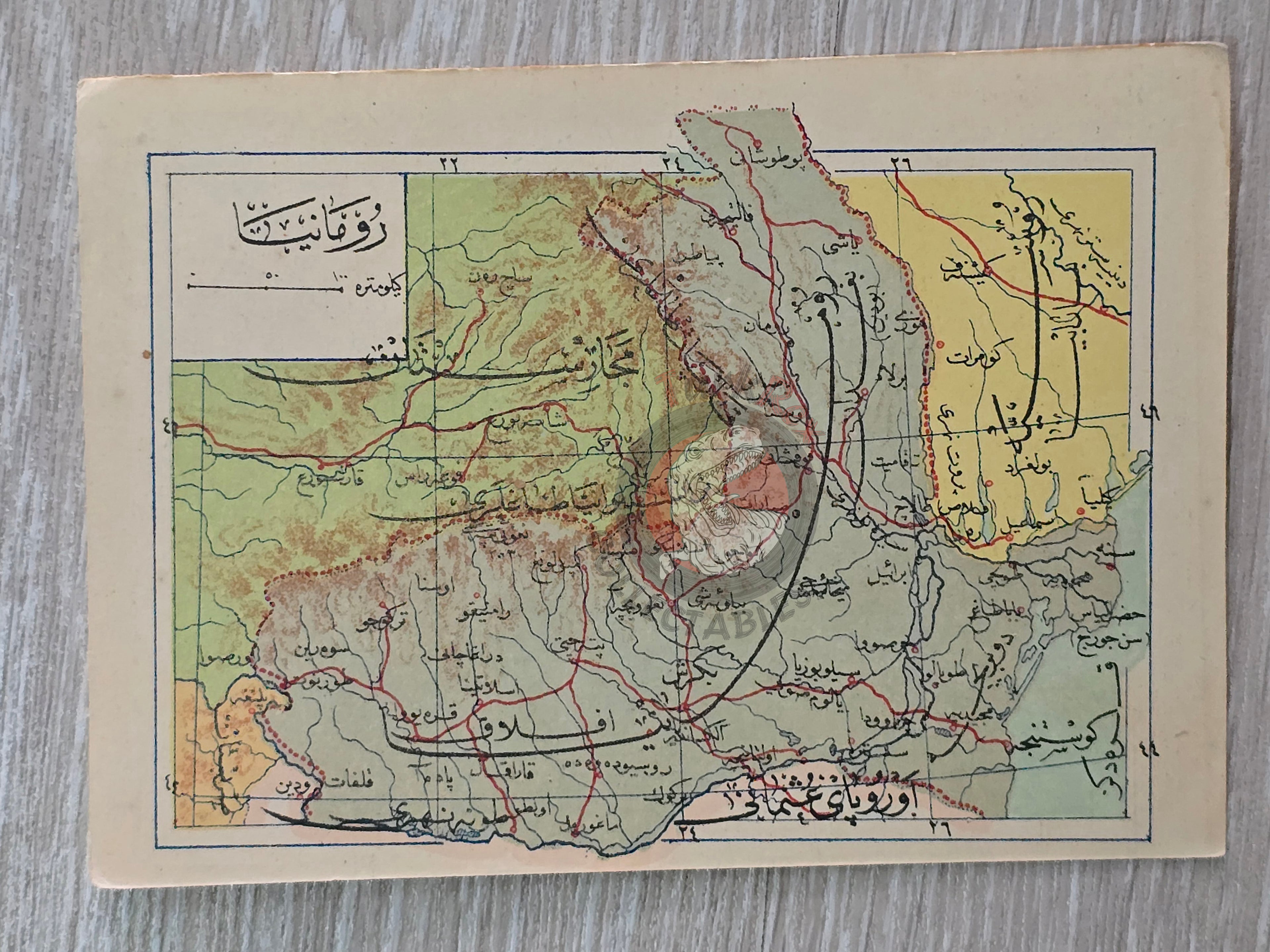
Romania 1907 Ottoman Atlas Map Empire Mehmed Eşref Europe Balkans -
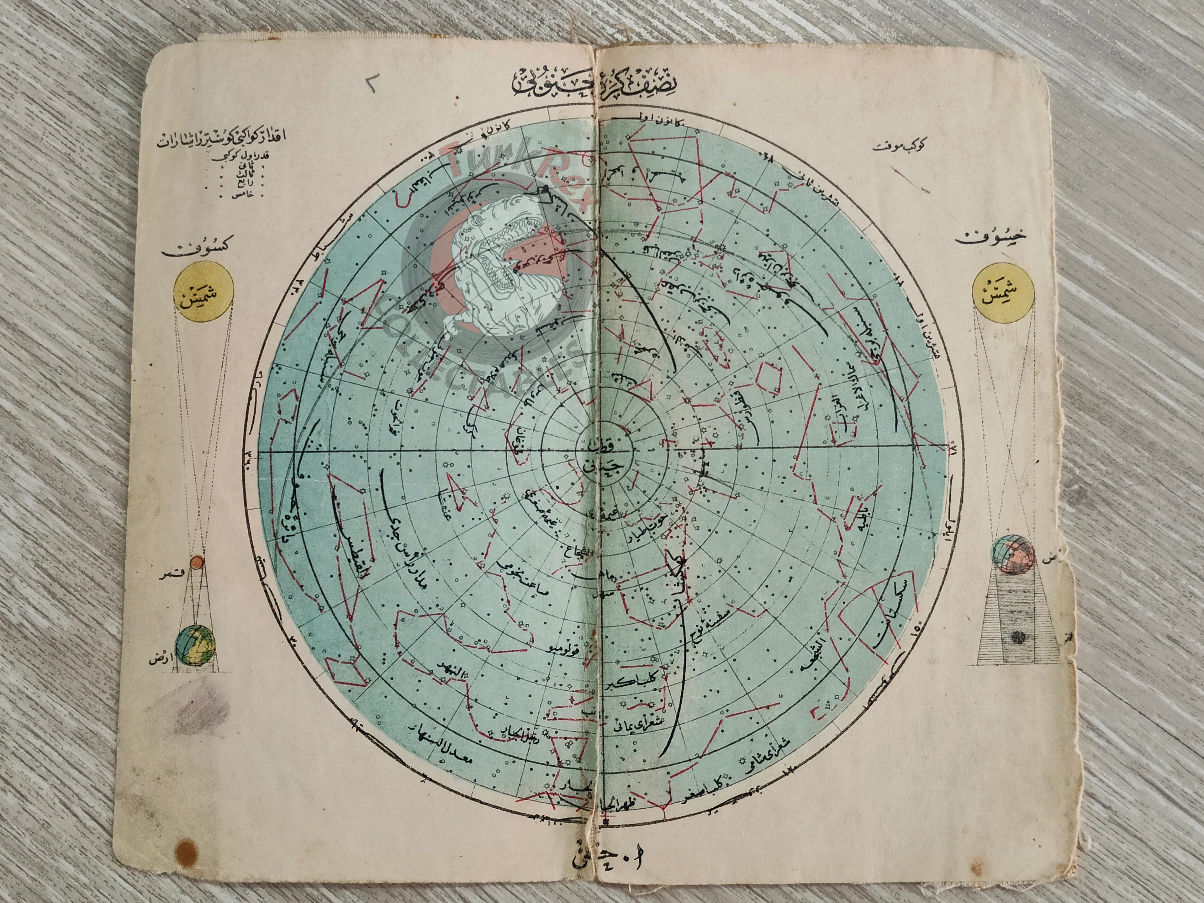
Southern Hemisphere Celestial Map 1906 Ottoman Map Sky Stars Astronomy -
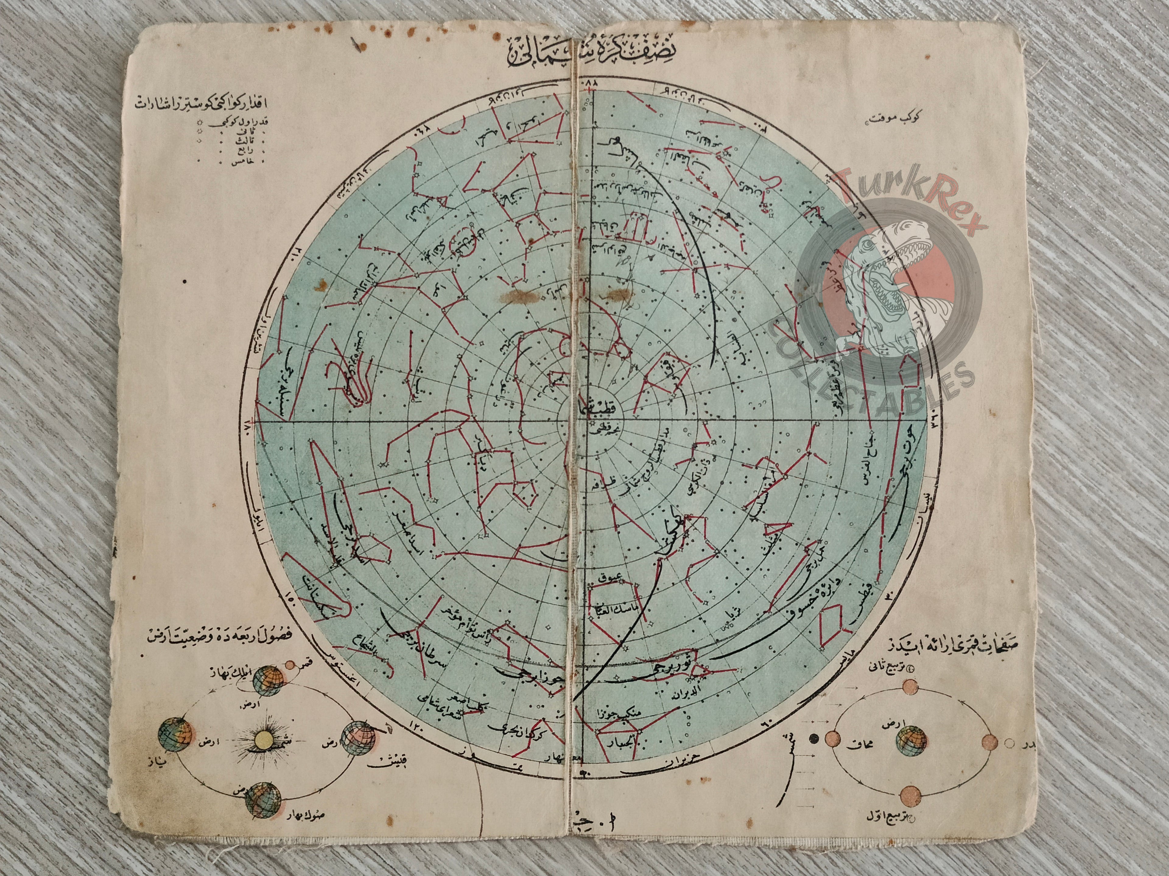
Northern Hemisphere Celestial Map 1906 Ottoman Map Sky Stars Astronomy -
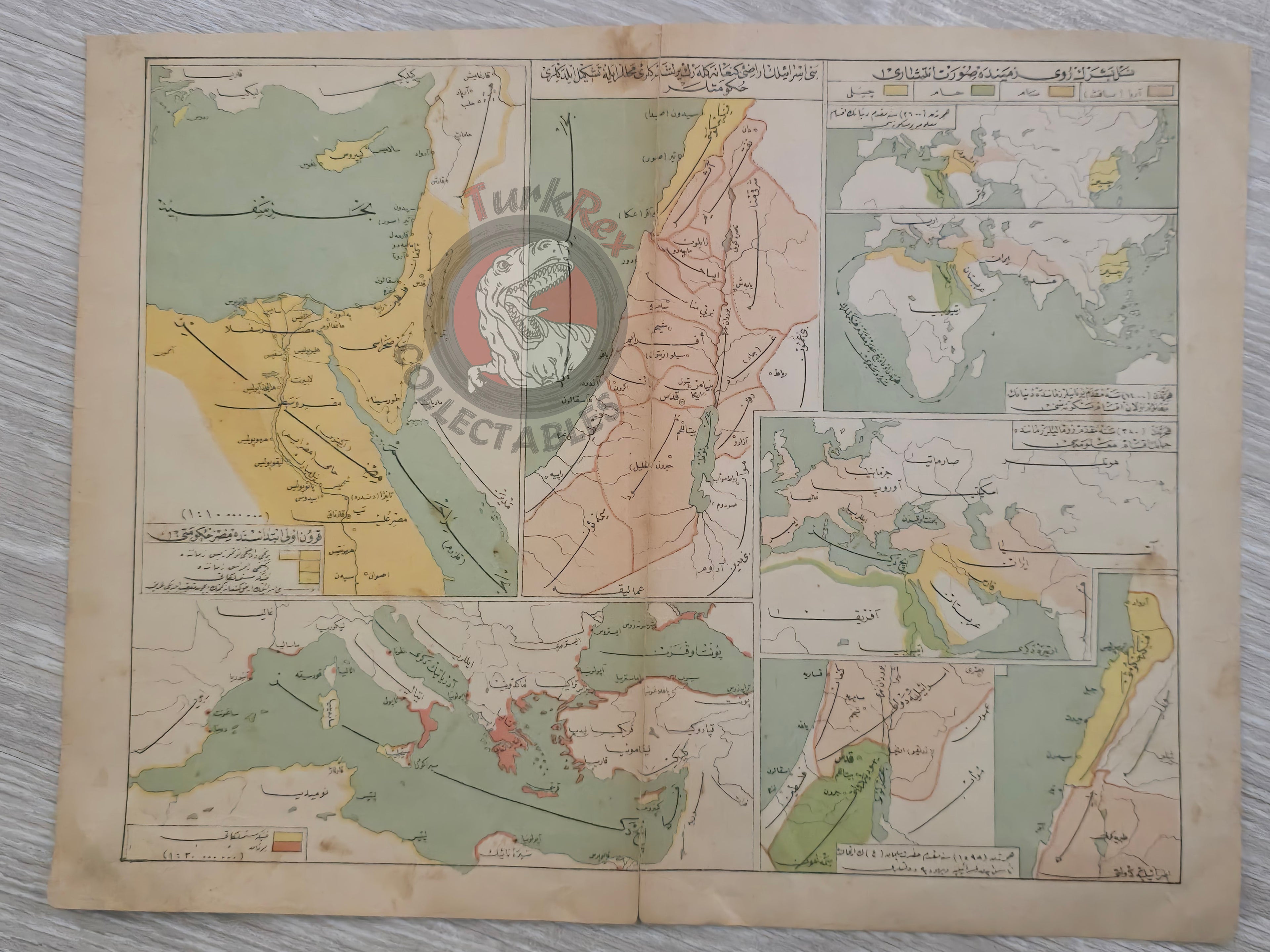
Ottoman Empire Map 1916 Administrative Divisions Middle East Palestine Jerusalem Israel Hejaz Railway -
Ottoman Empire 1916 Map Anatolia Middle East Arabian Peninsula Palestine Israel Hejaz Railway -
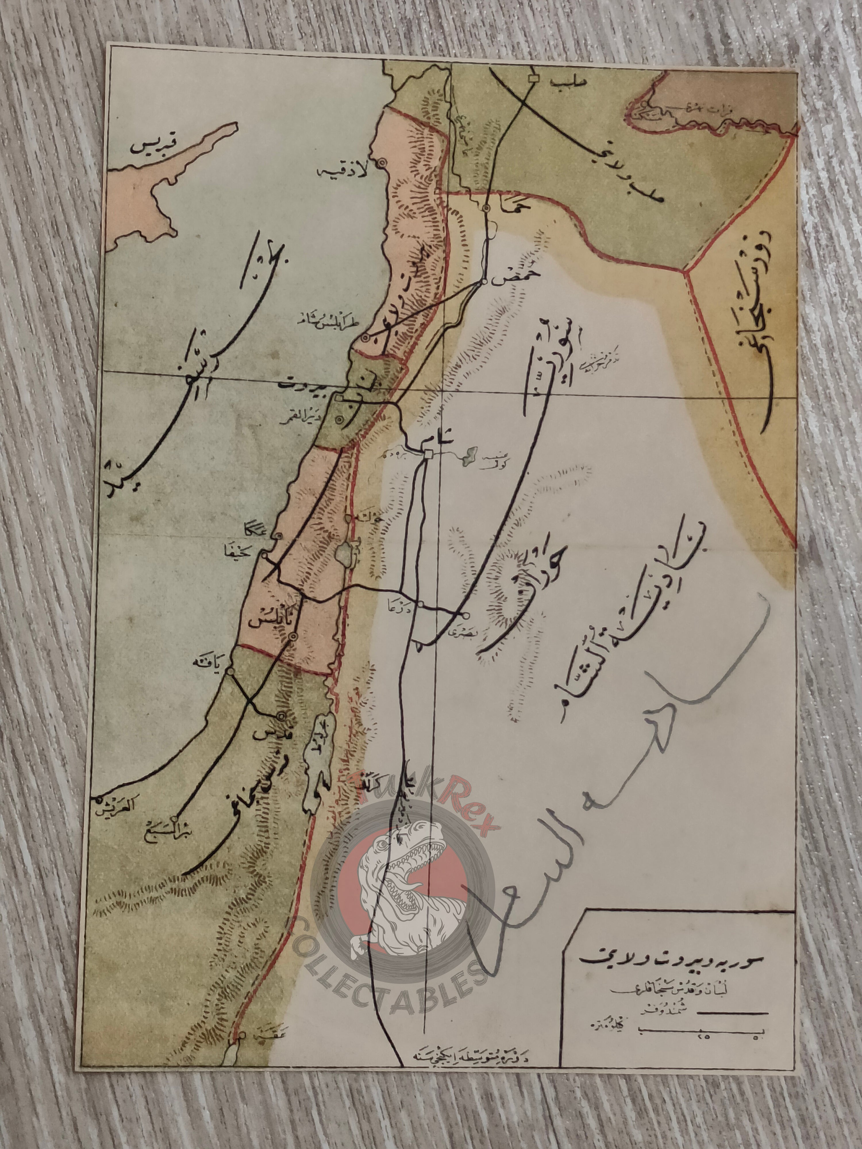
Human Race Palestine 1913 Ottoman Map Middle East Israel Syria Egypt -
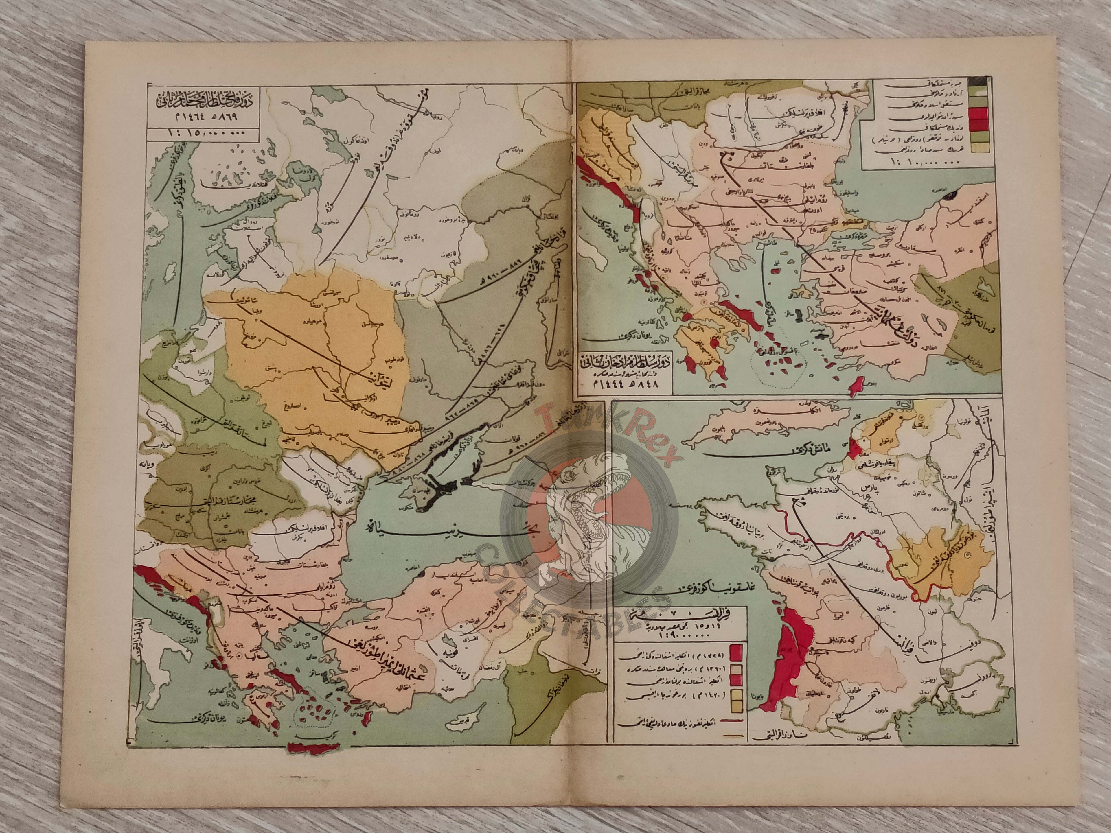
Ottoman Empire under Sultan Mehmed II 1913 Atlas Map France Sultan Murad II Anatolia -
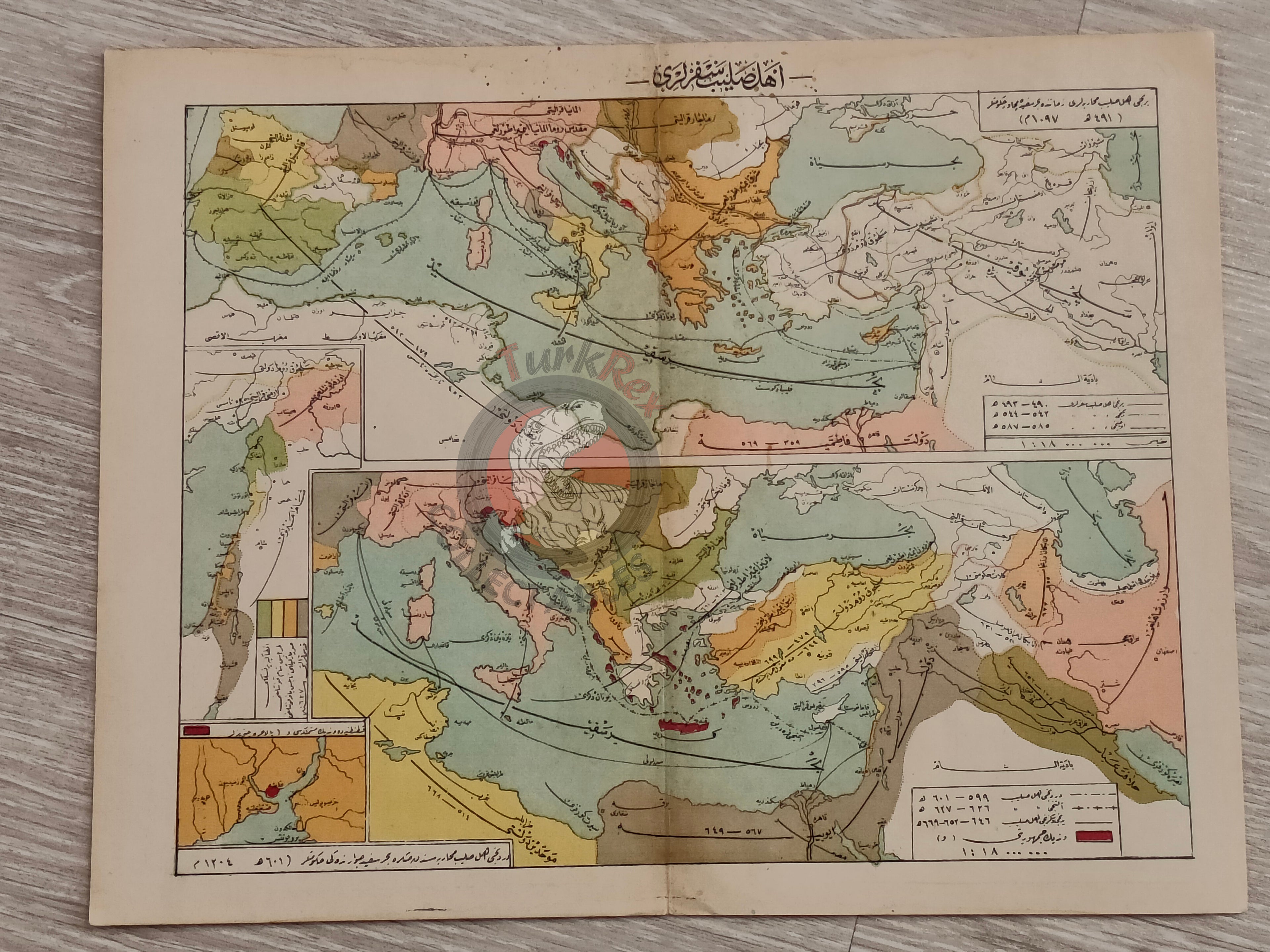
The Crusades 1913 Ottoman Map Middle East Palestine Israel Iraq Iran -
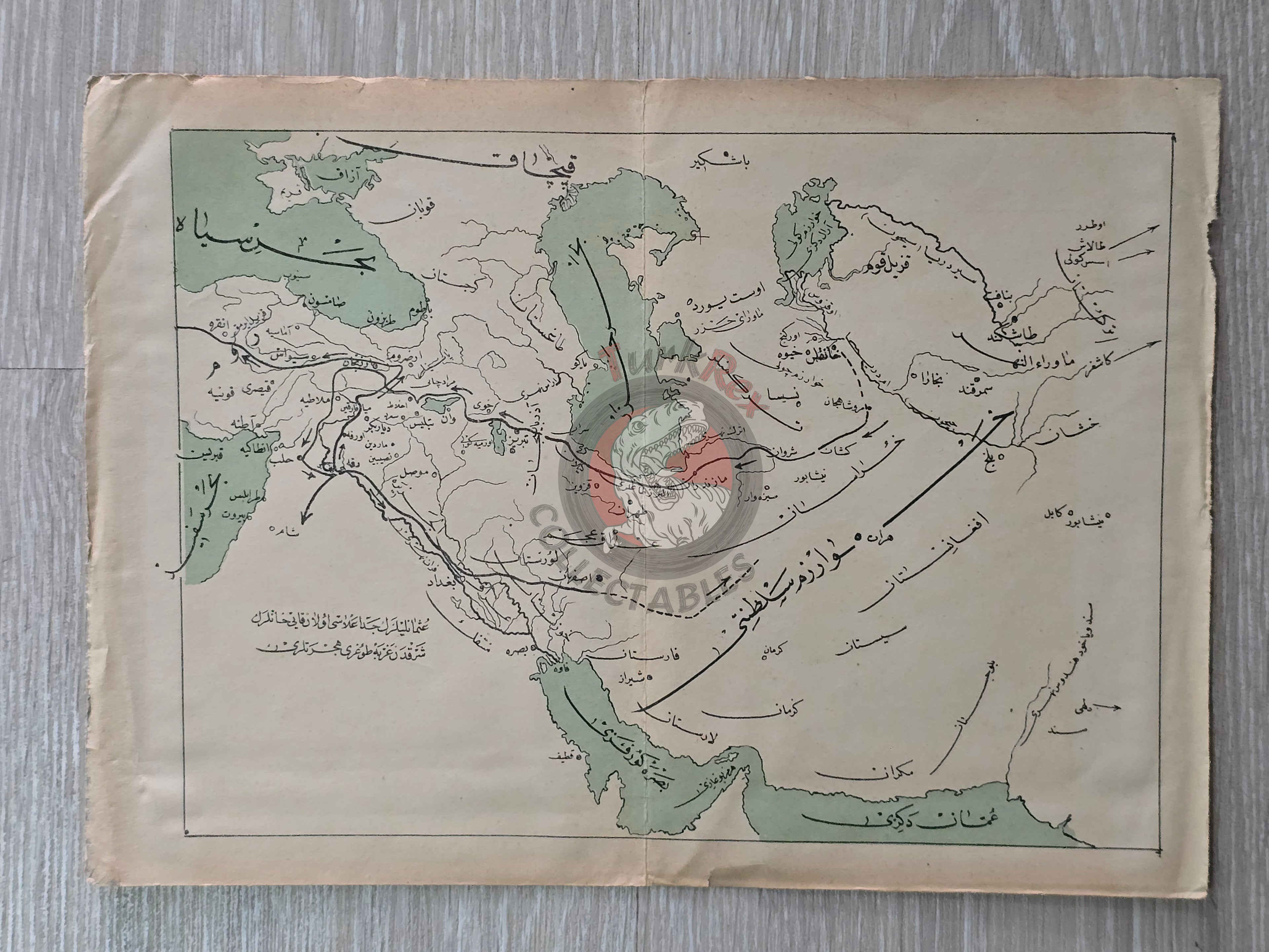
Migration of the Kayı Tribe Ottoman Map History Anatolia Arabian Peninsula Iran Iraq Middle East -
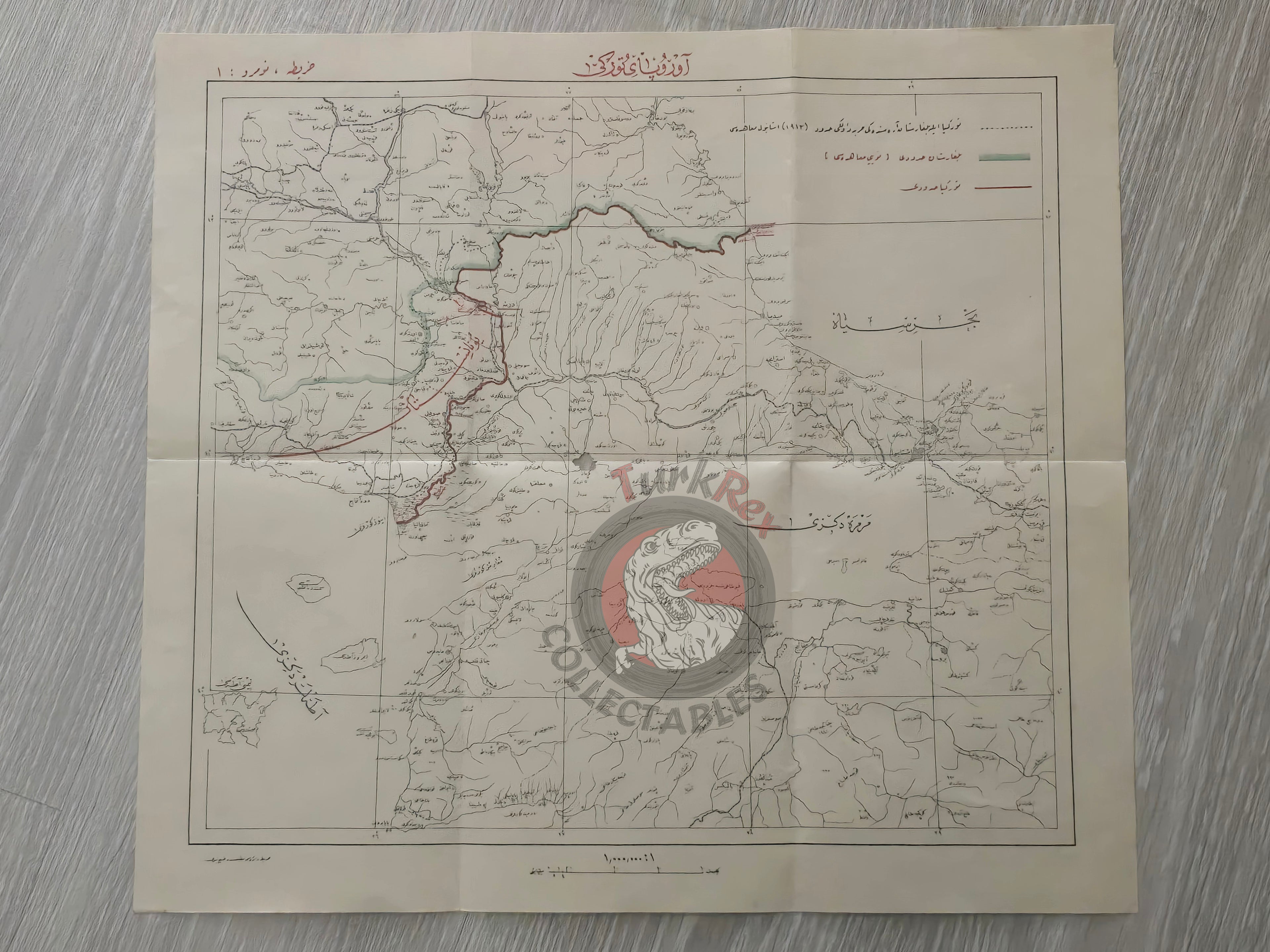
Turkey European Borders after the Treaty of Lausanne 1924 Ottoman Script Map Greece Bulgaria -
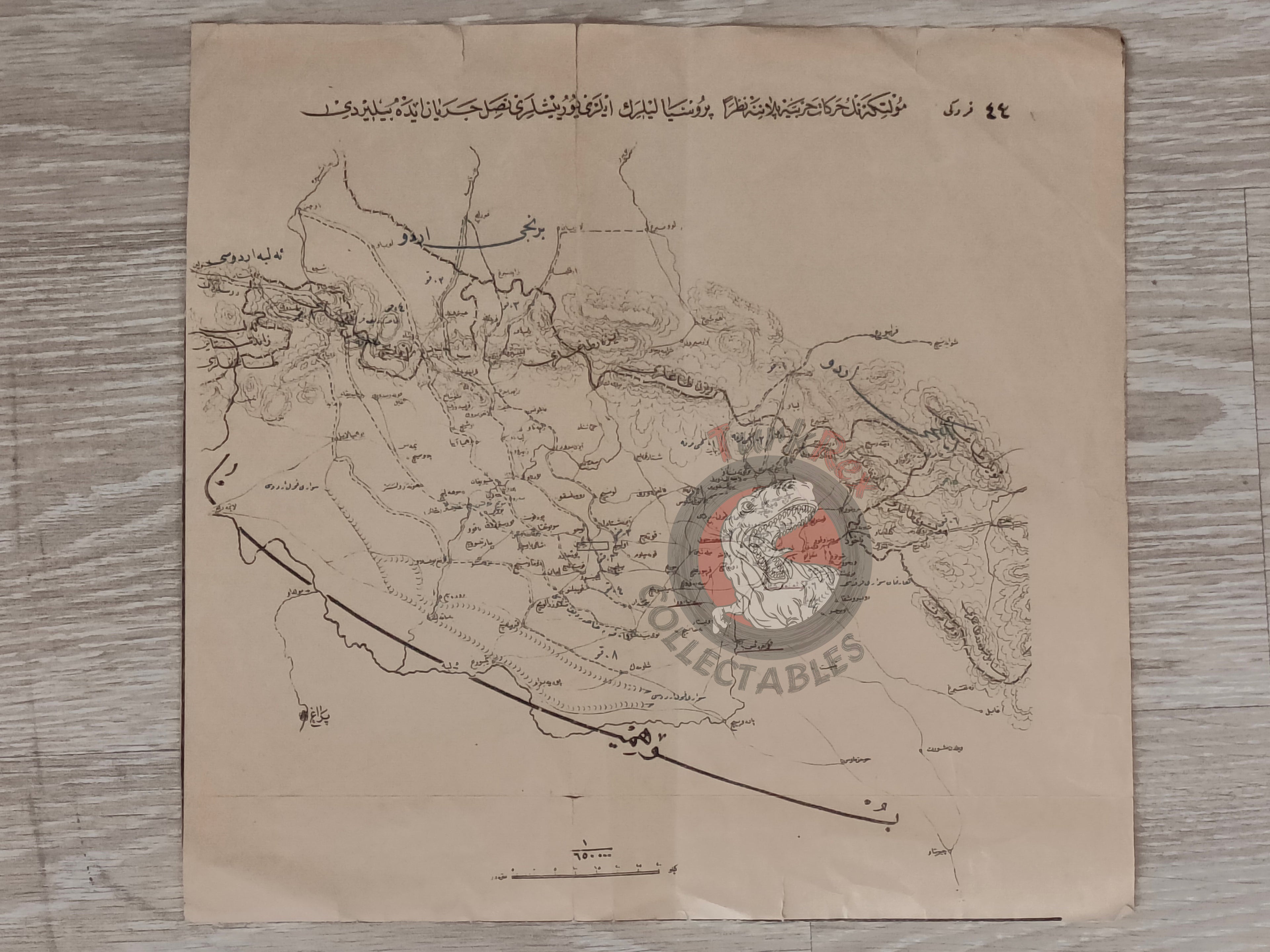
Germany Prussia Moltke’s Operational Plans Ottoman Script Map Empire Helmuth Karl Bernhard von -
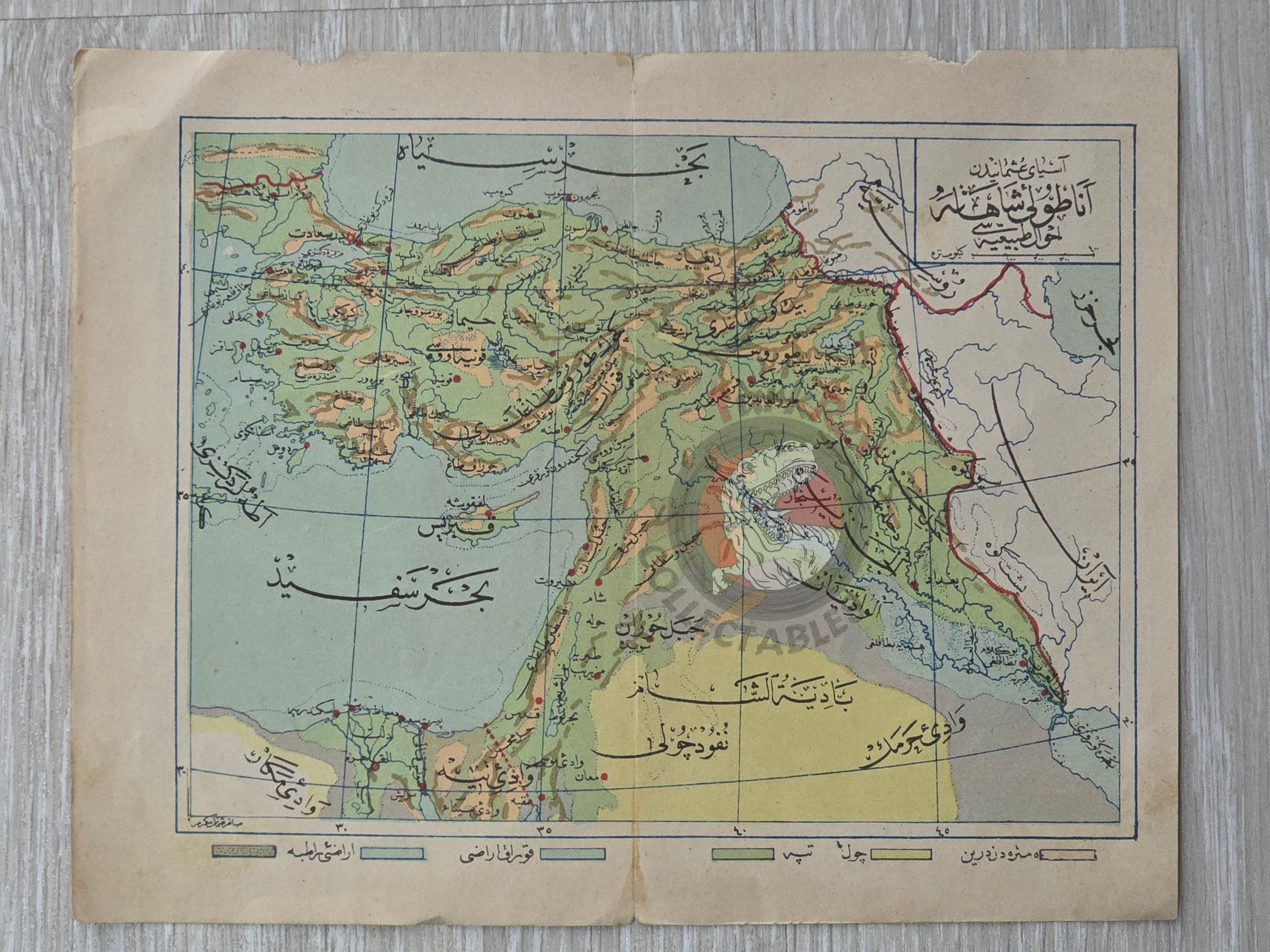
Ottoman Empire Physical Map 1914 Palestine Iraq Israel Egypt Middle East -
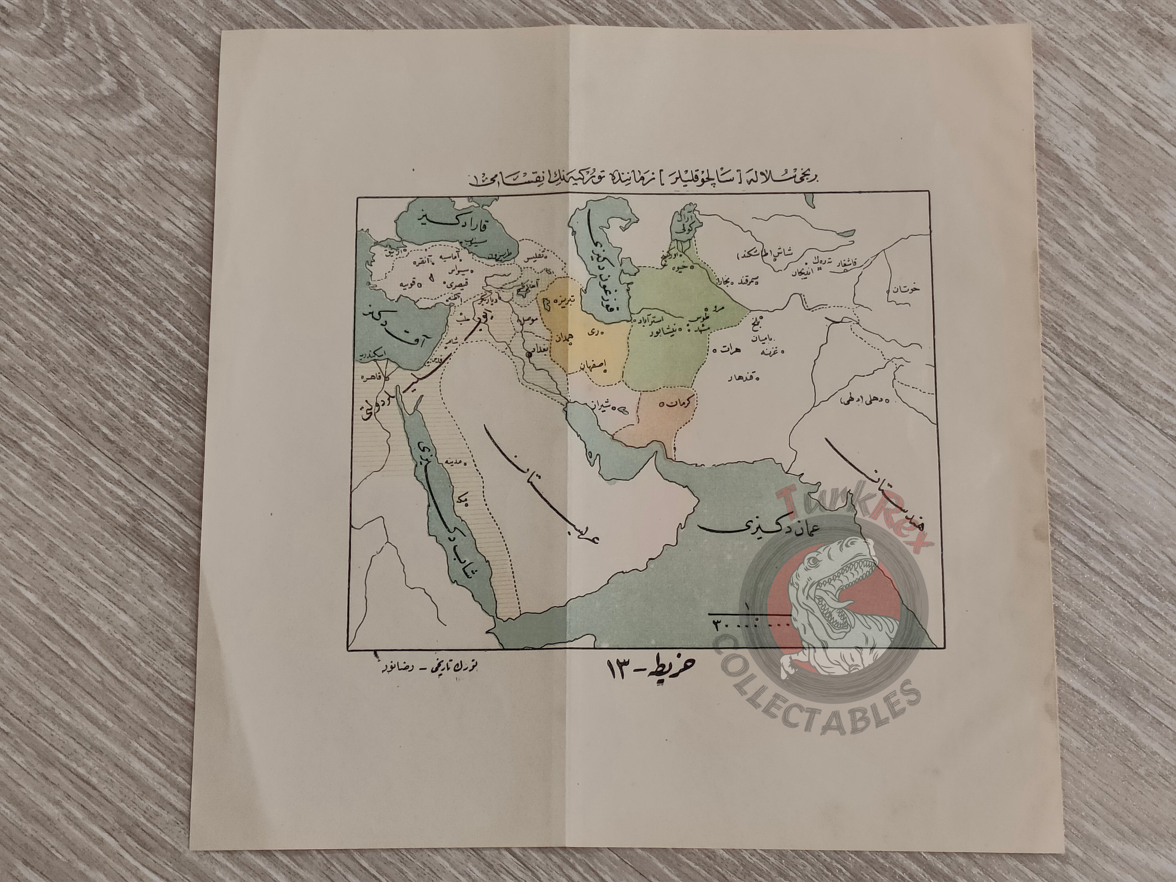
Turkey during the Seljuk Empire Period 1923 Ottoman Turkish Script Map Arabian Peninsula